In English

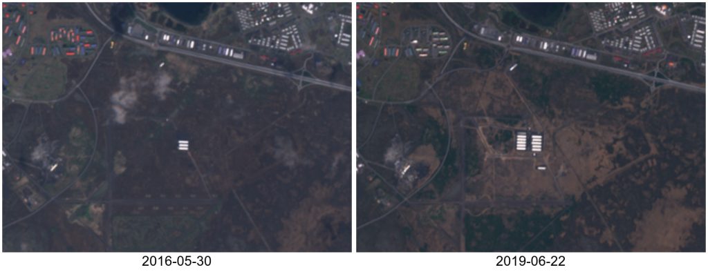
Sentinel-2 captures new data centers in Iceland

In a remote sensing study published in Nature, the authors claimed that they used « 101 CPU-core years of computation (..) within the Google data centres ». This made me wonder what could be the carbon footprint of such a study?. I estimated that it should be 65 tonnes of carbon dioxide, but a Google engineer replied: […]

Composite (3A)

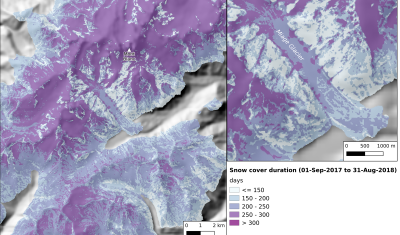
Detecting geolocation errors in glacier outlines with Sentinel-2 snow cover duration maps

Two years ago I posted an animation of the snow cover area evolution near Zermatt, Switzerland from Sentinel-2 L2A data processed by LIS. From this time series of snow maps I generated a snow cover duration map and then I added the glacier outlines from the Randolph Glacier Inventory 5.0. I was satisfied by the […]

En Français

Plus de 1000 téléchargements en deux ans pour le code de correction atmosphérique MAJA

=> Nous avons commencé à distribuer MAJA gratuitement en juillet 2017, il y a moins de deux ans, et le logiciel a déjà été téléchargé plus de 1000 fois (1068 précisément aujourd’hui). Cela représente en moyenne plus de deux téléchargements par jour de semaine, et ces dernières semaines, nous avons atteint environ 4 téléchargements par […]

En Français

Les dépôts d’avalanche sur le glacier du Miage vus par le produit neige Theia

Récemment j’ai extrait la carte de la durée de l’enneigement faite à partir des produits neige Theia pour la Direction Départementale des Territoires de Haute-Savoie (DDT 74). Pour cela j’ai traité quatre tuiles Sentinel-2 ce qui couvre une bonne partie des Alpes du Nord. En inspectant cette image mon œil a été attiré par des […]

In English

More than 1000 downloads of MAJA atmospheric correction software

=> We started distributing MAJA as a free software in July 2017, less than 2 years ago, and it already reached 1000 downloads (1043, as a mater of fact).  MAJA was in fact downloaded twice per working day, and in the very last weeks, we had about 4 downloads a day ! Of course it […]

CESBIO

Sen2Agri final version was just published

The Sen2Agri system was just released in version 2.0. As the project is now terminated and will not receive more funding from ESA, V2_0 is the final version, apart maybe for a few bug fixes. Sen2Agri is a very complete ground segment that automates download and processing of Sentinel-2 data to obtain multi-temporal syntheses, crop/non crop, […]

Composite (3A)

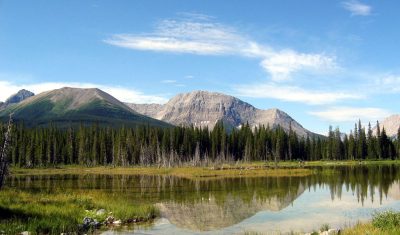
Snow cover duration in the Canadian Rockies from Sentinel-2 observations

Recently I generated one year of snow maps from Sentinel-2 in the Canadian Rockies for a talented colleague who is working on the numerical simulation of the snow cover at high-resolution with an exciting new hydrological model. The area is not covered by Theia, hence I used Start_Maja to generate the L2A products and then […]

Applications

Near real time detection of deforestation in French Guiana

Marie Ballère started in October 2018 a Ph.D. funded by WWF and CNES. The aim of her Ph.D. is to characterize animal habitats in tropical forest using radar and optical data. The first results on near real time forest disturbances assessment using radar Sentinel-1 data in French Guiana were shown at the ESA Living Planet […]

CESBIO

Combined exploitation of VENμS, Sentinel-2 and Landsat-8: the spectral bands

=> The combined use of VENμS, Sentinel-2 and Landsat-8 data can increase the likelihood of obtaining cloud-free images or may allow detailed tracking of rapidly evolving phenomena. In order to facilitate this combination, the table below summarizes the correspondences between the spectral bands of the instruments. VENμS does not have a spectral band in the […]