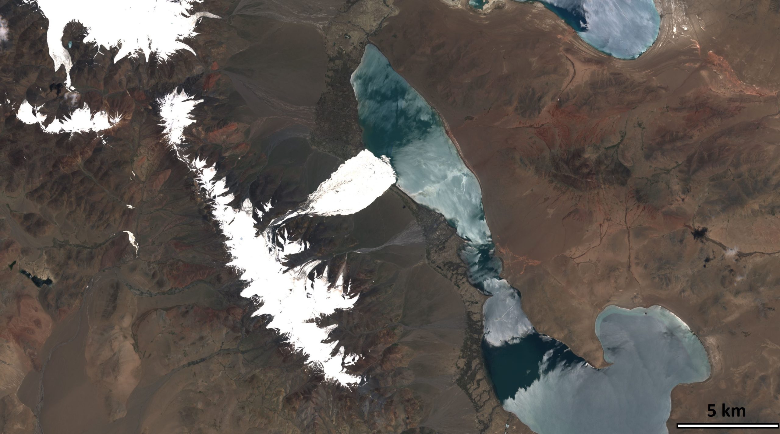
Sentinel-2A (and Landsat-8) capture a giant ice avalanche in Tibet

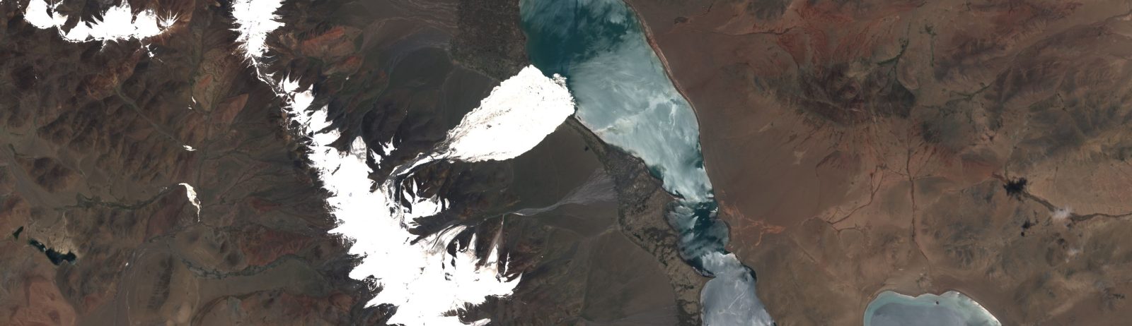
After reading my previous post about the Rutog ice avalanche, my distinguished colleagues Antoine R. and Olivier H. challenged me to look for a pre-event image to better highlight the avalanche area. The closest clear-sky image that I could find is a Landsat-8 image that was acquired on June 24 (23 days before the slide).

Sequence of two Landsat-8 and Sentinel-2A images. Both images are level 1 product displayed as natural color composites. Click to enlarge.

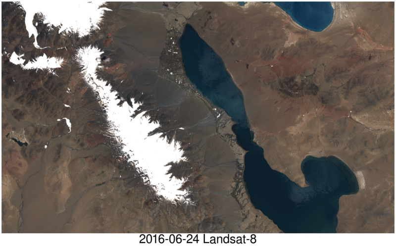
 Both images were taken on two different dates, by two different sensors, with different view angles and ortho-rectified by two different agencies… yet they appear to be very well co-registrated at least at this scale! A good co-registration of the Sentinel-2 and Landsat datasets is important to maximize our capacity to monitor the land surface changes.  For further reading about the current accuracy of the Landsat/Sentinel-2 coregistration in mountain regions see: Kääb, A., Winsvold, S. H., Altena, B., Nuth, C., Nagler, T., & Wuite, J. (2016). Glacier Remote Sensing Using Sentinel-2. Part I: Radiometric and Geometric Performance, and Application to Ice Velocity. Remote Sensing, 8(7), 598. http://doi.org/10.3390/rs8070598

Plus d'actualités

BIOMASS, the third launched satellite mission designed at CESBIO !

After SMOS in 2009, and VENµS in 2017, the CESBIO Laboratory is very proud to see its third proposed mission, Biomass, reach orbit. As always, it has been a long journey from the idea, at the beginning of the century, to the selection in 2013 as the seventh Earth Explorer Mission by ESA, to the […]

Sentinel-2 reveals the surface deformation after the 2025 Myanmar earthquake

Sentinel-2 captured several clear-sky images of Myanmar before and after the 28 March 2025 earthquake. The animation below shows a 5-day apart sequence of images captured by Sentinel-2B and Sentinel-2C (10 m resolution) near the epicenter located close to Mandalay. The surface slip due to the earthquake follows the Sagaing Fault, a major fault in […]

Evolution de l’altitude de la ligne de neige au cours des 41 dernières années dans le bassin versant du Vénéon (Oisans)

Pour contribuer à caractériser les conditions hydrométéorologiques lors de la crue torrentielle qui a frappé la Bérarde en juin, j’ai analysé une nouvelle série de cartes d’enneigement qui couvre la période 1984-2024 [1]. Grâce à la profondeur temporelle de cette série, on constate que l’altitude de la ligne de neige dans le bassin versant du […]

Rechercher