SPOT5 (Take5) is getting ready
![]() =>
=> ![]() The SPOT5 (Take5) project, lead by Sylvia Sylvander at CNES et Bianca Hoersch at ESA is getting ready. Here a a few news about the agenda of the coming months :
The SPOT5 (Take5) project, lead by Sylvia Sylvander at CNES et Bianca Hoersch at ESA is getting ready. Here a a few news about the agenda of the coming months :
- SPOT5 ends its operational life on March the 31st
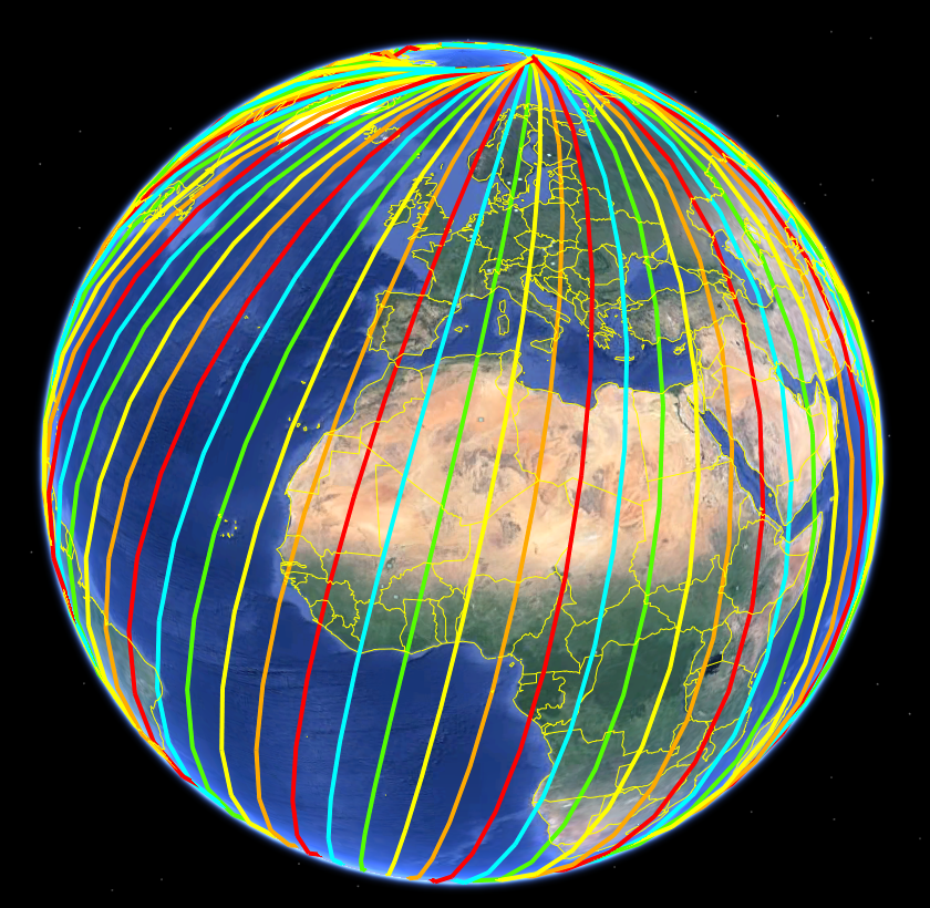
- The orbit change manoeuvre should take place on April the Second. We know now the satellite tracks for the whole experiment, thanks to Jean-Marc Walter from CNES. It is not exactly the same as SPOT4 (Take5). For the lucky users who will get a site for both experiments, the observation angles will be different.
- After the manoeuvre, a margin of a few days is kept in case a correction is necessary. Then a first image will be taken to check that all the processing works, as we did for SPOT4 (Take5).
- Then we will get some rest for the Easter Week-end, and the first acquisitions will be programmed for the 8th of April. However, if something prevented us from doing the manoeuvre on the Second of April, this whole schedule will be delayed by a few weeks, as we lack manpower to prepare a backup solution. But it is really not likely !
- F. Daniaud (CS-SI for CNES), is now assessing the possibility to observe the sites that were asked by ESA, by ESA’s call and by CNES. If we are unlucky, some modifications might be necessary, by moving or removing sites. This task is heavy, because the satellite is not on its nominal orbit, and must be programmed manually, site per site. And this time, we will observe more than 100 sites !
- Martine Béhague and the SPOT5 (Take5) operations team (CNES DCT/OP) are preparing simulations and tests to check that all the operations will work.
- The interfaces with Airbus D & S (ex Spot Image) are being prepared.
- The ground processing software preparation has started with the THEIA CNES team, with support from Cap Gemini and CESBIO. Mireille Huc, at CESBIO, just released the new version of MACCS prototype, which will handle the SPOT5 (Take5) data.
- Vincent Poulain (Thales-IS) is now developing some tools to help us prepare the auxiliary data needed to process each site. For each site, we need to define its footprint, choose its projection, prepare its DEM, find one or several reference images (mostly LANDSAT 8 ) without clouds and merge them. Multiply that by more than 100 !
- studies are starting to define the ESA-CNES SPOT5 (Take5) distribution server
The first SPOT5 (Take5) picture will be taken only two months from now, and we have a lot of work ahead !