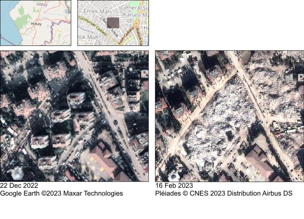
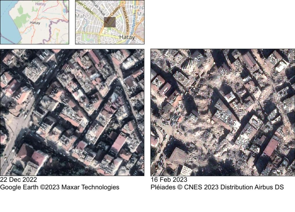
Antakya before and after the earthquakes

We received satellite images of Antakya, Turkey acquired by Pléiades 10 days after the earthquake. The comparison with pre-event imagery leaves me speechless.
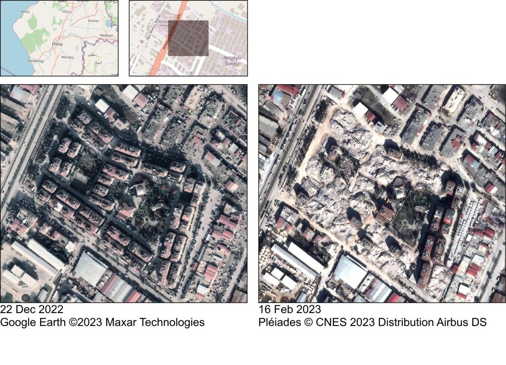
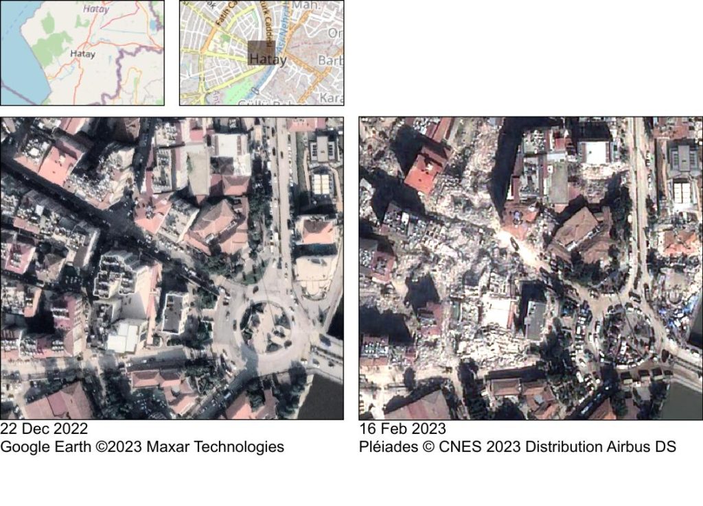
The post-event images were acquired by Pléiades PHR1A thanks to CNES Cellule d’Intervention et d’Expertise Scientifique et Technique nouvelle génération : CIEST²
(https://www.poleterresolide.fr/ciest-2-nouvelle-generation-2/). I rectified the raw images using the SRTM digital elevation model and pan-sharpened the multispectral image. All processing done using the Orfeo Toolbox.

Plus d'actualités

Rapid analysis of the GLOF in Gupis, Gilgit-Baltistan

Pakistan news media reported that a glacier lake outburst flood (the failure of a dam containing a glacial lake) occurred near Gupis, Gilgit-Baltistan, a highly mountainous region administered by Pakistan. Satellite images show that the flood triggered a debris flow, which reached the Gupis valley where it hit the Roshan (Rashon) village and blocked the […]

BIOMASS, the third launched satellite mission designed at CESBIO !

After SMOS in 2009, and VENµS in 2017, the CESBIO laboratory is very proud to see its third proposed mission, Biomass, reach orbit. As always, it has been a long journey from the idea, at the beginning of the century, to the selection in 2013 as the seventh Earth Explorer Mission by ESA, to the […]

Biophysical parameter retrieval from Sentinel-2 images using physics-driven deep learning for PROSAIL inversion

The results presented here are based on published work: Y. Zérah, S. Valero, and J. Inglada. « Physics-constrained deep learning for biophysical parameter retrieval from sentinel-2 images: Inversion of the prosail model« , in Remote Sensing of Environment, doi: 10.1016/j.rse.2024.114309. This work is part of the PhD of Yoël Zérah, supervised by Jordi Inglada and Silvia Valero. […]

Rechercher