Pléiades images of the Uttarakhand disaster
Update 17 June 2021: these images were used in a study published in Science by Shugar et al. (2021) A massive rock and ice avalanche caused the 2021 disaster at Chamoli, Indian Himalaya, doi:10.1126/science.abh4455.
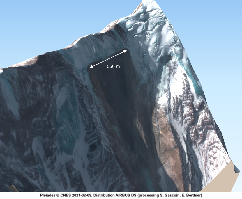
The Indian Space Agency (ISRO) activated the International Charter « Space and Major Disasters » to image the area of the disater in Uttarakhand (excellent visualisation here). Thanks to CNES and Airbus DS, Pléiades images (resolution: 70 cm in panchromatic, 2.8 m in multispectral) were acquired today 09 Feb 2021, two days after the event. These images show the detachment area with a clear rupture line of 550 m on the north face of Ronti.
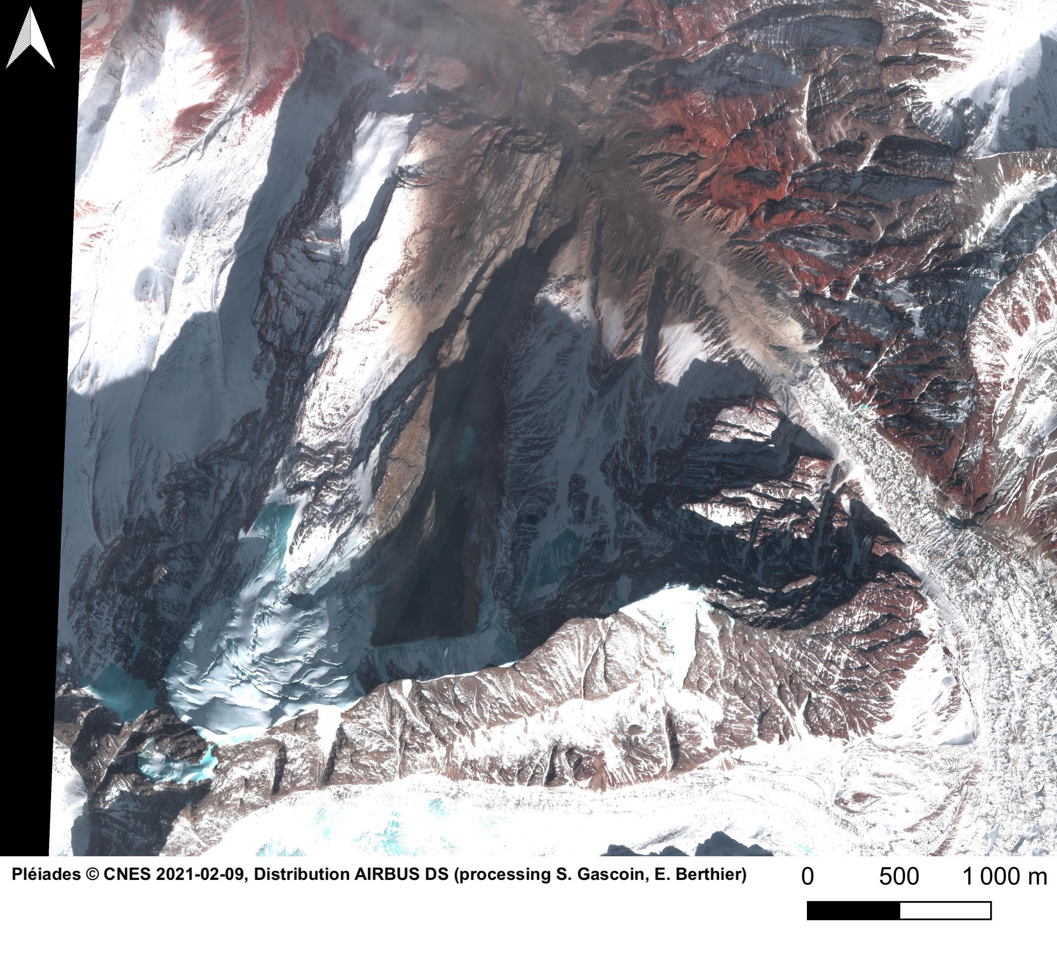
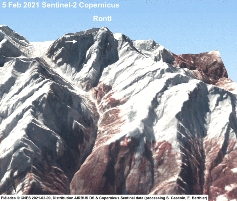
This is a comparison with the latest Sentinel-2 image, before the flood.
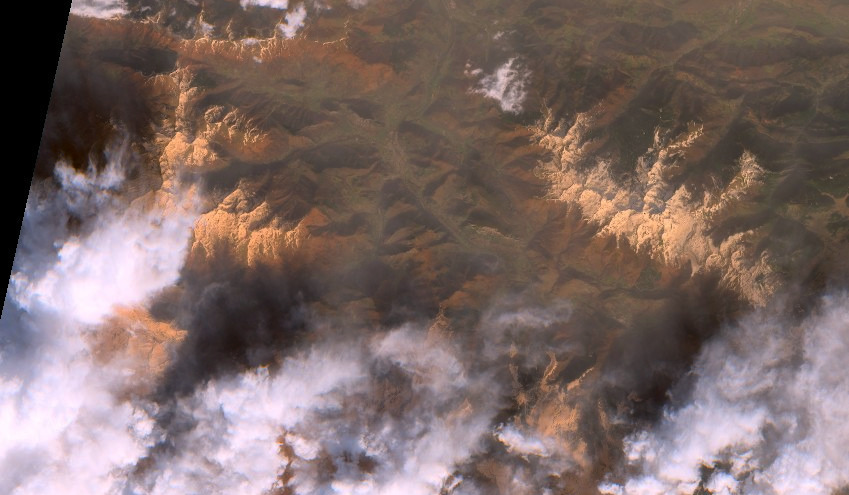
Preliminary work by many scientists suggests that a rockslope failure released a mixture of rock and ice which created a potent flood in the valley of the Rishiganga River.
UPDATE 10 Feb 2021. A Pléiades stereo pair has been acquired (B/H = 0.12) which allowed us to generate a high resolution 3D model of the area.

Update 11 Feb 2021
Two elevation difference maps were computed by Etienne. A first one by differencing the above Pléiades DEM with the Copernicus 30 m resolution DEM
Then, D. Shean (Univ Washington) computed a pre-event DEM from WorldView-1 images which allowed a finer analysis. The estimated detached volume is 25 millions cubic meters.
Authors Etienne Berthier (CNRS/LEGOS) and Simon Gascoin (CNRS/CESBIO)
Acknowledgements Work carried out with the support of CNES, the International Charter for Major Spaces and Disasters and the DINAMIS program.