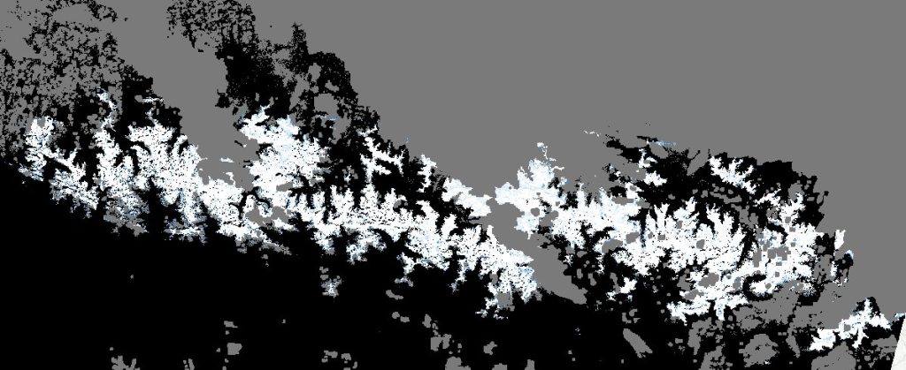
September snow captured by Sentinel-2

A sunny Sunday just after an exceptional late-September snowfall… That’s already a stroke of luck. But the passage of Sentinel-2 on the same day makes this weekend even more special!

The snow cover map was immediately processed and distributed by the new Copernicus Snow & Ice monitoring service powered by Cesbio’s algorithms! You can explore it in your web browser here.

Sentinel-2 fractional snow cover map (white = 100% snow, black = 0% snow, grey = cloud) (Source)

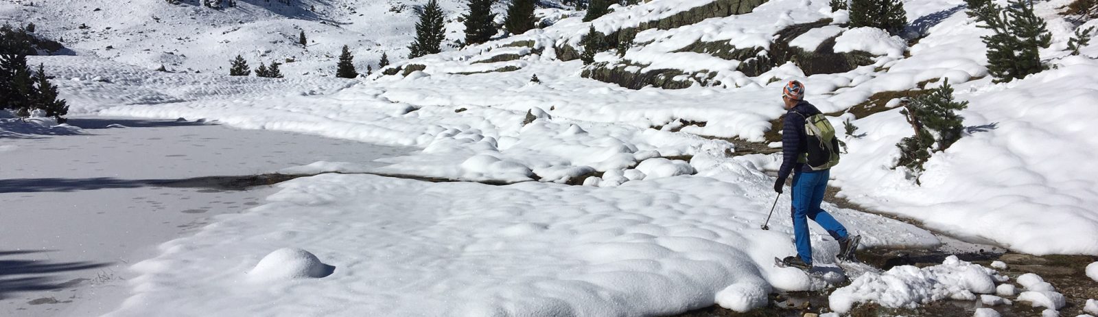
Ground validation was performed on Sunday in the beautiful Vallée du Marcadau by students from ENS geosciences master program who were visiting the region as part of their field trip with Pierre René (association Moraine).


Plus d'actualités

Autumn snow drought on Mount Damavand

« We are currently experiencing the driest autumn the country has experienced in 50 years » said Iran’s meteorological organisation. Near Tehran, Mount Damavand, the highest peak in Iran (5609 m) was reported to be « unusually bare of snow ». I checked this statement using my MODIS snow cover data processing algorithm implemented in Google Earth Engine (Gascoin […]

Evolution des glaciers du Vignemale sous l’œil des satellites Pléiades (2013-2025)

Grâce à DINAMIS, un couple d’images stéréoscopiques a été acquis par Pléiades 1B le 14 septembre 2025. Le modèle numérique de surface (MNS) produit à partir de ces images peut être comparé à un autre MNS de septembre 2013 produit à partir des images Pléiades 1A commandées par Marti et al. (2014). Le glacier d’Ossoue […]

Rapid analysis of the GLOF in Gupis, Gilgit-Baltistan

Pakistan news media reported that a glacier lake outburst flood (the failure of a dam containing a glacial lake) occurred near Gupis, Gilgit-Baltistan, a highly mountainous region administered by Pakistan. Satellite images show that the flood triggered a debris flow, which reached the Gupis valley where it hit the Roshan (Rashon) village and blocked the […]

Rechercher