The operational production of the Theia Snow collection has started
Great news, we can announce that the operational production of the Theia snow collection has started well. It means that maps of the snow cover area are now constantly added to the Theia portal. These maps are automatically generated from Sentinel-2 observations and have a spatial resolution of 20 m. The Snow collection will progressively cover most mountain regions in west Europe, but also the Atlas in Morocco, eastern Canada… The Snow collection can be freely downloaded from http://theia.cnes.fr by any registered user.
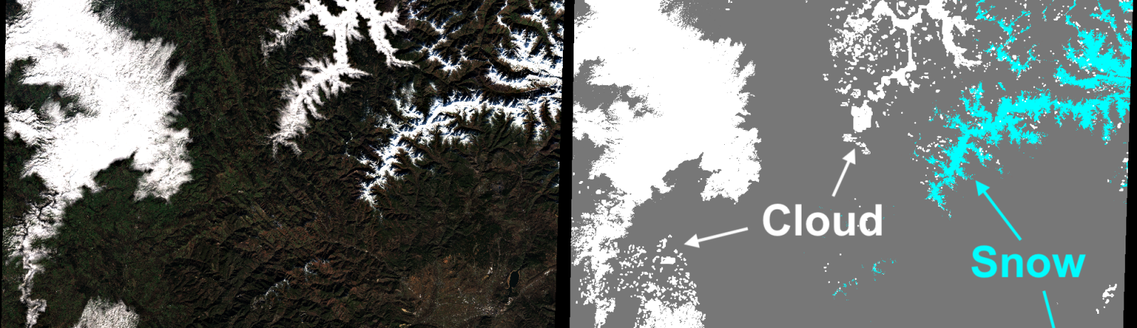
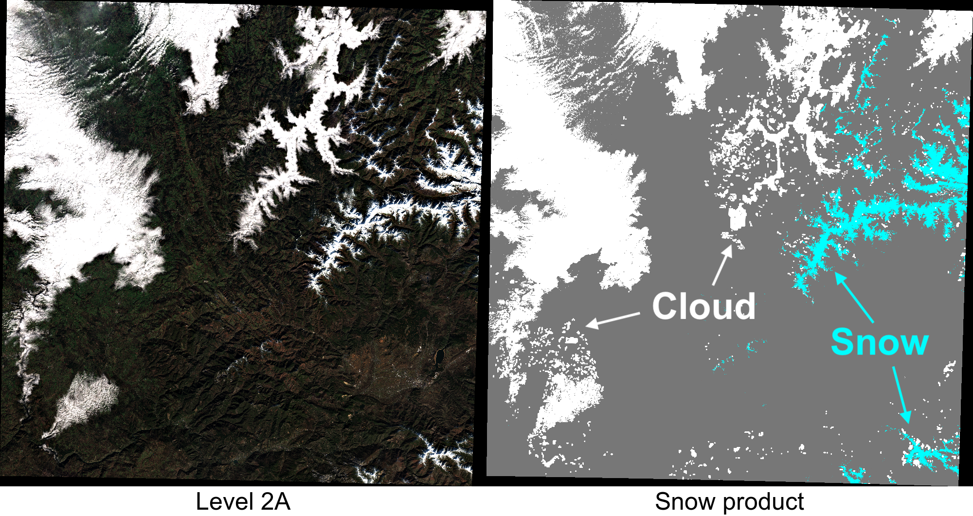
Today’s front page of the Theia website featured this nice example in Sierra de Ancares (western end of the Cantabrian Mountains, Spain). In the southeast, snow was also detected on the Montes Aquilanos, including the small ski resort El Morredero. The image was captured yesterday! It illustrates well the value of multispectral imagery to discriminate the snow cover from the clouds. There is a cloud which looks alike snow but it is actually a valley fog confined by local topography.
This product can be downloaded here: https://theia.cnes.fr/atdistrib/rocket/#/collections/Snow/03f0093c-f562-51ca-8720-b36033013d17, but many others are available, including in the Alps.


Since the previous release of the 1300 snow products [1], we have improved the snow detection in shaded slopes [2]. In some cases, cold and low elevation clouds can be wrongly classified as snow. We are working on this issue to improve the next release. This snow product is not reliable in areas of dense forest canopies. We will publish additional validation of the Theia snow product in the forthcoming weeks.
Notes
[1] ❄ Powder alarm on Theia / Avalanche de produits neige sur Theia ❄
[2] Validation et amélioration des produits Theia Surfaces Enneigées à partir d’images haute résolution
Related links
Theia snow product/produit neige (documentation)
Yesterday’s snow cover area in the Pyrenees
A script in Python for batch download
Acknowledgements
This was made possible thanks to the hard work by the Muscate development and exploitation teams at Cnes and Capgemini. Thanks to all of you!