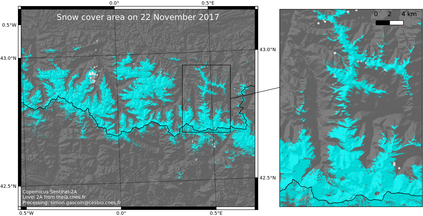
Yesterday’s snow cover area in the Pyrenees

Olivier pointed to me that ESA’s ground segment, PEPS and MUSCATE were all in really good shape today… And the sky was clear yesterday at the time of the Sentinel-2A acquisition! So I could download the Level-2A product from theia.cnes.fr, run our let-it-snow processor, start QGIS and here it is: the map of yesterday’s snow cover area at 20 m resolution. If you know the region, you might notice that there is currently a big contrast in the snow cover extent between the French and the Spanish Pyrenees. This is due to the blocking of the moist air masses coming from the north.

Stay tuned! Theia should start to distribute these Sentinel-2 snow products in near real time very soon.

Plus d'actualités

BIOMASS, the third launched satellite mission designed at CESBIO !

After SMOS in 2009, and VENµS in 2017, the CESBIO Laboratory is very proud to see its third proposed mission, Biomass, reach orbit. As always, it has been a long journey from the idea, at the beginning of the century, to the selection in 2013 as the seventh Earth Explorer Mission by ESA, to the […]

Sentinel-2 reveals the surface deformation after the 2025 Myanmar earthquake

Sentinel-2 captured several clear-sky images of Myanmar before and after the 28 March 2025 earthquake. The animation below shows a 5-day apart sequence of images captured by Sentinel-2B and Sentinel-2C (10 m resolution) near the epicenter located close to Mandalay. The surface slip due to the earthquake follows the Sagaing Fault, a major fault in […]

Evolution de l’altitude de la ligne de neige au cours des 41 dernières années dans le bassin versant du Vénéon (Oisans)

Pour contribuer à caractériser les conditions hydrométéorologiques lors de la crue torrentielle qui a frappé la Bérarde en juin, j’ai analysé une nouvelle série de cartes d’enneigement qui couvre la période 1984-2024 [1]. Grâce à la profondeur temporelle de cette série, on constate que l’altitude de la ligne de neige dans le bassin versant du […]

Rechercher