Watching snow melt at 10 minute intervals from space

This is something new to me…

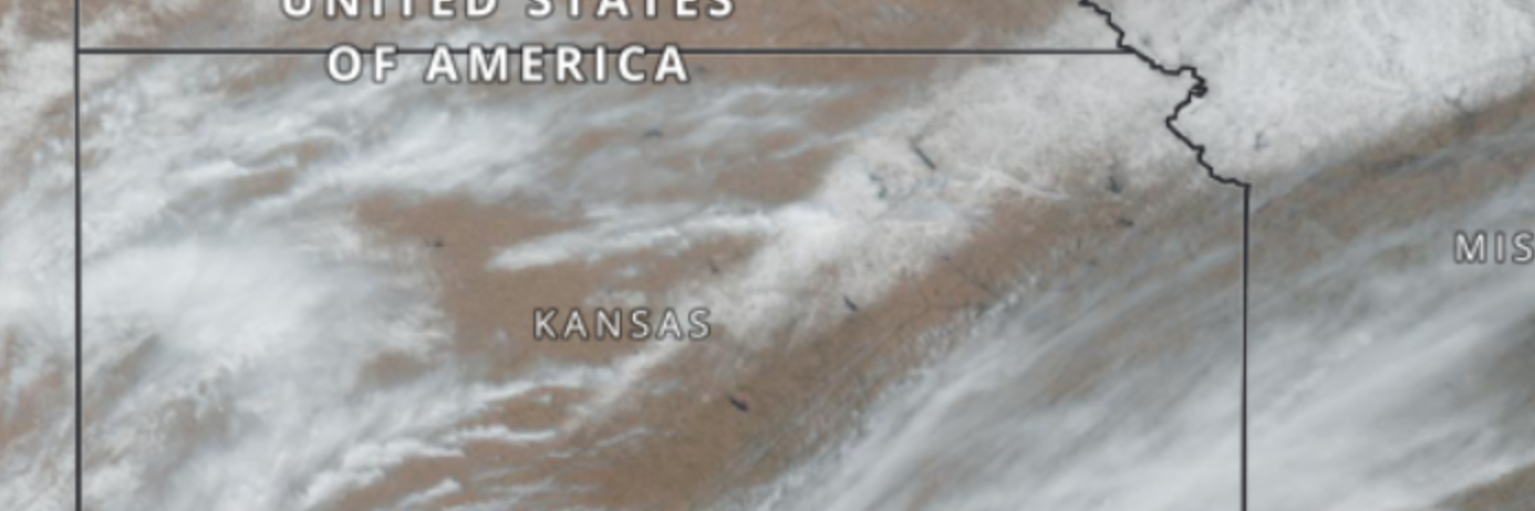
The Geostationary Operational Environmental Satellites (GOES) capture images every 10 minutes at 1 km resolution over America… Such imagery makes it possible to watch the quick melt of a thin snow cover over the US Great Plains during a single day.

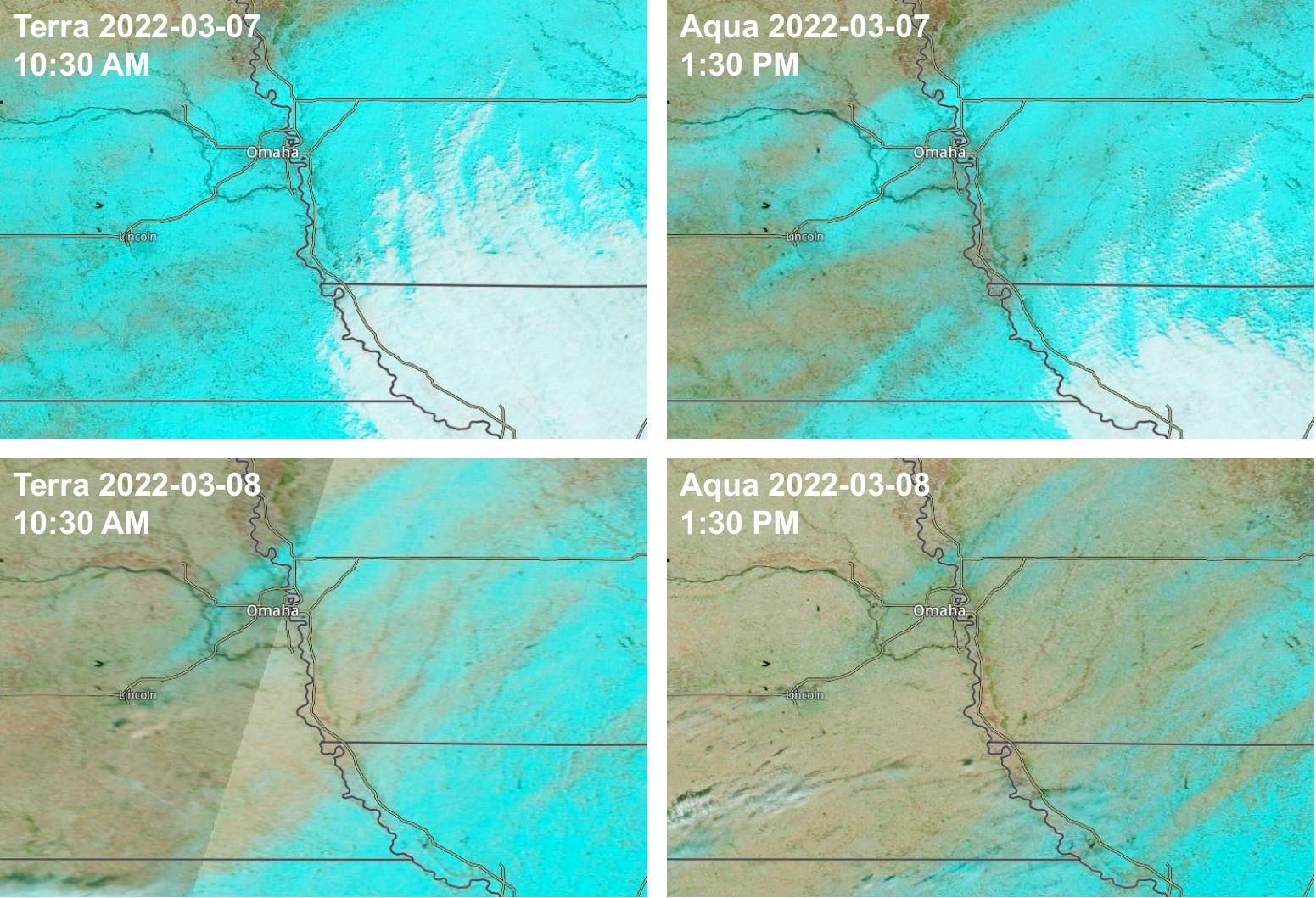
Sub-daily monitoring of the snow cover at such spatial resolution was already possible by combining Aqua and Terra observations (overpass times of 10:30am and 1:30 pm). Here is the same example zoomed in near Ohama, Nebraska (snow cover in blue, clouds in white):


Plus d'actualités

The missing link to valorize CESBIO’s applicative research works

=>  My colleagues at CESBIO are extremely creative! Over the past ten years, they have developed a wide range of new products and methods for extracting information from Copernicus data. They don’t just develop and validate the method on a few sites; they continue their work until they have produced data for the whole of […]

Le chaînon manquant dans la valorisation des travaux de recherche en télédétection

=> Mes collègues du CESBIO sont très créatifs ! Ils ont mis au point, au cours des dix dernières années, un grand nombre de nouveaux produits et de méthodes d’extraction de l’information à partir des données Copernicus (Sentinel-1 et 2). Et bien souvent, ils ne s’arrêtent pas à la mise au point de la méthode […]

Three Sentinel-2 satellites instead of two: impact on the retrieval of the snow disappearance date

Due to the success of Olivier’s petition, ESA kept Sentinel-2A operational after the launch of Sentinel-2C. Having three operational satellites instead of two increases the revisit, which should improve the quality of the derived products, and therefore the reliability of operational services based on Sentinel-2 data. One of this service is the Copernicus’ High Resolution […]

Rechercher