State of the snow cover in the Pyrenees in January 2016
![]() =>
=>![]() The first thing we do in the morning at CESBIO is a break : the coffee break. This is the perfect time to gather field information on the state of the snow cover in the Pyrenees. This year everyone agrees that snow is rare … Can we check this using remote sensing?
The first thing we do in the morning at CESBIO is a break : the coffee break. This is the perfect time to gather field information on the state of the snow cover in the Pyrenees. This year everyone agrees that snow is rare … Can we check this using remote sensing?
The National Snow and Ice Data Center in the USA distributes a global snow product at 500 m resolution that was generated from Terra/MODIS observations. Let’s look for the latest cloud-free image over the Pyrenees.
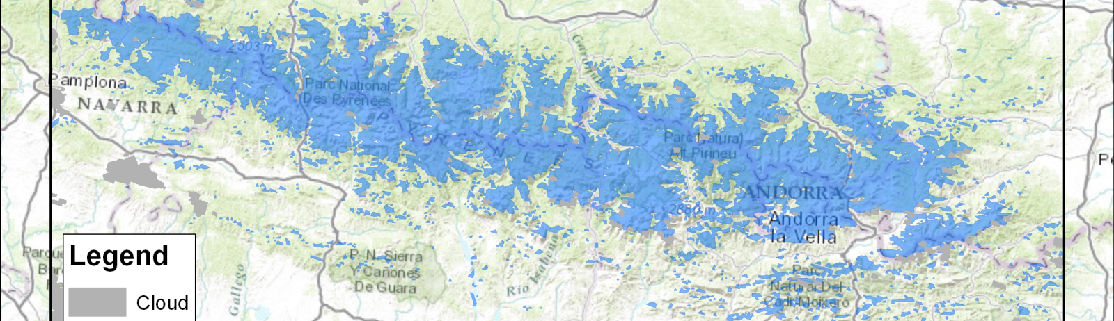
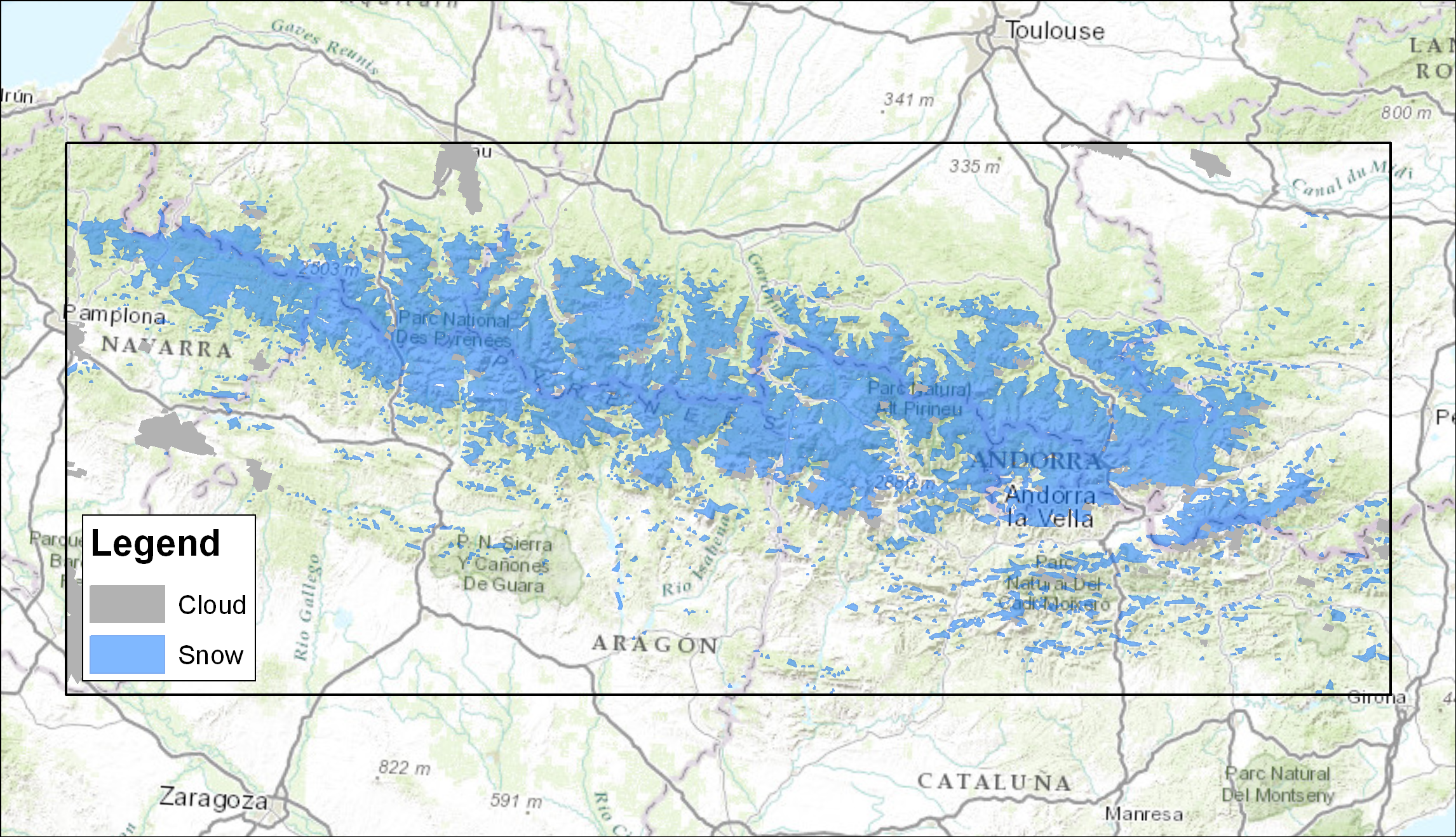
In memory of our Monarchy, and also because the sky was clear, let’s choose January 21 (the images of 28 and 29 January were not yet available, probably in processing) .
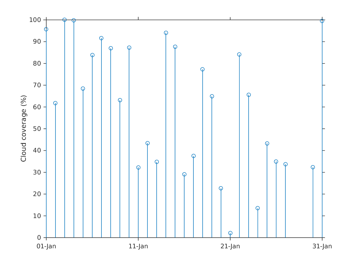
Now we would like to compare the snow cover of January 21, 2016 with all other observed by MODIS on January 21, that is to say since 2001. It is not guaranteed that the others 21 January were also sunny in the past. To solve this problem we can use a daily series of snow maps generated from MODIS for the 2000-2013 period in which all the cloudy pixels have been interpolated. As there are no more gaps, we can calculate for each pixel the number of years for which snow was present on January 21. This gives us an « exceedance probability » : for example, if snow was present every year between 2001 and 2013 then this probability is 1.
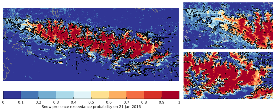
In the figure above, we chose a color scale to visualize directly if the snow of January 21, 2016 was more extended or less extended than usual. If the black line is in the red region, then the snow cover area was lower than average. If the black line is the the blue region, it is the opposite. The first thing that we see is that at the scale of mountain range, the snow cover area was indeed rather low, even if the situation was not unprecedented. But there are regional differences. It seems that the snow cover was particularly reduced in the Eastern Pyrenees, Andorra and in the Central Pyrenees. However, it is larger than usual in the Western Pyrenees.
Take a closer look
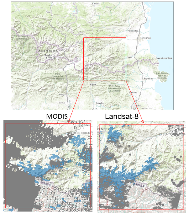
The MODIS product is suitable for an overview of the snow cover at the scale of the whole Pyrenees. However, if you zoom in, the resolution quickly becomes too low. For more details, we need to get optical images of higher resolution. In the Theia website, there is a Landsat-8 scene dated 10 January 2016 already processed at level 2A. The image is very cloudy except in the region of the Canigou peak and the Regional Park of the Catalan Pyrenees. Using LIS code we can quickly produce a snow mask at 30 m resolution from this image. This closer look reveals that the product MODIS is insufficient when looking at specific sites and its errors become all the more obvious.
In a few years, the accumulation of Sentinel-2 and Landsat data will enable to generate snow cover climatologies at high resolution and thus better characterize the fluctuations of the snow cover in the mountains. This gives us time to go take a coffee …