Multitemp blog is now 10 years old
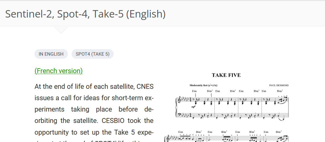
10 years ago, I managed to convince CNES to change the orbit of SPOT4 when it reached its end of life, to place it on a 5 days repeat orbit, in order to simulate the repetitive observations of Sentinel-2. It was the SPOT4 (Take5) experiment. We managed to distribute Sentinel-2 like data (With L1C, 2A and L3A products) on 50 sites, to a lot of users that used these data set to prepare their processing methods. Thanks to these data, at CESBIO, we were able to quickly distribute high quality L2A products with MAJA, or to generate the first ever fully automatic land cover map at 10m resolution and at country scale with Sentinel-2, using the data acquired in 2016.
Communication was an important part of the project, and to provide information and news to SPOT4 users, we decided to start a blog. Our first post is now 10 years old !
In this first post, I wrote some « visionnary » sentences :
The first Sentinel-2 satellite should be launched within the next two years, and the second satellite should follow 18 months later. Together, these satellites will provide us every fifth day with high-resolution images of all land areas… or of the clouds that cover them. Despite these clouds, users will be guaranteed access to cloud-free data at least once per month. The arrival of these data should therefore cause a revolution in the use of remote sensing data.
However, I have to confess that I completely underestimated the success of this mission we had been promoting for years. I was expecting thousands of users, and we had hundreds of thousands !
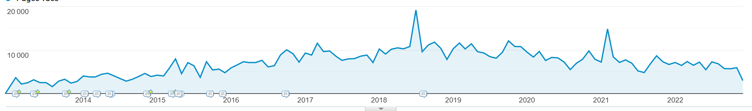
Coming back to our blog, we first intended to keep it only for the duration of the experiment, but as a matter of fact, providing news and writing post was fun ! I was soon joined by Simon Gascoin, and with the help of more than 20 co-authors, we published 1000 posts in the last 10 years. Our blog has been a success with more than 850 000 page views recorded. However, our audience is now slowly eroding, and we hardly publish a few articles per month. Simon and I are getting more and more busy, and perhaps do we lack a little bit of inspiration, it is maybe time to greet some new editors from CESBIO !