More than 1000 downloads of MAJA atmospheric correction software

![]() =>
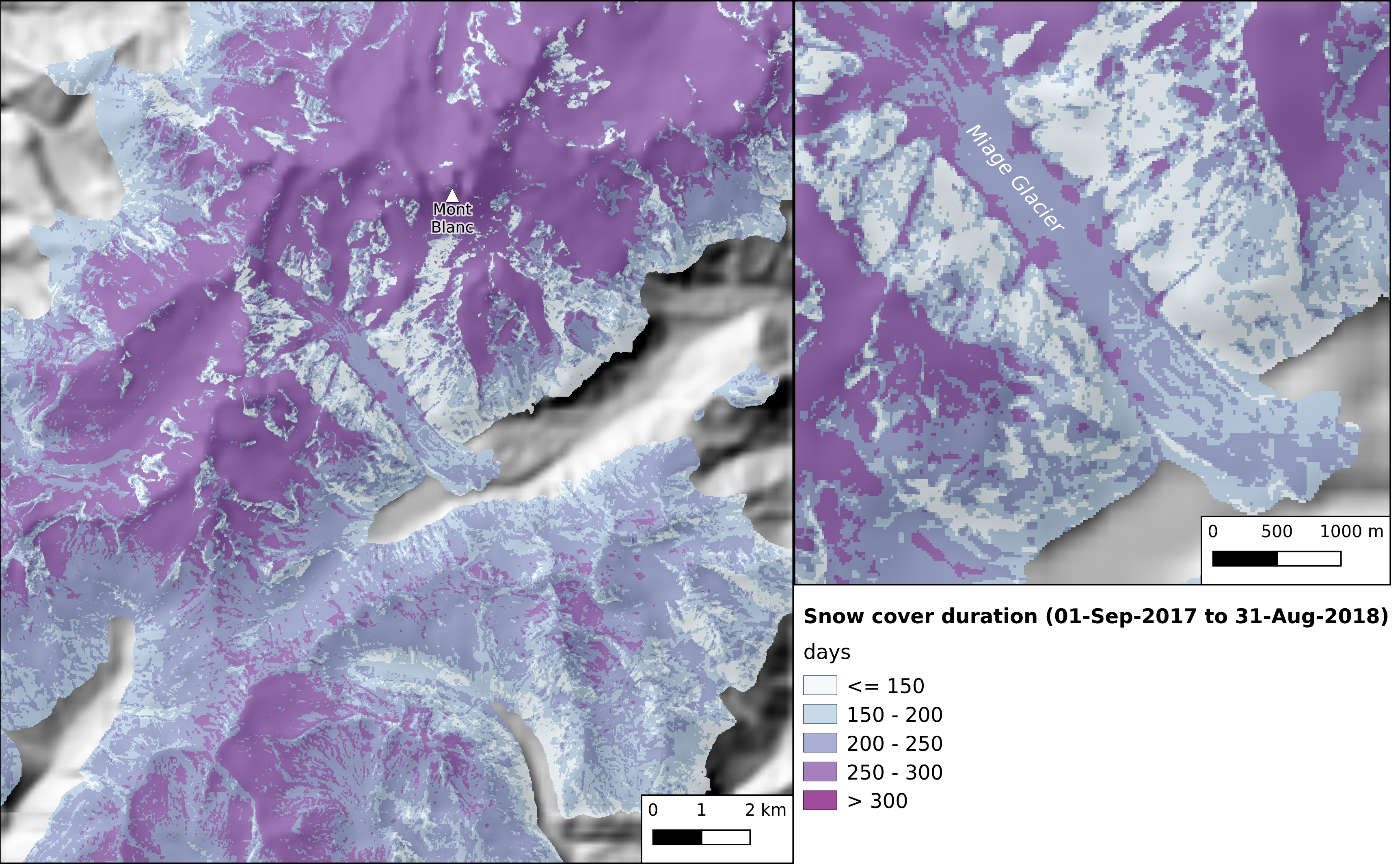
=> ![]() We started distributing MAJA as a free software in July 2017, less than 2 years ago, and it already reached 1000 downloads (1043, as a mater of fact). MAJA was in fact downloaded twice per working day, and in the very last weeks, we had about 4 downloads a day ! Of course it is probably much less than Sen2cor, which is a software with a comfortable funding to make it easy to install and use on a personal computer, under Windows, IOS or Linux systems. But both software are not in the same category, Sen2cor was designed to run on client side, while MAJA was designed to be robust and efficient in production environments. MAJA only works on linux systems, and its multi-temporal features make it less easy to use. MAJA does much more complex computations than Sen2cor, about twice faster thanks to a good parallelization using the Orfeo Toolbox C++ Library. Still, despite this complexity, a lot of users seem to have managed to make it work and seem to be happy with it.Comparison of MAJA (left) and Sen2cor (right) time series over Naples, Italy. Cloud masks are outlined in green, shadows in yellow. click on the image to enlarge.We recommend the use of the latest version 3.3 which brings a lot of improvements. Users can run MAJA through 2 main launchers:
We started distributing MAJA as a free software in July 2017, less than 2 years ago, and it already reached 1000 downloads (1043, as a mater of fact). MAJA was in fact downloaded twice per working day, and in the very last weeks, we had about 4 downloads a day ! Of course it is probably much less than Sen2cor, which is a software with a comfortable funding to make it easy to install and use on a personal computer, under Windows, IOS or Linux systems. But both software are not in the same category, Sen2cor was designed to run on client side, while MAJA was designed to be robust and efficient in production environments. MAJA only works on linux systems, and its multi-temporal features make it less easy to use. MAJA does much more complex computations than Sen2cor, about twice faster thanks to a good parallelization using the Orfeo Toolbox C++ Library. Still, despite this complexity, a lot of users seem to have managed to make it work and seem to be happy with it.Comparison of MAJA (left) and Sen2cor (right) time series over Naples, Italy. Cloud masks are outlined in green, shadows in yellow. click on the image to enlarge.We recommend the use of the latest version 3.3 which brings a lot of improvements. Users can run MAJA through 2 main launchers:
- Sen2Agri, for which MAJA (or its former MACCS version) was downloaded almost 700 times
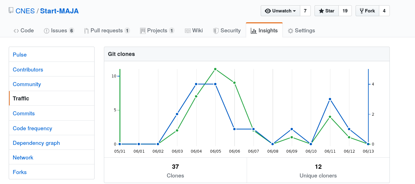
- Start-MAJA, which is a little scheduler I developed first for my own usage and then released as open source on github. It has been downloaded 450 times and has received 18 stars on the CNES github platform, and 45 on my github repository, where it was available before moving to CNES’s.
However, it is not easy to know how many users managed to install it properly, and how many failed. We know some users manage to install it easily. We often receive feedback and questions when users do not succeed at once, and we do not know the proportion who give-up. We would be happy to receive feedback emails and know if you succeeded, and if you are happy with the results.