
Landslides in Kyrgyzstan captured by Sentinel-2

The giant Kurbu-Tash landslide in Kyrgyzstan occurred on 23-24 April 2017 and was highlighted by Dave Petley in the landslide blog of the American Geophysical Union.

Please read the erratum: https://www.cesbio.cnrs.fr/multitemp/?p=10566

The landslide can be seen in a Sentinel-2 image acquired 5 days after the event. I used a near-infrared composite to increase the contrast  between the vegetation and the bare soil.
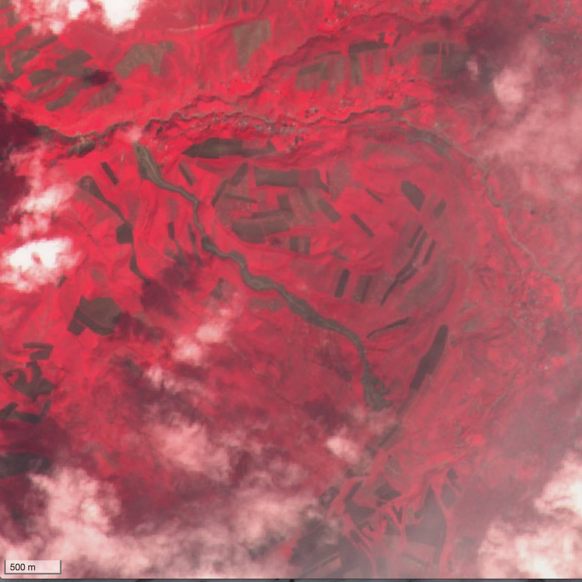
I used this image to estimate that the length of the landslide is about 3.5 km [1]. The volume of the landslide was estimated to 2.8 million cubic meters by AKI press [2]. Local news reported there were no fatalities, but 5 days later, another landslide in Ayu village killed 24 people. I think that this landslide is also visible in the same Sentinel-2 imagery although it is less evident.

[1] Half of the length of the massive Glacier Bay landslide!

[2] This is still 20 times less than the first Aru glacier avalanche.

Plus d'actualités

New clear-sky image of the Rasuwa rock-ice avalanche

On 08 Sep 2026, Sentinel-2 acquired a clear-sky image near the release area of the landslide which caused the catastrophic flood in Nepal. Using this image and a pre-event digital elevation model (Berthier 2026) we can analyze the upper part of the avalanche runout profile. The block of rock and ice was released near 5120 […]

Near real time snow cover maps in the Copernicus Browser!

Copernicus provides near real time snow cover maps at 20 m resolution (fractional snow cover, code name: FSC OG). These products have been recently reprocessed and are now available through the Copernicus Data Space Ecosystem (CDSE) API and visualization tool, the Copernicus Browser! The latter is very useful to explore the data, for example if […]

Suivi du manteau neigeux dans les parcs naturels des Alpes franco-italiennes

Dans les Alpes, le manteau neigeux est un stock d’eau saisonnier naturel dont dépendent la faune, la flore et les humains pour de multiples usages (refuges, bétail, etc.). Dans le cadre du projet ACLIMO financé par le programme européen Interreg ALCOTRA, le Cesbio a été sollicité pour mettre en oeuvre un outil d’estimation de l’équivalent […]

Rechercher
