Our First Sentinel-2 Level 2A processing

Now that Sentinel-2A has started to acquire time series over Europe, we have been able to try our MACCS Level 2A processor to perform atmospheric corrections. As you probably know if you have been following this blog, MACCS works with time series to detect clouds, shadows, water and estimate aerosols optical thickness. Our processor therefore requires at least a couple of images to get a good initialization, .
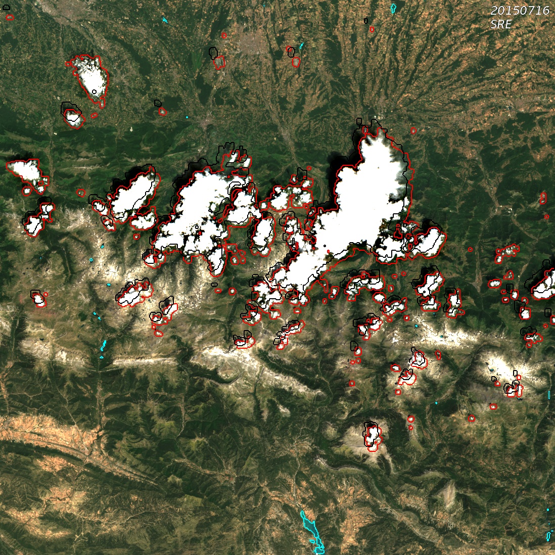
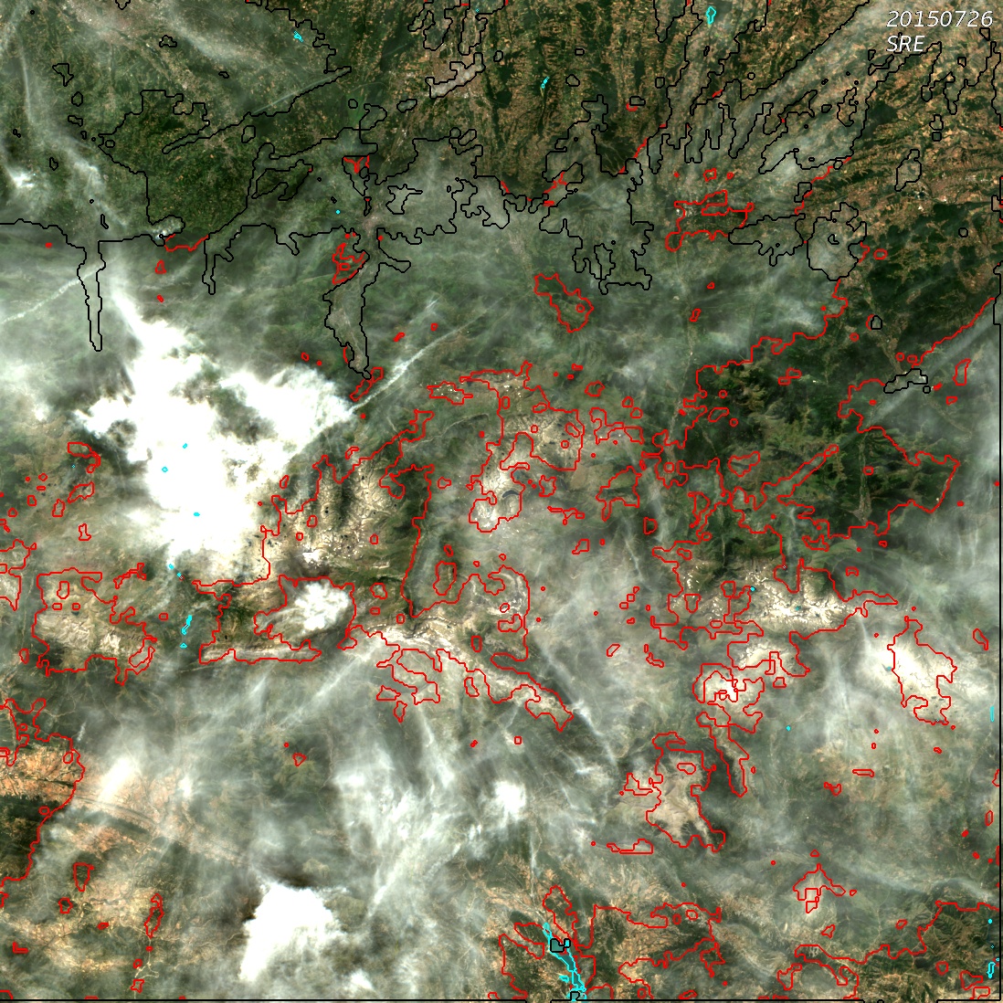
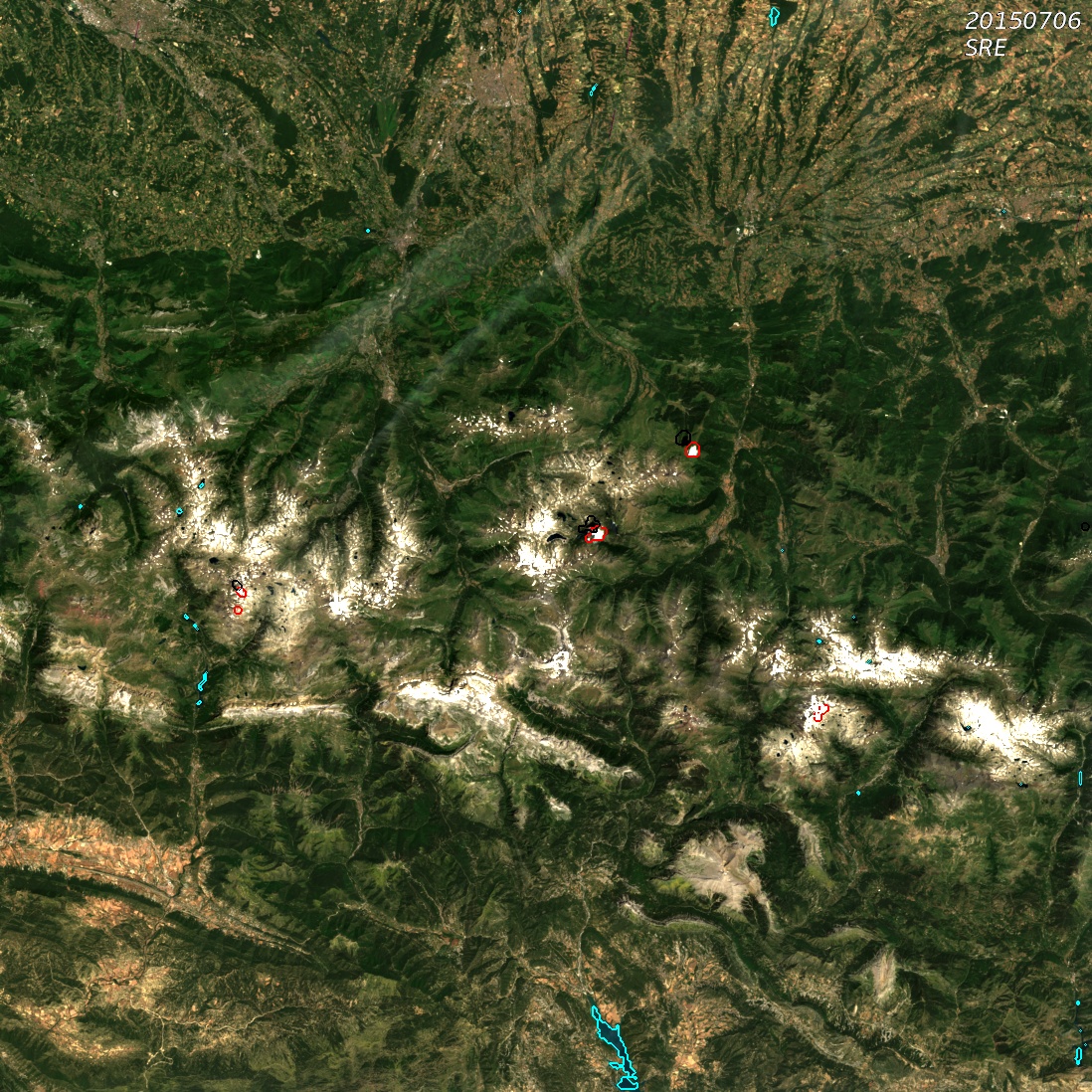
Beatrice Petrucci, from CNES, launched the first processing with a time series of L1C images obtained near the Pyrenees. The L1C data were produced at CNES with the Ground Processing Prototype, which is used to define and validate the processing methods, and also produces all the data needed for the commissioning phase. The results obtained on these L2A data are just great, with a very good detection of clouds and shadows, as you may see on the attached quicklooks. On the joined images, the detected clouds are circled in red, while the shadows are circled in black and water is in blue. You will need to click on the images to see them at 100 m resolution (we had to reduce it to let you download them quickly). You might wonder why on the top of the image of 26/7 some clouds are circled in black and not in red. There is no error in MACCS mask detection, but when cloud mask and shadow mask overlap exactly, the red contour is hidden by the black contour. The atmospheric correction also looks fine, but of course needs to be validated scientifically. These excellent results have been found with a first set of parameters coarsely tuned on the basis of our experience with other sensors; we expect to have even better results when the fine tuning of the parameters will be completed using much more images…