Erratum to « Landslides in Kyrgyzstan captured by Sentinel-2 »

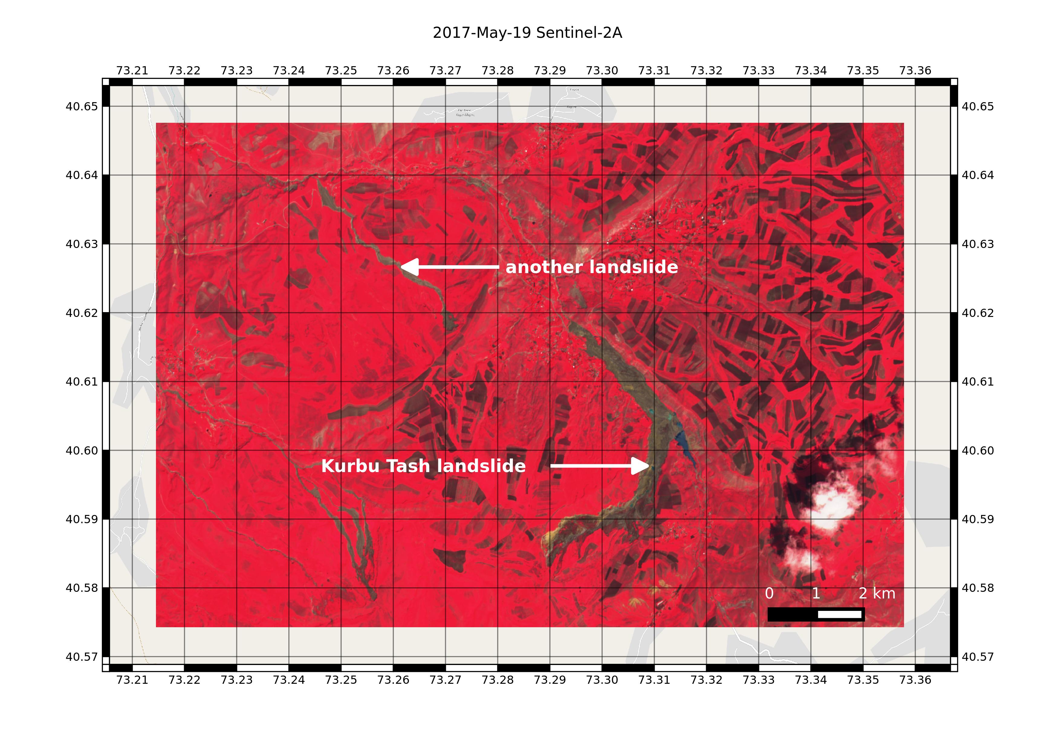
In this post « Landslides in Kyrgyzstan captured by Sentinel-2 » I showed two landslides that I identified as the Kurbu and Ayu landslides, both featured in the AGU landslide blog. However, as pointed out by Isakbek Torgoev, the Kurbu-Tash landslide is located about 5 km farther south than the one I found on the Sentinel-2 image of Apr 29. The actual Kurbu-Tash was not visible in this image due to cloud cover, but today I found a more recent image (May 19), where the Kurbu-Tash landslide is evident.. and it’s even more massive! From this image I estimate that the runout distance of the Kurbu-Tash is about 7 km and not 3.5 km.

Location of the Kurbu-Tash landslide

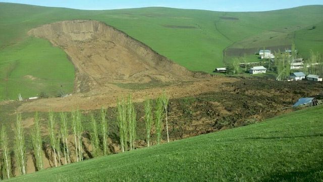
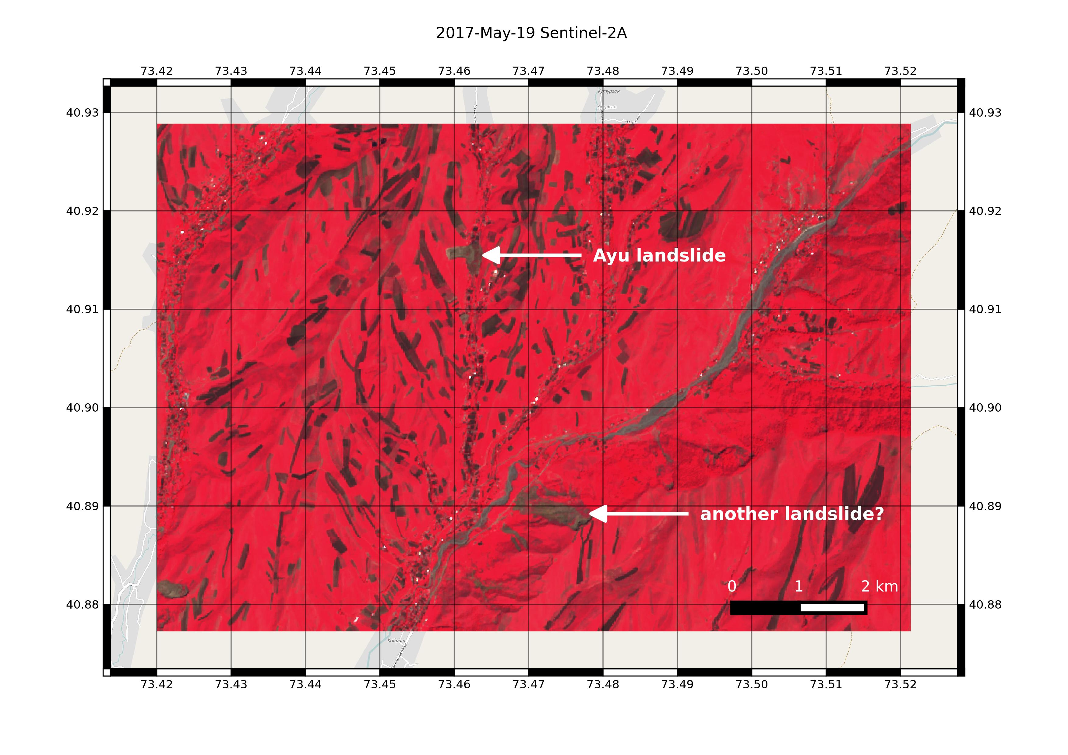
I also failed to find the smaller, but deadlier landslide in Ayu village, which killed 24 people… Thanks to Isakbek Torgoev, I could spot it in the May 19 Sentinel-2 image.

Location of the Ayu village landslide

Landslides are common in Kyrgyzstan. However, it seems that the number of landslides this year is higher than the average, probably due to heavy rainfalls.

Ayu village landslide (via KABAR and Dave Petley)

Plus d'actualités

BIOMASS, the third launched satellite mission designed at CESBIO !

After SMOS in 2009, and VENµS in 2017, the CESBIO Laboratory is very proud to see its third proposed mission, Biomass, reach orbit. As always, it has been a long journey from the idea, at the beginning of the century, to the selection in 2013 as the seventh Earth Explorer Mission by ESA, to the […]

Sentinel-2 reveals the surface deformation after the 2025 Myanmar earthquake

Sentinel-2 captured several clear-sky images of Myanmar before and after the 28 March 2025 earthquake. The animation below shows a 5-day apart sequence of images captured by Sentinel-2B and Sentinel-2C (10 m resolution) near the epicenter located close to Mandalay. The surface slip due to the earthquake follows the Sagaing Fault, a major fault in […]

Evolution de l’altitude de la ligne de neige au cours des 41 dernières années dans le bassin versant du Vénéon (Oisans)

Pour contribuer à caractériser les conditions hydrométéorologiques lors de la crue torrentielle qui a frappé la Bérarde en juin, j’ai analysé une nouvelle série de cartes d’enneigement qui couvre la période 1984-2024 [1]. Grâce à la profondeur temporelle de cette série, on constate que l’altitude de la ligne de neige dans le bassin versant du […]

Rechercher