Satellite Missions

Capturing the Diurnal Cycle of Urban Overheating with ECOSTRESS data

The successive heat waves of the summer of 2026 remind us of the urgent need to take action to adapt to episodes of extreme heat that are set to become more frequent, intense, and occur earlier in the year. In this context, the urban heat island effect emerges as a major problem. Indeed, cities, as […]
16.07.2026

Évolution journalière de la température de surface en ville : apport du capteur ECOSTRESS

Les canicules successives de cet été 2026 nous rappellent l’urgence d’agir pour s’adapter à des épisodes de chaleur extrême appelés à devenir plus fréquents, intenses et précoces. Dans ce contexte, la surchauffe urbaine apparaît comme un problème majeur. En effet, les villes, telles qu’elles sont construites aujourd’hui, présentent des températures plus élevées de plusieurs degrés […]

Near real time snow cover maps in the Copernicus Browser!

Copernicus provides near real time snow cover maps at 20 m resolution (fractional snow cover, code name: FSC OG). These products have been recently reprocessed and are now available through the Copernicus Data Space Ecosystem (CDSE) API and visualization tool, the Copernicus Browser! The latter is very useful to explore the data, for example if […]

26.05.2026

The missing link to valorize CESBIO’s applicative research works

=>  My colleagues at CESBIO are extremely creative! Over the past ten years, they have developed a wide range of new products and methods for extracting information from Copernicus data. They don’t just develop and validate the method on a few sites; they continue their work until they have produced data for the whole of […]

23.02.2026

Le chaînon manquant dans la valorisation des travaux de recherche en télédétection

=> Mes collègues du CESBIO sont très créatifs ! Ils ont mis au point, au cours des dix dernières années, un grand nombre de nouveaux produits et de méthodes d’extraction de l’information à partir des données Copernicus (Sentinel-1 et 2). Et bien souvent, ils ne s’arrêtent pas à la mise au point de la méthode […]

Sentinel-2 overtakes Landsat in scientific litterature

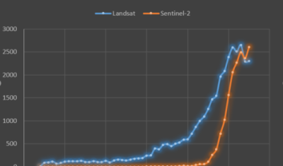
OpenAlex is a new, yet already very useful, open database for exploring scientific literature. For an upcoming blog post on the CNES Datacampus website, I analysed the proportion of papers that used only one of the Sentinel-2 or Landsat missions, as well as those that used both, in 2025. What struck me was that Sentinel-2 […]

20.02.2026

Everything, Everywhere, All at Once

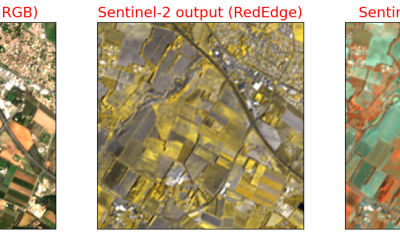
This blog post is not a review of the excellent and deeply philosophical, parallel-universes delirium movie by Daniel Kwan and Daniel Scheinert, but the title of this drama resonates with the capabilities of our latest algorithm, which has just been published in Remote Sensing of Environment: J. Michel and J. Inglada, « Temporal attention multi-resolution fusion […]

17.02.2026

Three Sentinel-2 satellites instead of two: impact on the retrieval of the snow disappearance date

Due to the success of Olivier’s petition, ESA kept Sentinel-2A operational after the launch of Sentinel-2C. Having three operational satellites instead of two increases the revisit, which should improve the quality of the derived products, and therefore the reliability of operational services based on Sentinel-2 data. One of this service is the Copernicus’ High Resolution […]

24.01.2026

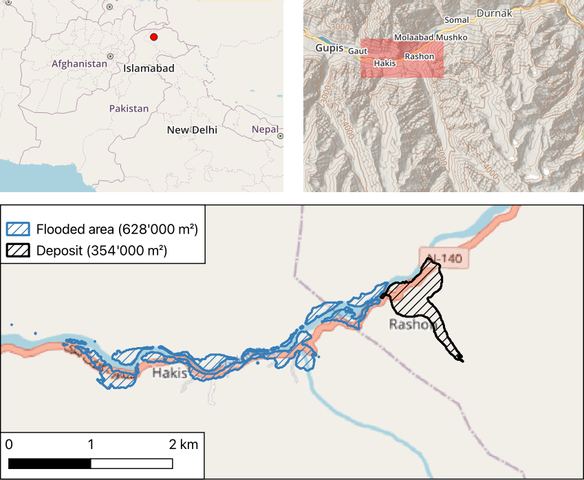
Rapid analysis of the GLOF in Gupis, Gilgit-Baltistan

Pakistan news media reported that a glacier lake outburst flood (the failure of a dam containing a glacial lake) occurred near Gupis, Gilgit-Baltistan, a highly mountainous region administered by Pakistan. Satellite images show that the flood triggered a debris flow, which reached the Gupis valley where it hit the Roshan (Rashon) village and blocked the […]

24.08.2025

Rechercher