Le Million : le centre de données MUSCATE au CNES a mis à disposition plus d’un million de produits
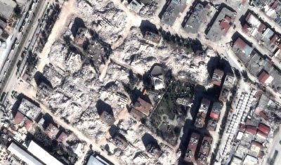
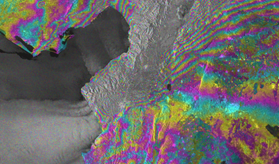
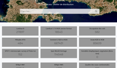
=> Le Million ! Si vous calculez la somme des nombres de produits distribués par le CNES pour THEIA, vous pourrez voir que notre centre distribue maintenant plus d’un million de produits (1 000 000 !). Les lecteurs qui suivent ce blog se souviennent peut-être de nos difficultés initiales, qui nous poussaient à célébrer les […]