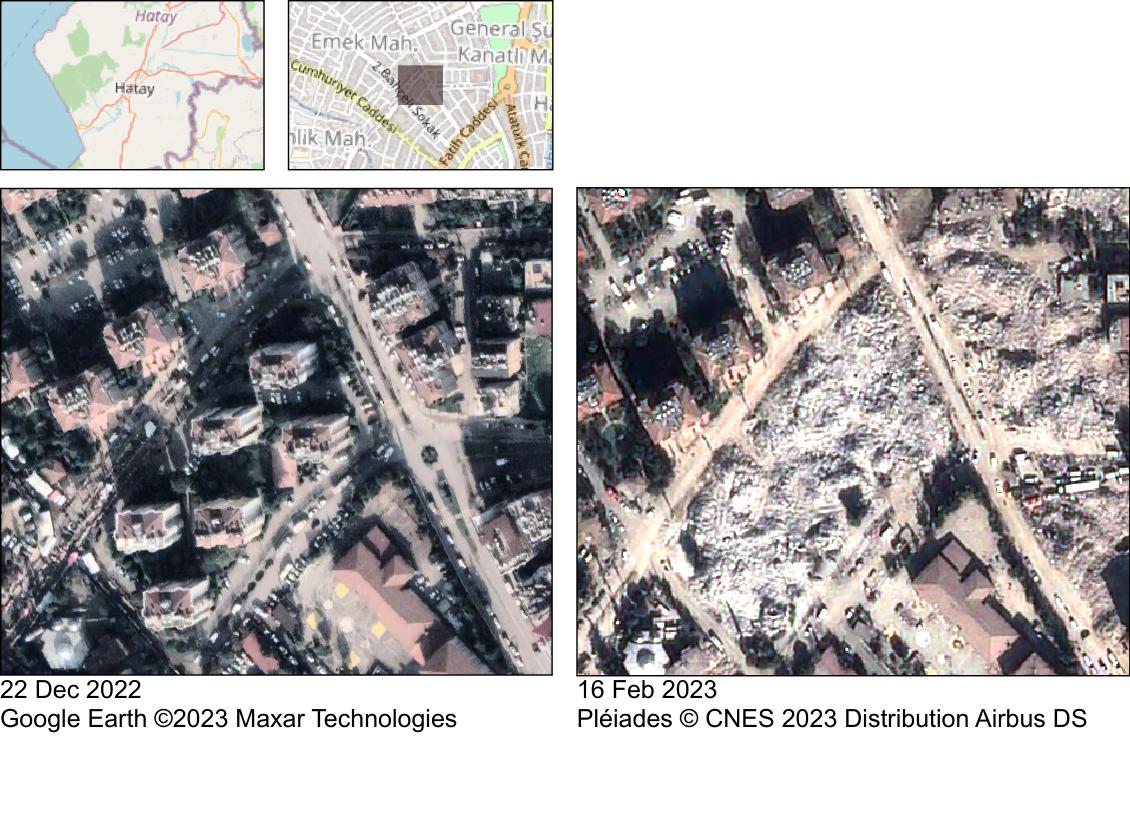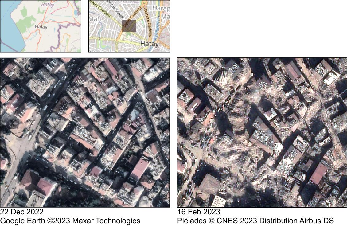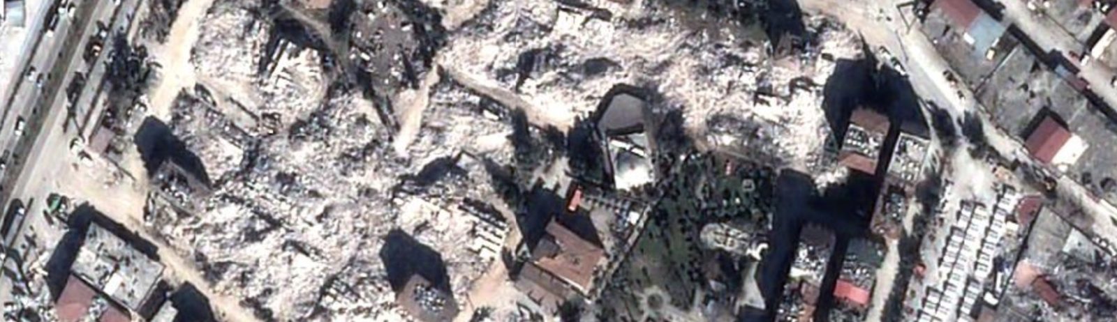
Antakya before and after the earthquakes

We received satellite images of Antakya, Turkey acquired by Pléiades 10 days after the earthquake. The comparison with pre-event imagery leaves me speechless.
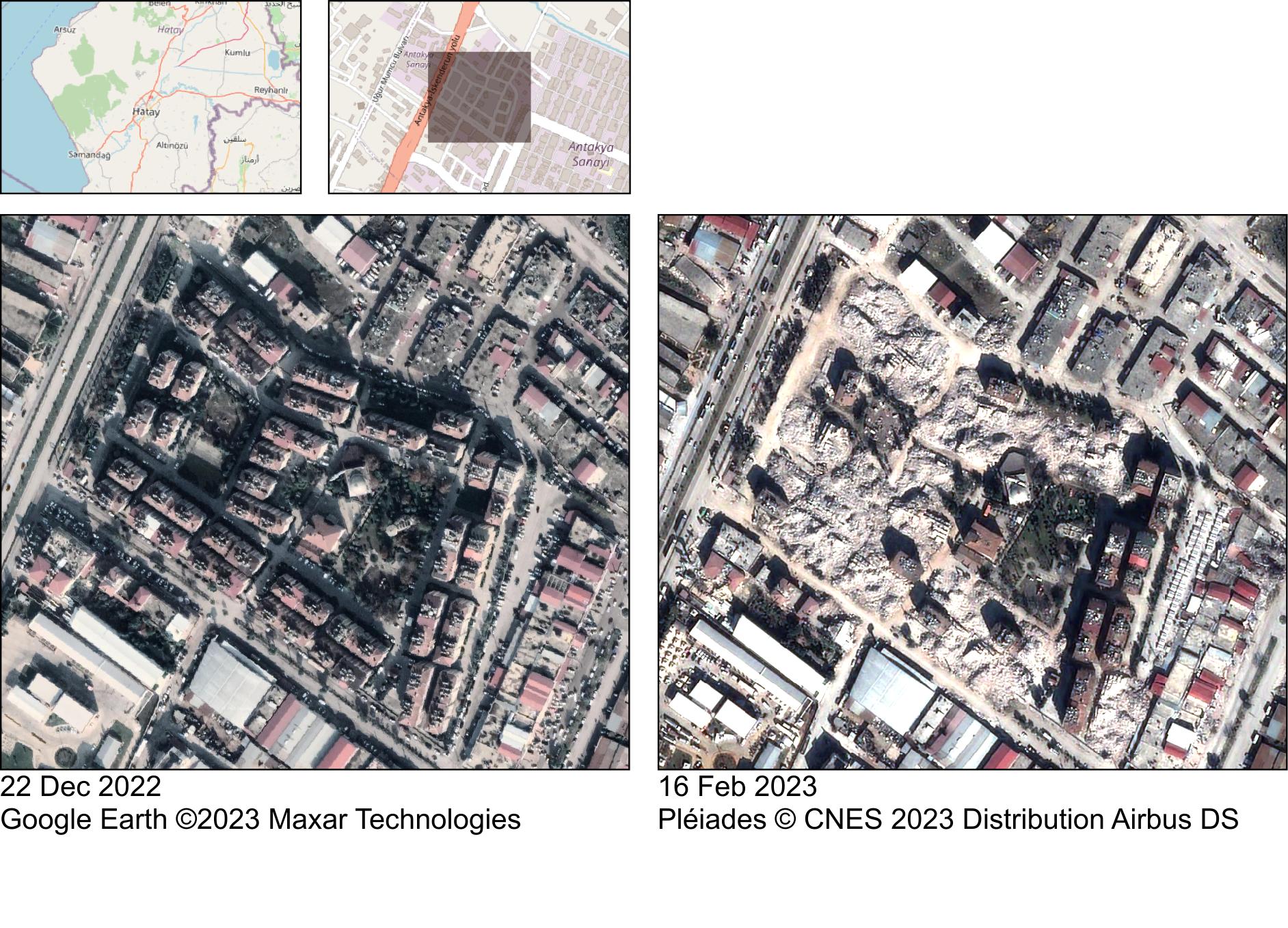
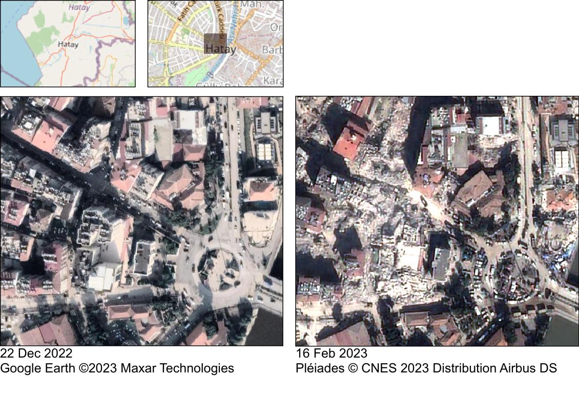
The post-event images were acquired by Pléiades PHR1A thanks to CNES Cellule d’Intervention et d’Expertise Scientifique et Technique nouvelle génération : CIEST²
(https://www.poleterresolide.fr/ciest-2-nouvelle-generation-2/). I rectified the raw images using the SRTM digital elevation model and pan-sharpened the multispectral image. All processing done using the Orfeo Toolbox.

Plus d'actualités

How long is the cooling effect of a cloud shadow ?

How long does it take for the cannon barrel to cool down after firing a shell ? Fernand Raynaud This quote is from a famous old French funny sketch by Fernand Raynaud, which was based on a question in a French manual for soldiers: the sketch is rather long, so I’ll give you the answer […]

Impact of the August 12, 2026 eclipse on photovoltaic electricity generation in Spain

Photovoltaic (PV) energy supplies more 20% of Spain’s total electricity, and this share hit a new high in July 2026 (28.3% of the nation’s monthly electricity mix). Some media outlets were concerned about the drop in photovoltaic power generation during the 12-Aug-2026 eclipse. Le Monde explained that « the drop is expected to be particularly pronounced […]

The missing link to valorize CESBIO’s applicative research works

=>  My colleagues at CESBIO are extremely creative! Over the past ten years, they have developed a wide range of new products and methods for extracting information from Copernicus data. They don’t just develop and validate the method on a few sites; they continue their work until they have produced data for the whole of […]

Rechercher