Detecting geolocation errors in glacier outlines with Sentinel-2 snow cover duration maps
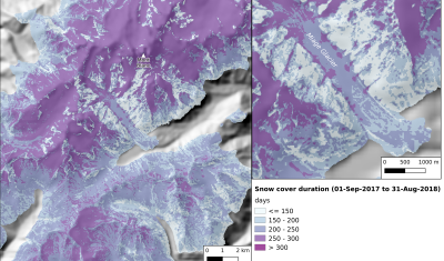
Two years ago I posted an animation of the snow cover area evolution near Zermatt, Switzerland from Sentinel-2 L2A data processed by LIS. From this time series of snow maps I generated a snow cover duration map and then I added the glacier outlines from the Randolph Glacier Inventory 5.0. I was satisfied by the […]