Landsat

Let it snow! Development of an operational snow cover product from Sentinel-2 and Landsat-8 data

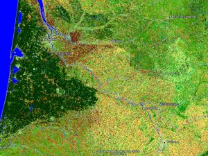
=> « Winter is coming » ― George R.R. Martin, A Game of Thrones As Christmas holidays are approaching you might want to know if there is snow in your favorite spot of ski touring? A good knowledge of the snow cover variability is important – not only to plan your next week-end, but also because the snow is […]

15.12.2015

Génération automatique et opérationnelle de cartes d’occupation des sols

=> Pour le moment,  il n’existe pas de cartes d’occupation des sols en France produites annuellement à résolution décamétrique. La carte Corine Land Cover, largement utilisée, n’est produite que tous les 5 ans, et la version de 2012 est sortie il y a tout juste quelques mois. Celle-ci est en effet produite par photo-interprétation, ce […]

28.11.2015

Quelle projection pour les produits Sentinel-2 de Theia autour de la France ?

Plusieurs équipes sont en train de préparer leurs réponses à l’appel à propositions Theia pour le traitement des données de niveau 2 Sentinel-2 (date limite le 8 décembre). Parmi les projets dont j’ai entendu parler, deux d’entre eux concernent les massifs des Pyrénées et des Alpes. Si ces deux projets sont sélectionnés, ils vont nous […]

24.11.2015

Real time production of land cover maps without terrain data of the current time period.

=> With the new availability of repetitive image time series after atmospheric correction over France from the Theia Land Data Centre, it is now possible to imagine the automatic production of land cover maps continuously with the availability of new images. In the framework of the SYRHIUS project, a prototype was developed at CESBIO to assess the […]

01.11.2015

Calcul automatique de cartes d’occupation du sol sans données de terrain

=>Avec la mise à disposition régulière d’images corrigées des effets atmosphériques et téléchargeables librement par le pôle Theia, il est possible d’imaginer la production de classifications de l’occupation du sol automatique et en continu au fil de la mise à disposition de nouvelles images. Dans le cadre du projet SYRHIUS, un prototype a été développé au […]

24.10.2015

Landsat Science Team meeting slides

Twice a year, there is a  Landsat Science Team meeting, organised by USGS. One day is dedicated to LANDSAT news, and one or two days to the science team presentations. And what is good, is that the slides are made available just after the meeting. It is a good way to get news from LANDSAT, and […]

20.08.2015

CNES THEIA distribution site is back on line

=>  The CNES THEIA distribution site was closed for 3 weeks for renovation works. It just reopened with a new address : It is possible again to downloat the L2A LANDSAT data over France. Besides anan enhanced look and feel, there are two new possibilities :     As it is a new version, you might […]

20.06.2015

L’atelier de distribution THEIA réouvre

=>Après 3 semaines de fermeture pour rénovation, l’atelier de distribution THEIA réouvre avec une nouvelle adresse : Vous pouvez de nouveau télécharger des données LANDSAT sur la France. Outre une interface plus complète et encore plus moderne, cette nouvelle version apporte deux grandes nouveautés :    Cette version étant nouvelle, vous aurez probablement des suggestions […]

18.06.2015

THEIA’s LANDSAT and SPOT4 (Take5) distribution suspended for a few days

=> The distribution servers of LANDSAT and SPOT4 (Take5) within THEIA land data center went off-line today for two to three weeks. A new version of the distribution software must be installed. The next days will be used by CNES teams to install the softwares, transfer the databases and obtain the security clearance. When all […]

21.05.2015

Rechercher