Applications

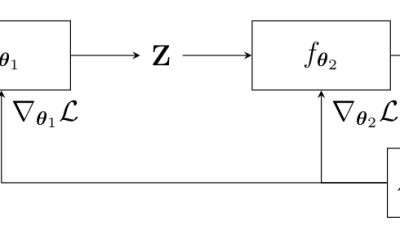
End-to-end learning for land cover classification using irregular and unaligned satellite image time series

The results presented here are based on published work : V. Bellet, M. Fauvel, J. Inglada and J. Michel, « End-to-end Learning For Land Cover Classification Using Irregular And Unaligned SITS By Combining Attention-Based Interpolation With Sparse Variational Gaussian Processes, » in IEEE Journal of Selected Topics in Applied Earth Observations and Remote Sensing, doi: 10.1109/JSTARS.2023.3343921. This […]

19.01.2024

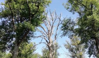
Une nouvelle méthode opérationnelle pour surveiller le dépérissement des chênes en région Centre-Val de Loire

 => Les résultats présentés ici sont issus des travaux publiés dans l’article: F. Mouret, D. Morin, H. Martin, M. Planells and C. Vincent-Barbaroux, « Toward an Operational Monitoring of Oak Dieback With Multispectral Satellite Time Series: A Case Study in Centre-Val De Loire Region of France, » in IEEE Journal of Selected Topics in Applied Earth Observations […]

22.11.2023

A new operational method for monitoring oak dieback in the Centre-Val de Loire region

=>  The results presented here are based on work published in the journal paper: F. Mouret, D. Morin, H. Martin, M. Planells and C. Vincent-Barbaroux, « Toward an Operational Monitoring of Oak Dieback With Multispectral Satellite Time Series: A Case Study in Centre-Val De Loire Region of France, » in IEEE Journal of Selected Topics in Applied […]

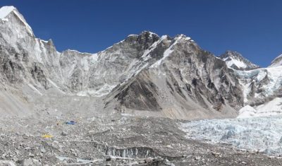
Glacier changes in the Lingtren–Khumbutse catchment using Pléiades

The iconic Khumbu Glacier in Nepal is fed by several tributaries, such as this branch in the Lingtren–Khumbutse catchment. Recently a new Pléiades triplet covering the Khumbu region was added into the DINAMIS repository (acquisition date 22 Oct 2023). There is another triplet in the same area acquired on 11 Mar 2016 hence we can […]

13.11.2023

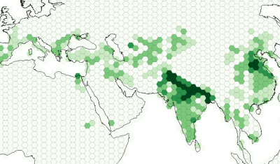
Global map of irrigated areas

It’s not easy to find a good cartographic representation of the global irrigated land, therefore I made my own map using data from Meier et al. (2018). The raw resolution of the above product is 30 arcsec, i.e. 1 pixel covers about 1 km by 1 km at equator. Here, I aim to represent the […]

01.08.2023

Découvrir les structures cachées du paysage grâce au lidar

Le lidar est magique ! Cette technologie permet de mesurer très précisément l’altitude du sol y compris sous la végétation. Voici un exemple qui montre des sentiers cachés dans une forêt du Jura :   L’image en teintes de gris est un « hillshade » c’est-à-dire un ombrage du relief. Ce relief est issu du RGE ALTI […]

28.05.2023

Artificial snow accumulation detected from space

People often ask if we can detect artificial snow in satellite images. It’s not so easy except when the surrounding slopes are totally snow-free… But recently, I noticed some anomalous snow accumulations patterns in one of my satellite-derived snow depth maps near Super Barèges ski resort (Pyrenees). I made this snow depth map from a […]

03.04.2023

Télédétection de l’orientation des cultures

(article publié aussi sur le site du labo-OT au CNES) Pourquoi s’intéresser à l’orientation des cultures agricoles ? Au moins pour deux raisons. L’orientation des cultures par rapport à la pente du terrain contribue de façon importante au risque de ruissellement intense et par voie de conséquence à l’érosion des sols. Par ailleurs, connaitre l’orientation des […]

22.03.2023

How to use on demand InSAR to analyse the Joshimath landslide

International news media reported that the Joshimath city in north India (Uttarakhand) was « sinking » due to a slow landslide. In January, many houses had developed major cracks on the walls and 145 families were temporarily moved. The Indian space agency published a map of the ground deformation obtained by SAR interferometry using Sentinel-1 data. Although […]

21.01.2023

Rechercher