Land cover – Occ.des sols

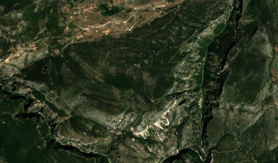
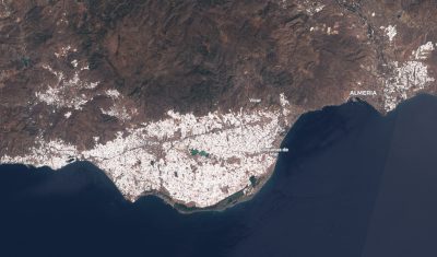
Whitewhashing the Plastic Sea near Almería

Almería province in Spain is « one of the most recognisable spots on the planet from the lens of a passing satellite. The roofs of tens of thousands of closely packed plastic greenhouses form a blanket of mirrored light beaming into space. » (The Guardian). Greenhouses in Almería are typically made with transparent plastic to increase the […]

26.08.2018

Sentinel-2 sees a persistent degradation of forests near the Gorges du Verdon, after 2017 drought

=> Coming back from our stay in the Alps, we stayed one day near the Verdon Gorges, the European Grand Canyon (I know there is a difference in scale with the American one). Anyway, the landscape was gorgeous as you can seen on the panorama below.    But don’t worry, I will not tell you […]

01.08.2018

La vectorisation du produit OSO, comment ça marche ?

Le produit vecteur d’OSO 2017 est enfin sorti ! Après plusieurs semaines de traitements, les vecteurs de chaque département sont disponibles ici. La production requiert la mobilisation d’une grande quantité de ressources de calcul et une stratégie de traitements un peu particulière. Nous voulions vous expliquer comment parvient-on à produire cette couche d’information. A priori, […]

12.06.2018

Machine learning for land cover map production – Follow-up on the TiSeLaC challenge

I discussed some important aspects to take into account when validating land cover maps in a previous post. In that same post I insisted on the fact that machine learning pipeline building using a blind optimisation of accuracy metrics can lead to unrealistic expectations about land cover maps produced using these approaches. I cited as an […]

17.05.2018

Another validation of CESBIO’s 2016 France land-cover map

In this post, a validation of the land-cover map of France produced by CESBIO for the 2016 period was presented. This validation used independent data (that is data collected by different teams and using different procedures than the data used for the classifier training), but the validation procedure consisted in applying classical machine learning metrics […]

21.02.2018

Machine learning benchmarking for land cover map production

Land cover map validation is a complex task. If you read French, you can check this post by Vincent Thierion which shows how the 2016 LC map of France produced by CESBIO stands with respect to data sources independent from those used for its production. But this is only one aspect of the validation. A […]

11.01.2018

Venµs à l’honneur en Haute-Garonne et en Ariège en 2018

Le satellite Franco-Israelien Venµs, attendu depuis si longtemps, a été lancé le 2 août 2017. 110 sites dans le monde vont être observés en 2018 et 2019 à 10 m de résolution et avec 12 bandes spectrales. Alors que la plupart des sites ne correspondent qu’à l’emprise d’une scène Venµs (27 à 32 km de […]

05.12.2017

Building a global cropland mask, is not an easy task

Criticizing is easy, and doing is hard, especially when trying to create a global map of croplands. Some collegues from CESBIO have worked on that subject within the Sen2Agri project, and obtained good resuts, but only at the local or country scale. Finding a method that works everywhere must clearly be much harder.These days, I […]

27.11.2017

The Delta of the Ebro seen by Venμs

=> The Ebro (Iberus in Latin) flows into the Mediterranean in Catalonia after a journey of more than 900 km from its source in Cantabria. The current morphology of the Delta results from the significant increase in sediment inputs caused in the 15th century by the intensive deforestation of the river catchment: the conquest of […]

01.09.2017

Rechercher