Artificial snow accumulation detected from space

People often ask if we can detect artificial snow in satellite images. It’s not so easy except when the surrounding slopes are totally snow-free…

But recently, I noticed some anomalous snow accumulations patterns in one of my satellite-derived snow depth maps near Super Barèges ski resort (Pyrenees). I made this snow depth map from a pair of Pléiades stereo images acquired on 16-Mar-2021 (to know more about the method see Marti et al. 2016; Deschamps-Berger et al. 2020).

Pléiades multispectral image and snow depth 16 Mar 2021 © CNES Distribution Airbus DS

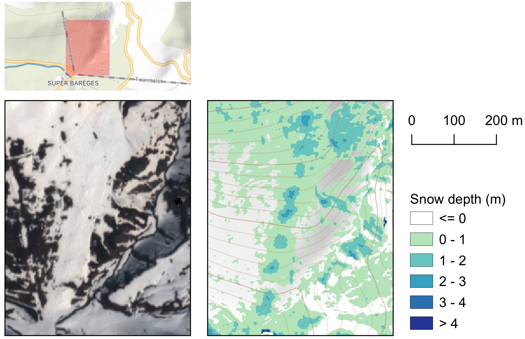
The little snow mounds are located on the Toue ski slope. By looking closely on Google Maps, I noticed that this slope is equipped with snow cannons precisely located near these little mounds… Hence we see here artificial snow accumulation. To my knowledge, this is the first time that artificial snow depth is spotted from space!

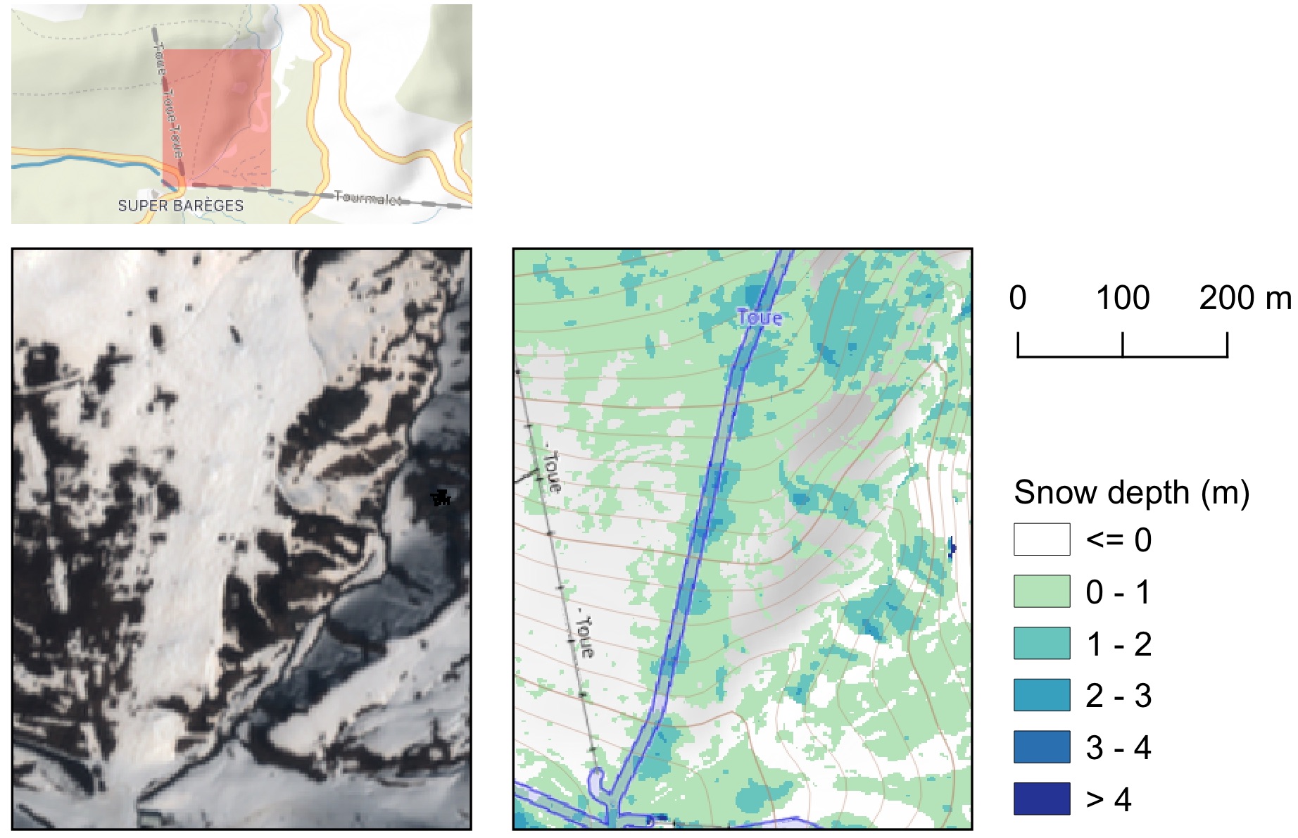
That year the ski resorts were closed because of the Covid-19. But the ski resort managers had the snow cannons running anyway as the decision was made quite late by the government. The accumulated snow remained there the whole winter as snow groomers were not used to spread it on the slopes.

La Plagne-Montalbert (French Alps) on 3 Jan 2021 (photo by César Deschamps-Berger). Snow cannons were operated before the ski season was cancelled due to the pandemic and the snow was just there the whole winter..

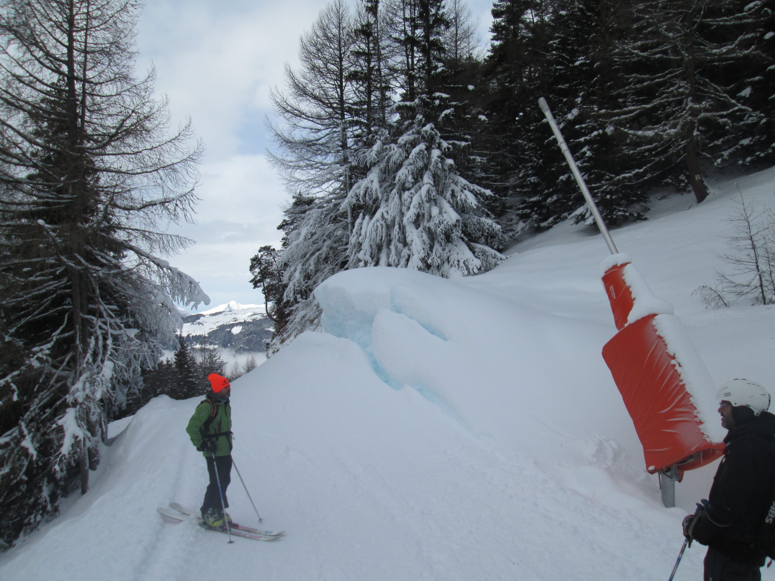
PS. There is another way to spot artificial snow even if your eyes can’t see it..


Plus d'actualités

Three Sentinel-2 satellites instead of two: impact on the retrieval of the snow disappearance date

Due to the success of Olivier’s petition, ESA kept Sentinel-2A operational after the launch of Sentinel-2C. Having three operational satellites instead of two increases the revisit, which should improve the quality of the derived products, and therefore the reliability of operational services based on Sentinel-2 data. One of this service is the Copernicus’ High Resolution […]

Autumn snow drought on Mount Damavand

« We are currently experiencing the driest autumn the country has experienced in 50 years » said Iran’s meteorological organisation. Near Tehran, Mount Damavand, the highest peak in Iran (5609 m) was reported to be « unusually bare of snow ». I checked this statement using my MODIS snow cover data processing algorithm implemented in Google Earth Engine (Gascoin […]

IOTA2 software mailing list

Hello everyone, We have just created a mailing list for users of the IOTA2 software (iota2 — iota2 documentation). The tool will undergo significant developments in the coming months, and the purpose of this list is to communicate with the community to support these changes and to maintain the processing workflows needed by the users. […]

Rechercher