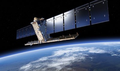
In English

Viedma glacier terminus since 1985

Viedma Glacier is an iconic glacier of the Southern Patagonia icefield. Landsat 5, Landsat 8 and Sentinel-2 images series show that its terminus has retreated by 3 km since 1985. Looking closer one can notice a new proglacial lake forming in a recently deglaciated area. Since I won 80 sq km of Airbus Pléiades data, […]

BRDF

First validation results with the Lamasquère ROSAS instrument

=> Following its installation in March 2021, our new ROSAS device at Lamasquère has produced a first series of acquisitions over a complete maize crop cycle. The ROSAS system is based on the use of a multi-spectral photometer to carry out angular and spectral measurements of both incident and reflected radiation from the surface. The […]

BRDF

Premiers résultats de validation du site ROSAS de Lamasquère

=> Suite à sa mise en place en mars 2021, notre nouveau dispositif ROSAS de Lamasquère a produit une première série d’acquisitions sur un cycle complet de culture de maïs. Le dispositif ROSAS repose sur l’utilisation d’un photomètre multi-spectral pour non seulement réaliser des mesures angulaires et spectrales du rayonnement incident, mais aussi du rayonnement […]

In English

The snow you can’t see

Last year in November we noticed these unusual white spots in a Sentinel-2 image near Barèges… These white spots were artificial snow spread by snow cannons. At the same time of the Sentinel-2 acquisition, they were also « visible » as cold spots from our thermal infrared camera installed at Pic du Midi. This year in November […]

En Français

Sortie de MAJA 4.5, compatible avec le nouveau format des L1C Sentinel-2

=> Suite à l’annonce par l’ESA d’une mise à niveau majeure du format du produit Sentinel-2 pour début janvier 2022, l’équipe de développement de CS et du CNES s’est empressée d’adapter MAJA à ces nouvelles spécifications. En particulier : prendre en compte le nouvel offset radiométrique permettant des valeurs négatives ; prendre en compte du […]

Comment ça marche /how it works

The plainbow over Fraser river sediment plume

Sentinel-2 captured an impressive view of the Fraser river sediment plume in Georgia Strait caused by the historic flood in British Columbia (250 mm rainfall in 48 hours). The image contains an amusing detail west off the Vancouver International Airport. This red-green-blue object is an airplane or « plainbow« . It is due to shifts between the […]

En Français

Ça y est, le glacier de l’Astrolabe a vêlé !

En janvier dernier nous vous annoncions la mise en couveuse d’un bel iceberg au terminus du glacier de l’Astrolabe … Yann Niort qui travaille actuellement pour Météo-France en Terre-Adélie nous a signalé que le glacier avait enfin vêlé ! En fait ce n’est pas un iceberg mais une jolie portée de plusieurs icebergs que l’Astrolabe […]

Datascience

MAGicians and deep learning wizards

There are several MAGicians in the CESBIO laboratory, and I am one of them (with all due modesty). According to my definition, MAGicians are participants to Mission Advisory Groups, for instance for CNES or ESA satellite projects. These days, I participate to the MAG for Sentinel-HR at CNES, and for Sentinel-2 Next Generation at ESA. […]

Sentinel-2

Mount Everest in 3D

Because it’s a stunning place that I will probably never visit, I have spent some time to make a 3D visualization of Mount Everest using QGISthreejs plugin in QGIS. I draped the 24 Oct 2021 clear-sky Sentinel-2 image on a gapfilled version of the HMA 8m digital elevation model (like in this post on the […]