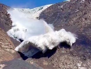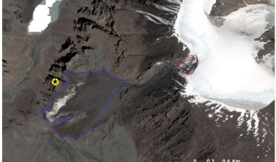
Kyrgyzstan glacier collapse. New Pléiades and SPOT7 images tell us more…
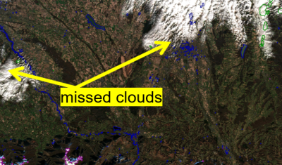
Because the first images were partly cloudy, the Pléiades 1A and 1B satellites (CNES/Airbus) continued to acquire images over Kyrgyzstan and a cloud-free 0.7-m stereoscopic pair was acquired 16 July 2022. We could also obtain a 1.5 m SPOT7 stereoscopic pair from the Airbus DS archive thanks to the Dinamis initiative. The latter was taken […]