Release of Theia Sentinel-2 L2A data over la Réunion

Because of the little issues we stumbled upon when producing Sentinel-2 level 2A data over France with MUSCATE, we had not yet demonstrated an end-to-end production, with a distribution on the operational server. While waiting for the end of the production of data over metropolitan France, we did this test the processing of Réunion Island. 

The island is covered by only one Sentinel-2 tile, but the processing worked very smoothly, which is a very good sign after all teh difficulties we met. The data are now released on :

https://theia.cnes.fr

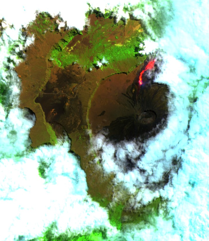
 We processed all the available data, strating from January the 18th, 2016, until end of November. To produce the data acquired later on, we are waiting for the new version of PEPS, compatible with the new Sentinel-2 data format. We hope it will be possible as soon as February. .The data set includes a nice image of the eruption of the Piton de la Fournaise volcano, in September. Regarding the data quality, you may find that the cloud shadows are a little exaggerated. We will try to fix that with a better tuning of the threshold for the next versions. 

Plus d'actualités

BIOMASS, the third launched satellite mission designed at CESBIO !

After SMOS in 2009, and VENµS in 2017, the CESBIO laboratory is very proud to see its third proposed mission, Biomass, reach orbit. As always, it has been a long journey from the idea, at the beginning of the century, to the selection in 2013 as the seventh Earth Explorer Mission by ESA, to the […]

Sentinel-2 reveals the surface deformation after the 2025 Myanmar earthquake

Sentinel-2 captured several clear-sky images of Myanmar before and after the 28 March 2025 earthquake. The animation below shows a 5-day apart sequence of images captured by Sentinel-2B and Sentinel-2C (10 m resolution) near the epicenter located close to Mandalay. The surface slip due to the earthquake follows the Sagaing Fault, a major fault in […]

Evolution de l’altitude de la ligne de neige au cours des 41 dernières années dans le bassin versant du Vénéon (Oisans)

Pour contribuer à caractériser les conditions hydrométéorologiques lors de la crue torrentielle qui a frappé la Bérarde en juin, j’ai analysé une nouvelle série de cartes d’enneigement qui couvre la période 1984-2024 [1]. Grâce à la profondeur temporelle de cette série, on constate que l’altitude de la ligne de neige dans le bassin versant du […]

Rechercher