Pine Island Glacier rift: 50,000,000 Elvis Fans Can’t Be Wrong

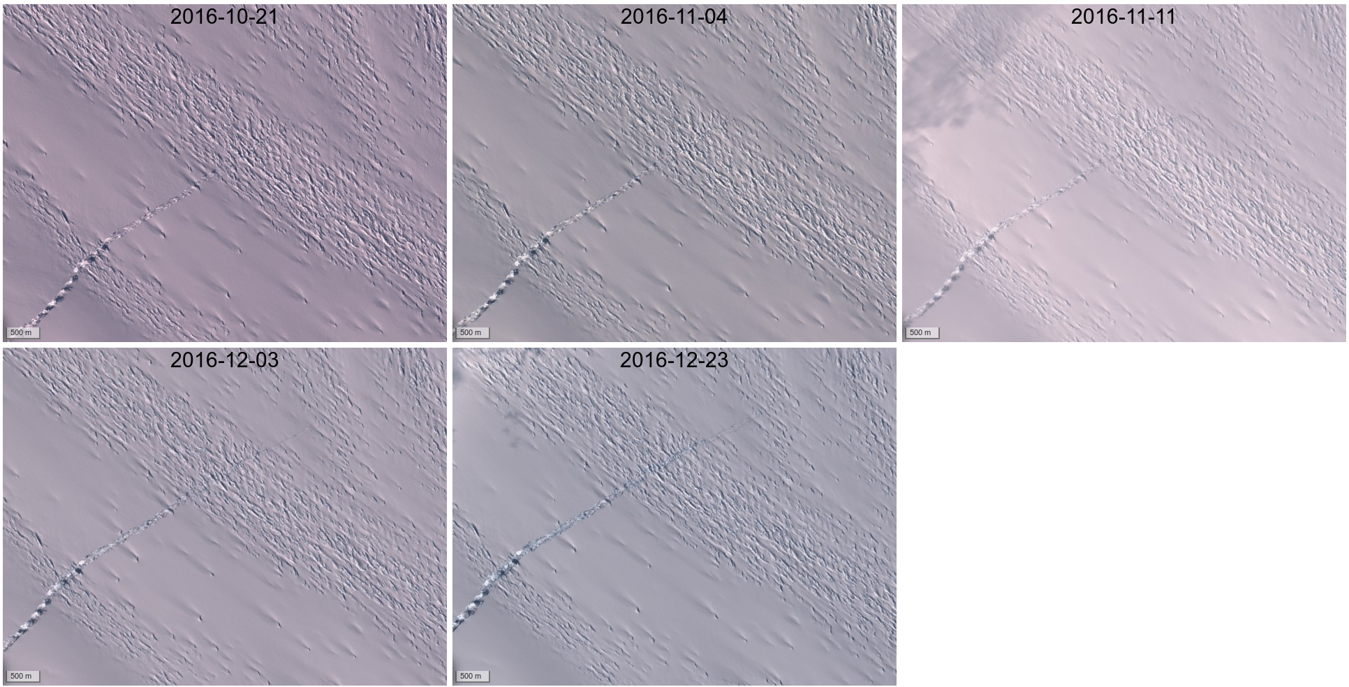
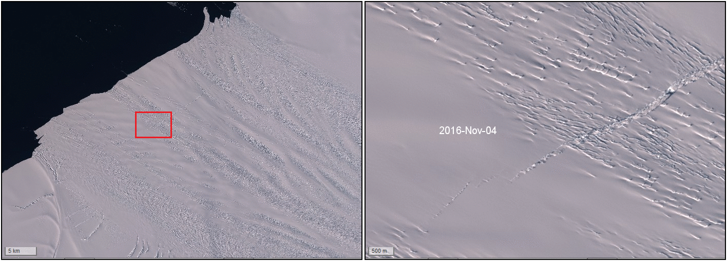
The rift of Pine Island glacier was captured by Sentinel-2A several times since Sentinel-2A is watching Antarctica. However I was not sure if the crack was growing by looking at the images only.

The answer is not obvious from a simple image comparison since this part of the glacier is moving at 10 m per day in summer. The best solution would be to use a GIS software and digitalize the whole crack to compute its length [1] … but my PhD students were already busy. So I made this small online survey. The participants were asked to choose the image which they think has the longest rift without knowing the acquisition dates. The result are unambiguous. The most recent image was selected by 95% of the 63 voters. This means that the rift is actually expanding… unless you think that argumentum ad populum is not a definitive proof of scientific truth?

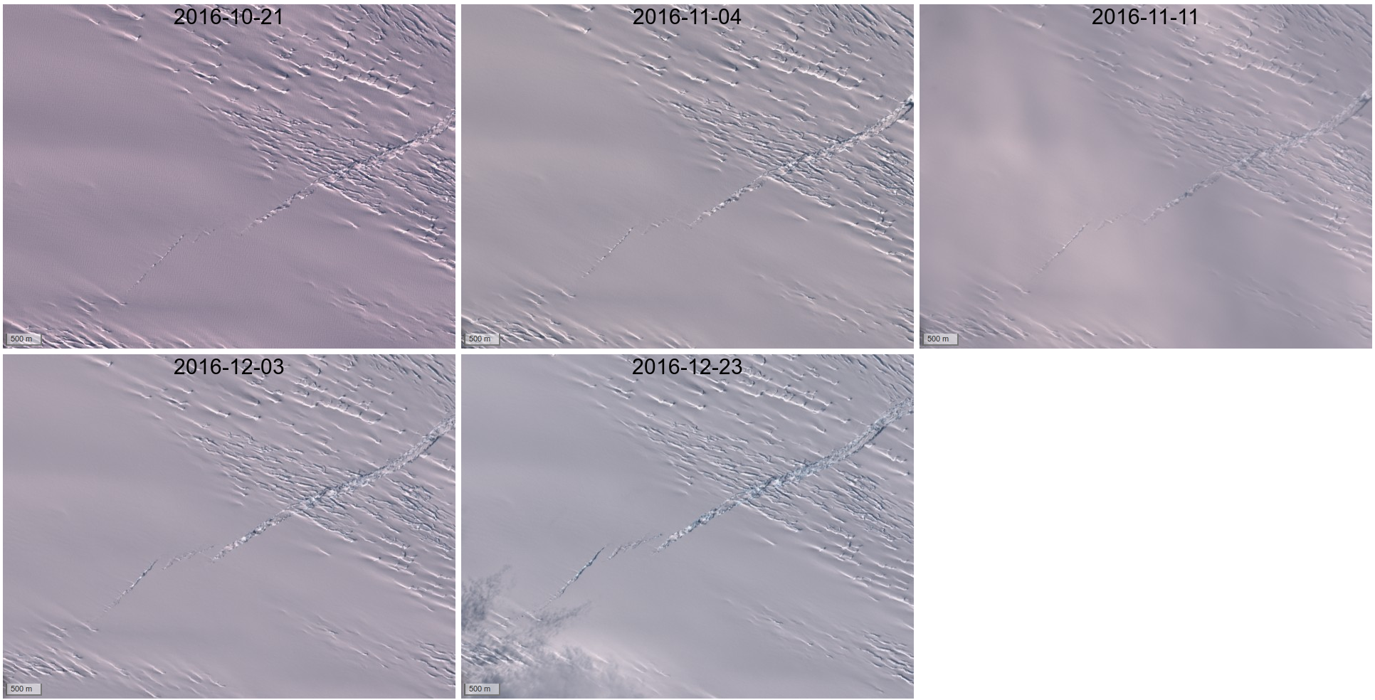
 In the same period the western part also seems to have expanded a little.

Update: a more recent image acquired on Jan 06 shows that the crack is now opening faster in the west (click on the image below to see the animation)

 Footnote:[1] See this other disturbing rift in the Larsen C ice shelf, which is now making the headlines https://youtu.be/Sf8kedzFLGI

Plus d'actualités

BIOMASS, the third launched satellite mission designed at CESBIO !

After SMOS in 2009, and VENµS in 2017, the CESBIO Laboratory is very proud to see its third proposed mission, Biomass, reach orbit. As always, it has been a long journey from the idea, at the beginning of the century, to the selection in 2013 as the seventh Earth Explorer Mission by ESA, to the […]

Sentinel-2 reveals the surface deformation after the 2025 Myanmar earthquake

Sentinel-2 captured several clear-sky images of Myanmar before and after the 28 March 2025 earthquake. The animation below shows a 5-day apart sequence of images captured by Sentinel-2B and Sentinel-2C (10 m resolution) near the epicenter located close to Mandalay. The surface slip due to the earthquake follows the Sagaing Fault, a major fault in […]

Evolution de l’altitude de la ligne de neige au cours des 41 dernières années dans le bassin versant du Vénéon (Oisans)

Pour contribuer à caractériser les conditions hydrométéorologiques lors de la crue torrentielle qui a frappé la Bérarde en juin, j’ai analysé une nouvelle série de cartes d’enneigement qui couvre la période 1984-2024 [1]. Grâce à la profondeur temporelle de cette série, on constate que l’altitude de la ligne de neige dans le bassin versant du […]

Rechercher