

New clear-sky image of the Rasuwa rock-ice avalanche
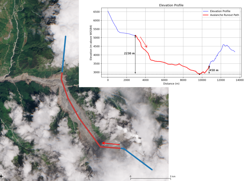
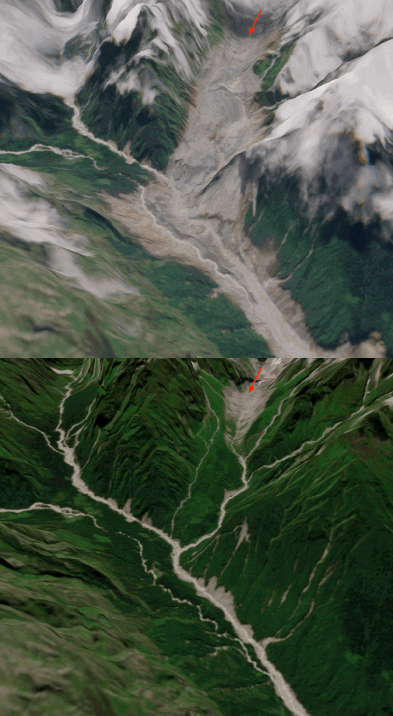
On 08 Sep 2026, Sentinel-2 acquired a clear-sky image near the release area of the landslide which caused the catastrophic flood in Nepal. Using this image and a pre-event digital elevation model (Berthier 2026) we can analyze the upper part of the avalanche runout profile. The block of rock and ice was released near 5120 m (meters above WGS84 ellipsoid). The avalanche descended a vertical drop of 2,230 m and then rose 450 m up the opposite slope.
Berthier, E. (2026). 13 October 2019 Pléiades (CNES) pre-event Digital Elevation Models (DEMs) for the rock-ice avalanche source area of the August 2026 Trishuli catastrophic flood [Dataset]. Zenodo. https://doi.org/10.5281/zenodo.22147118

