THEIA’s Sentinel-2 L2A processing on Sahel is progressing
![]() =>
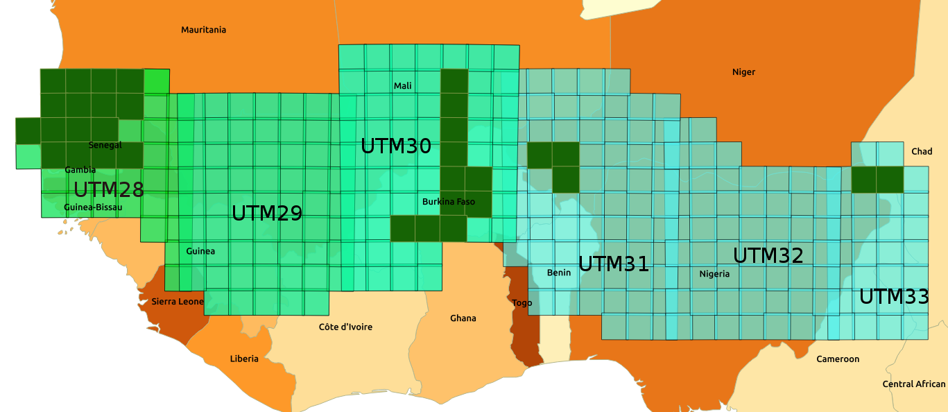
=> ![]() As we had announced in November, the MUSCATE production centre in Theia is gradually adding areas in the Sahel, which are shown in the image below. The data are processed from December 2016 onwards, which means that we have a large amount of data to process. We started with the most westerly tiles, in Senegal on the UTM28 zone, then progressed from one zone to another towards the East.
As we had announced in November, the MUSCATE production centre in Theia is gradually adding areas in the Sahel, which are shown in the image below. The data are processed from December 2016 onwards, which means that we have a large amount of data to process. We started with the most westerly tiles, in Senegal on the UTM28 zone, then progressed from one zone to another towards the East.
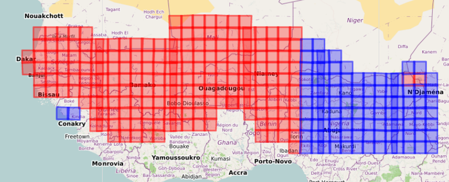
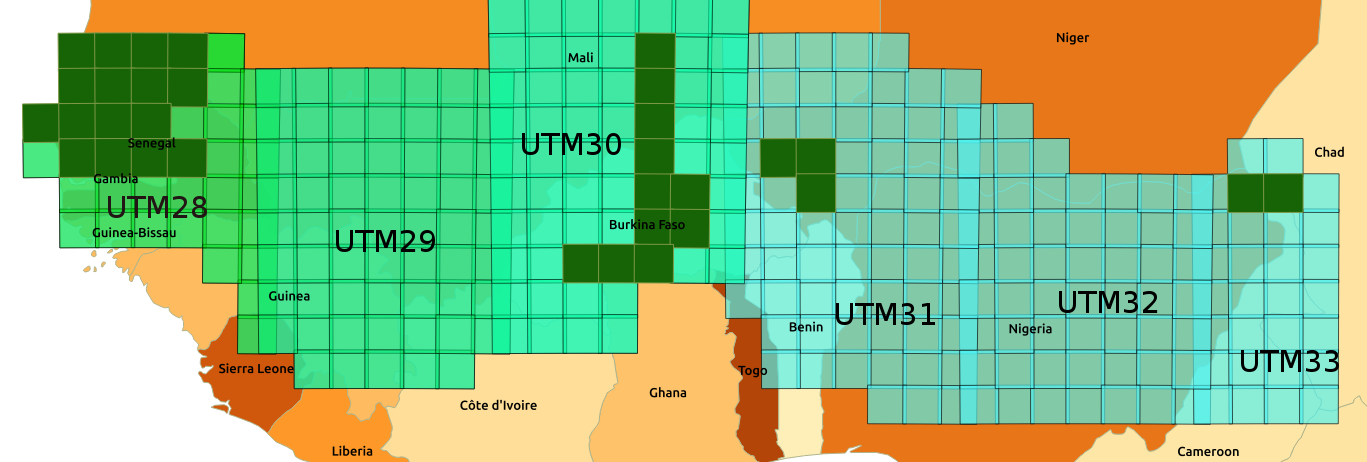
In the recent days, Theia has completed the processing of tiles in the UTM30 zone and in most of UTM31 area. The added region includes Burkina Faso, South of Mali, West of Niger, North of Benin. The processing of the east of UTM31 and the whole UTM 32 tiles has started. Feel free to take a look from time to time at the map of areas covered by MUSCATE. The blue tiles turn red as soon as we switch to near real time processing. The data can be downloaded from here:
https://theia.cnes.fr