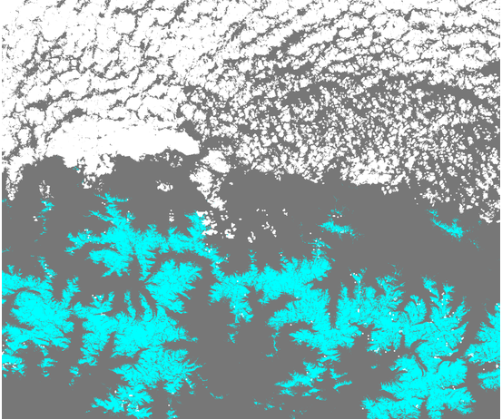
Last Sunday’s snow cover map from Sentinel-2

We know that fast distribution of satellite products is critical for many applications, including the planning of your next weekend. Olivier just announced that Theia is now delivering Sentinel-2 Level 2A data in near real time. This is great because today I was able to make the snow cover map of the Pyrenees on Sunday at 20-m resolution. The L2A image was actually published on Tuesday afternoon so I could have posted this snow map two days ago.
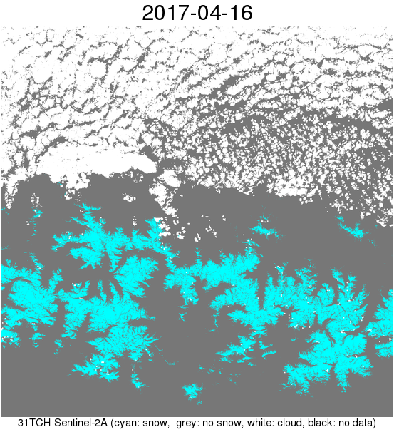
You can look at a simplified version of this snow map in Google maps here. For example you can check the snow conditions in Baqueira…

Baquiera snow cover on 16 Apr 2017

Plus d'actualités

Dates de fauche en France

En 2024, des collègues du Cesbio ont publié un article* sur la cartographie de la date de fauche en France en 2022 à partir des données satellitaires Sentinel-2.   Leur magnifique figure 10 a attiré mon attention. La version à haute résolution fournie avec l’article (2861 × 2911 pixels) correspond à une image dont les pixels font […]

Évolution du jour de déneigement dans les Alpes françaises et les Pyrénées

Les socio-écosystèmes des Alpes et des Pyrénées dépendent étroitement des fluctuations annuelles du manteau neigeux. En particulier, le moment de l’année où la neige disparait détermine le début de la saison de croissance de la végétation de montagne et donc la période des estives. Le changement climatique est en train de bouleverser ce rythme saisonnier. […]

BIOMASS, the third launched satellite mission designed at CESBIO !

After SMOS in 2009, and VENµS in 2017, the CESBIO laboratory is very proud to see its third proposed mission, Biomass, reach orbit. As always, it has been a long journey from the idea, at the beginning of the century, to the selection in 2013 as the seventh Earth Explorer Mission by ESA, to the […]

Rechercher