What makes earthworms move ?
What makes earthworms move?
Eartworms directly relies on soil water. Though, their activity seems completely disconnected to the variations of soil water content.
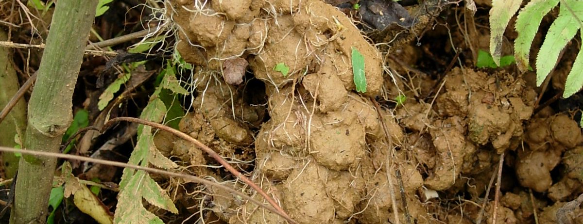
Earthworms have a key role in soil dynamics. Among them, the anecic earthworms dig vertical galleries, ingest the earth located in the first meters of the ground and come to reject it onto the surface in the form of small castings. Passing through their digestive system makes the soil nutrients usable by plants. Since castings are always very water-laden, water from the soil is expected to play an important role in earthworms activity. Yet, the production of castings does not vary at all like the water content in the soil. The behaviour of the earthworms is therefore difficult to understand.
The global modelling technique was used to unveil the dynamical couplings between earthworms activity and soil water content (Dong Cao basin, Viêt Nam). Results show that high water content will not generate a strong and immediate activity of earthworms but a progressive increase, by sensitization. Conversely, low water content will generate a gradual decrease in their activity, by habituation. This progressivity will result in an evolution of the production of castings completely different from that of the water content. In return, earthworms activity will lead to very different soil evolution from one site to another, even for identical hydroclimatic conditions.
Since the obtained models enables to formulate algebraically the coupling between earthworm activity and soil water content, soil moisture estimated from satellite may now be used to monitor earthworm activity from space.
La dynamique des lombrics relève de la théorie du chaos, Olivier Blot, IRD le Mag’, 21 janvier 2021.
Photo: Earthworm casting rejected by earthworm at the soil surface (Dong Cao basin, Viêt Nam). Copyright: Pascal Jouquet.