TropiSCO scores against deforestation
 =>
=> 
The TropiSCO project aims at providing maps of tree cover loss in dense tropical forests using Sentinel-1 satellite images, starting in 2018 and in near real time. The maps will soon be publicly available via a webGIS platform and updated weekly at 10m resolution. Forest loss as small as 0.1 hectare will be detected (corresponding to ten Sentinel-1 pixels). Compared to other existing systems, TropiSCO brings two main improvements: its fine spatial resolution and, above all, its short forest loss detection time, whatever the weather conditions, which is essential in the tropics to allow rapid interventions on the ground.
The TropiSCO project, labelled by the Space Climate Observatory in 2021, is led by the GlobEO company in close collaboration with CNES and CESBIO. The project is divided into two phases, A and B. Phase A, which will end in April 2022, has three objectives:
- The collection of user requirements,
- An analysis of the system architecture and of the costs associated with each technical solution studied,
- A demonstration of the concept in seven countries with the creation of a dedicated webGIS by the Someware company. The demonstration was carried out in Guyana, Suriname, French Guiana, Gabon, Vietnam, Laos and Cambodia.
The production will be extended to the whole tropical dense forests in the frame of phase B.
User needs have been collected via a questionnaire filled by twenty-five institutions, which is being analysed in order to produce and distribute the most relevant maps. In parallel, the architecture of the production system is being studied at CNES, in order to tailor a technical solution adapted to the ambition of this project.
The products generated in the frame of the TropiSCO project consist mainly of maps of forest loss dates at a high spatial and temporal resolution, but also of synthetic maps highlighting areas of significant activity, as well as monthly and annual statistics by territory (provinces, countries, etc.).
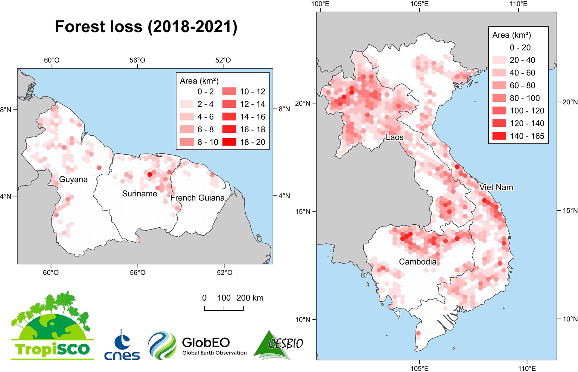
Examples of synthetic maps are shown in Figure 1. The red shading indicates the area of forest loss within each 460 km² hexagon. Examples include gold mining in Suriname on the border with French Guiana, as well as tree plantations harvests in central Vietnam and the conversion of natural forests to tree plantations in northern Laos. The contrast between northern Laos and Vietnam is striking, illustrating the fact that forest exploitation and management is highly dependent on national strategy. More than 70,000 Sentinel-1 images were processed with CNES computing resources to produce maps of Vietnam, Laos and Cambodia, covering 1,230,000 km². For these three countries, the errors of omission and commission were estimated at 10% and 0.9% respectively according to an adapted validation protocol (Mermoz et al., 2021).
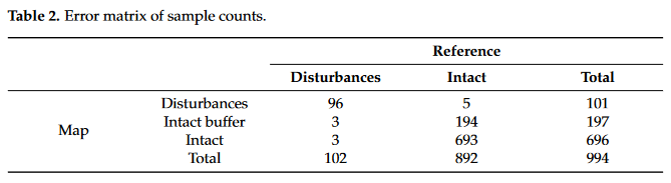
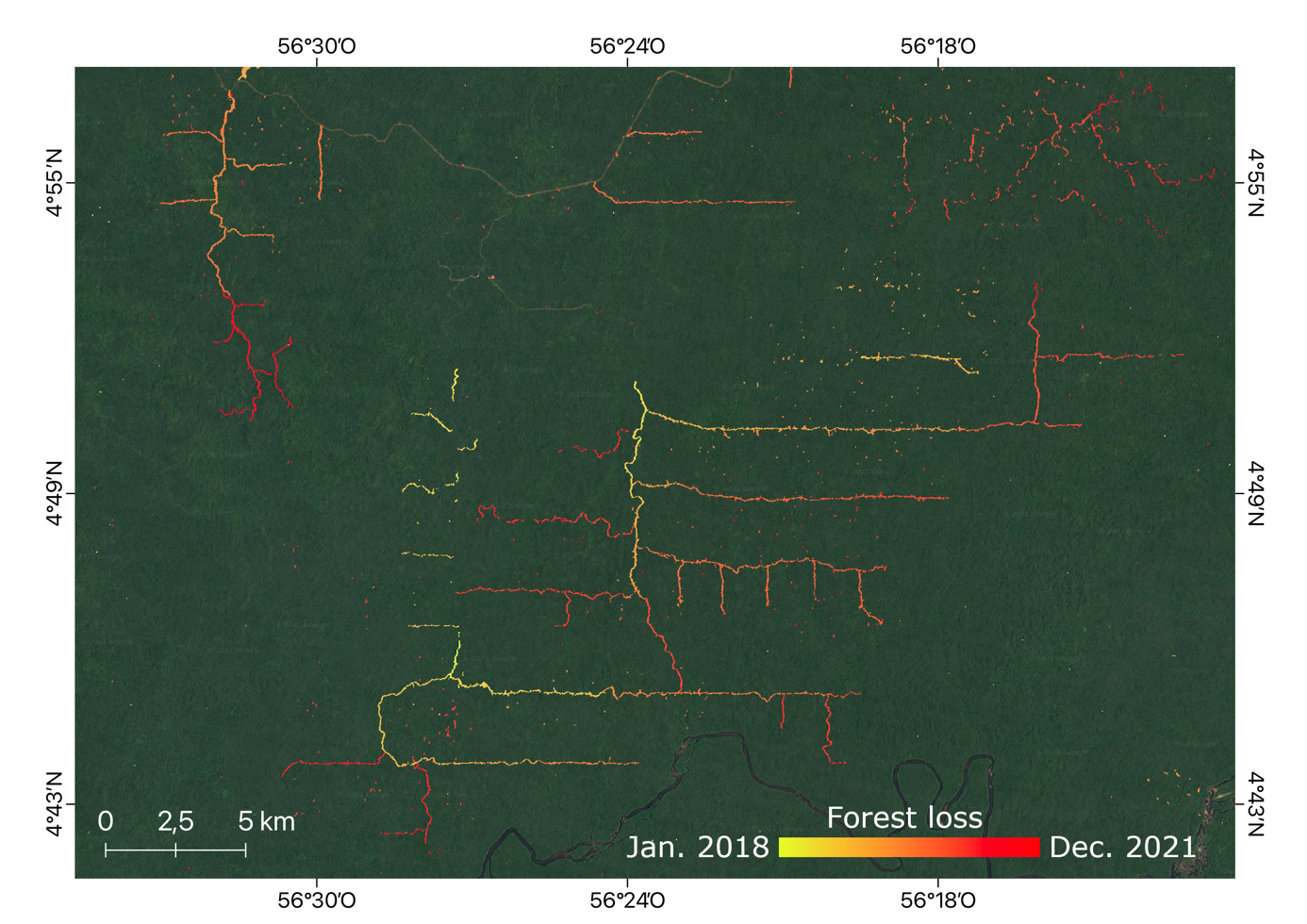
Figure 2 shows an example of a detection map for Suriname from 2018 to 2021. The colour gradations from yellow to red show the progressive temporal evolution of logging roads. Selective logging (yellow to red dots) is visible between the roads.
This work was presented on 11 October 2021 at the Theia workshop on the uses of remote sensing for forestry, and on 20 January 2022 at the third Quarterly Meeting of the SCO France. By the end of phase A, the TropiSCO team is working on the complete automation of the processing chain and on the production of forest loss maps for Gabon. The webGIS will be open and accessible to all by April 2022.
References :
Mermoz et al. (2021). Continuous Detection of Forest Loss in Vietnam, Laos, and Cambodia Using Sentinel-1 Data. Remote Sensing, 13(23), 4877. https://doi.org/10.3390/rs13234877