There is an issue with Paris

When Mireille Huc steps in my office saying « il y a un problème » (there is an issue), it is generally due to a new case that is not handled by our level 2A methods. This time, she said : « there is an issue with Paris ».

Such issues happen regularly each time we observe a new type of Landscape. That’s why it so important to process a wide range of landscapes and images to qualify our methods. Here are a few examples of the issues we encounter once in a while :
- The very turbid Gironde estuary classified as snow, because very bright in the visible while dark in the SWIR, as for snow
- false clouds due to drying white soils whose reflectance is increasing

- False Cloud Shadows after fields were irrigated in Mexico, whose reflectance decreases quickly
- Snow in the middle of desert in South Tunisia (a dry salt lake, bright in the visible, and dark in the SWIR)


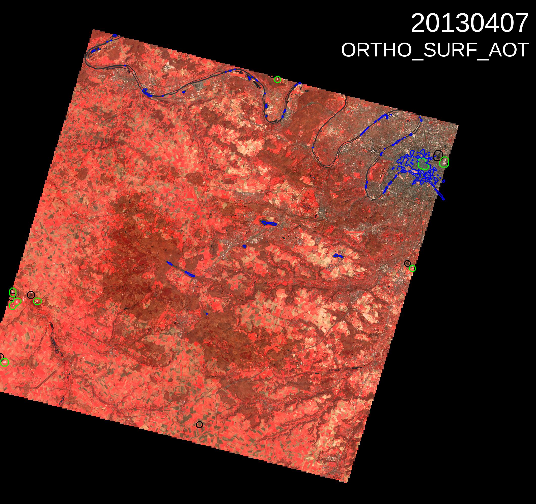
This time, on this SPOT4 (Take5) time series near Versailles, the clouds are well classified, the atmospheric correction seems to work, but … but, this zone oulined in blue in the North East Corner, it is Paris centre. It means the region is under water, but if Paris had been under water for two months, we would have known (given what they say when there is only one inch of snow). Mireille checked the data, and it turns out that Paris centre meets all the criteria we use to detect water (computed at 200m resolution):
- NDVI <0
- Red Reflectance < 0.1
It is the first town for which we observe this issue, maybe because of Paris huge density, of its slate roofs, and because of the winter period with no leaves on the trees.
A solution would be to process the water mask at a higher resolution (100m, 60m). Or could we just say that our « water » mask is in fact a « water and dense town centre with slate roofs » mask ? Or even better ask Parisians to grow plants on their roofs.
Meanwhile, one can note on this time series that despite a repetitivity of 5 days, we only got one partially clear image in March, but this month was exceptionally cloudy, they say in Paris. The onset of vegetation can also be clearly seen on the last image of the series, after nice weather came back at the beginning of April.