
SPOT4(Take5) first cloud masks
 =>
=> 
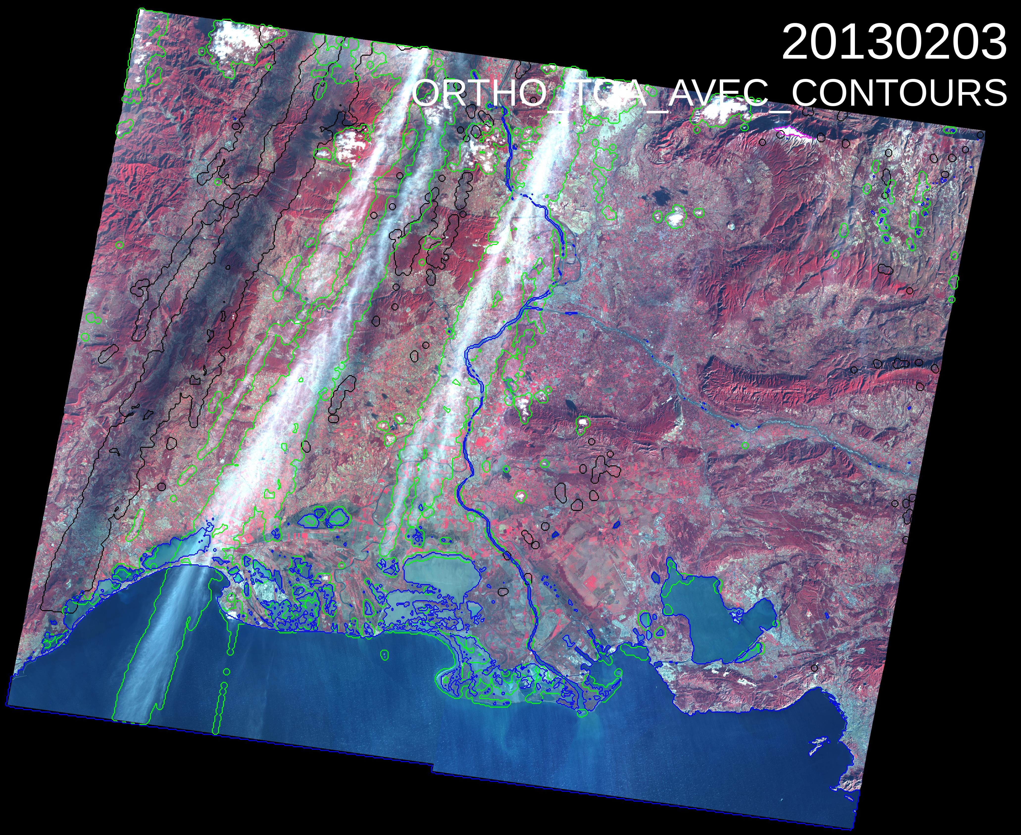
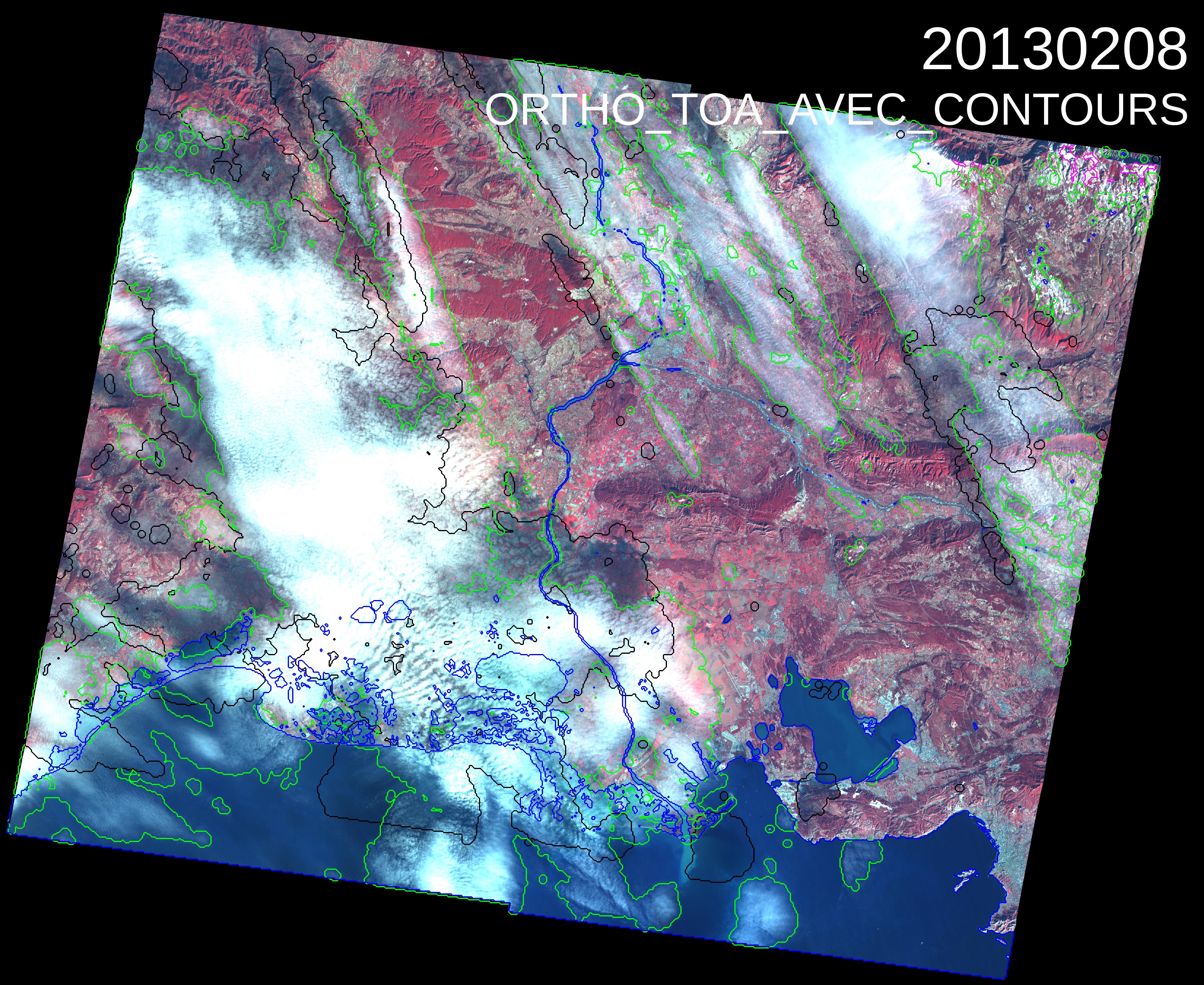
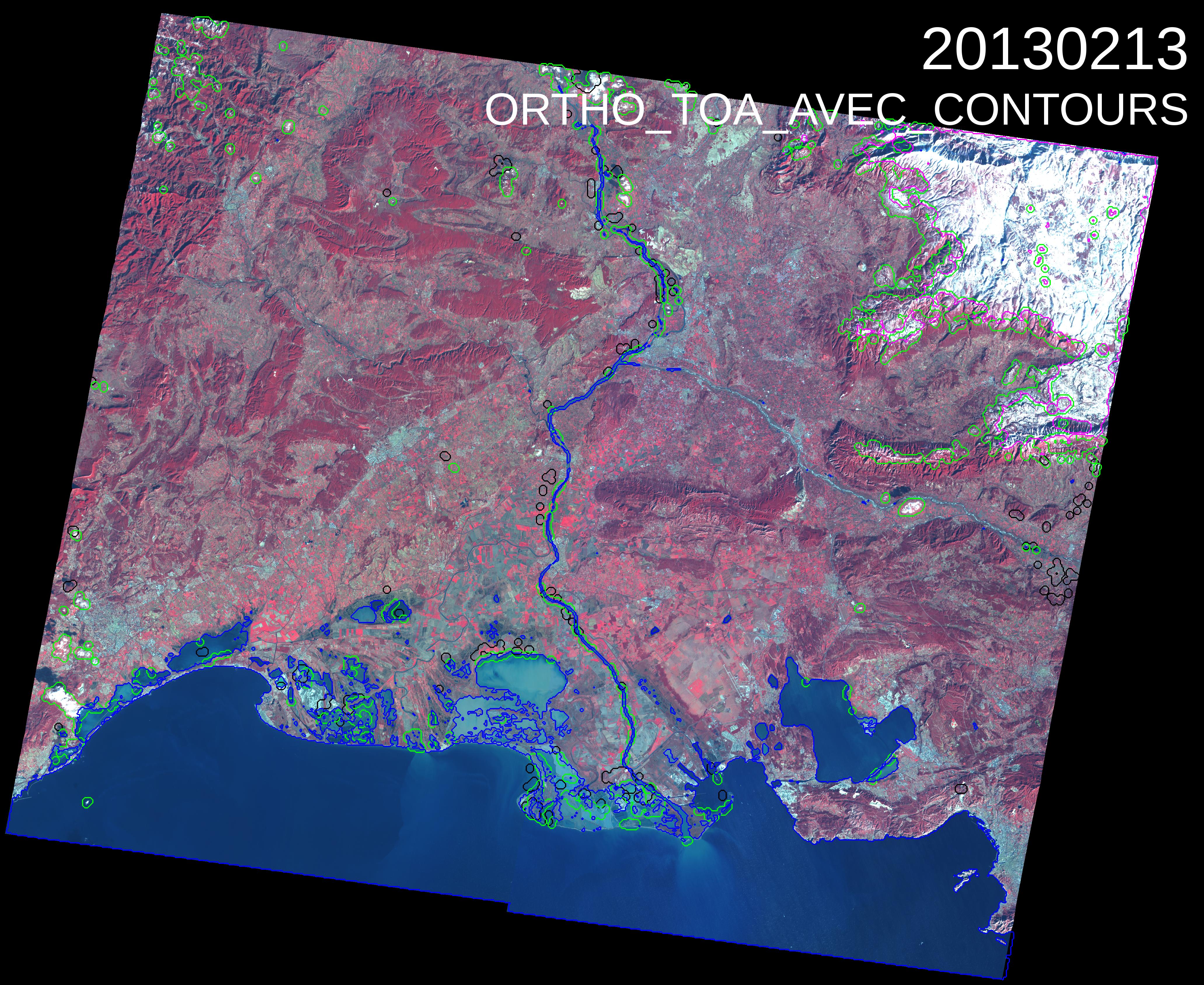
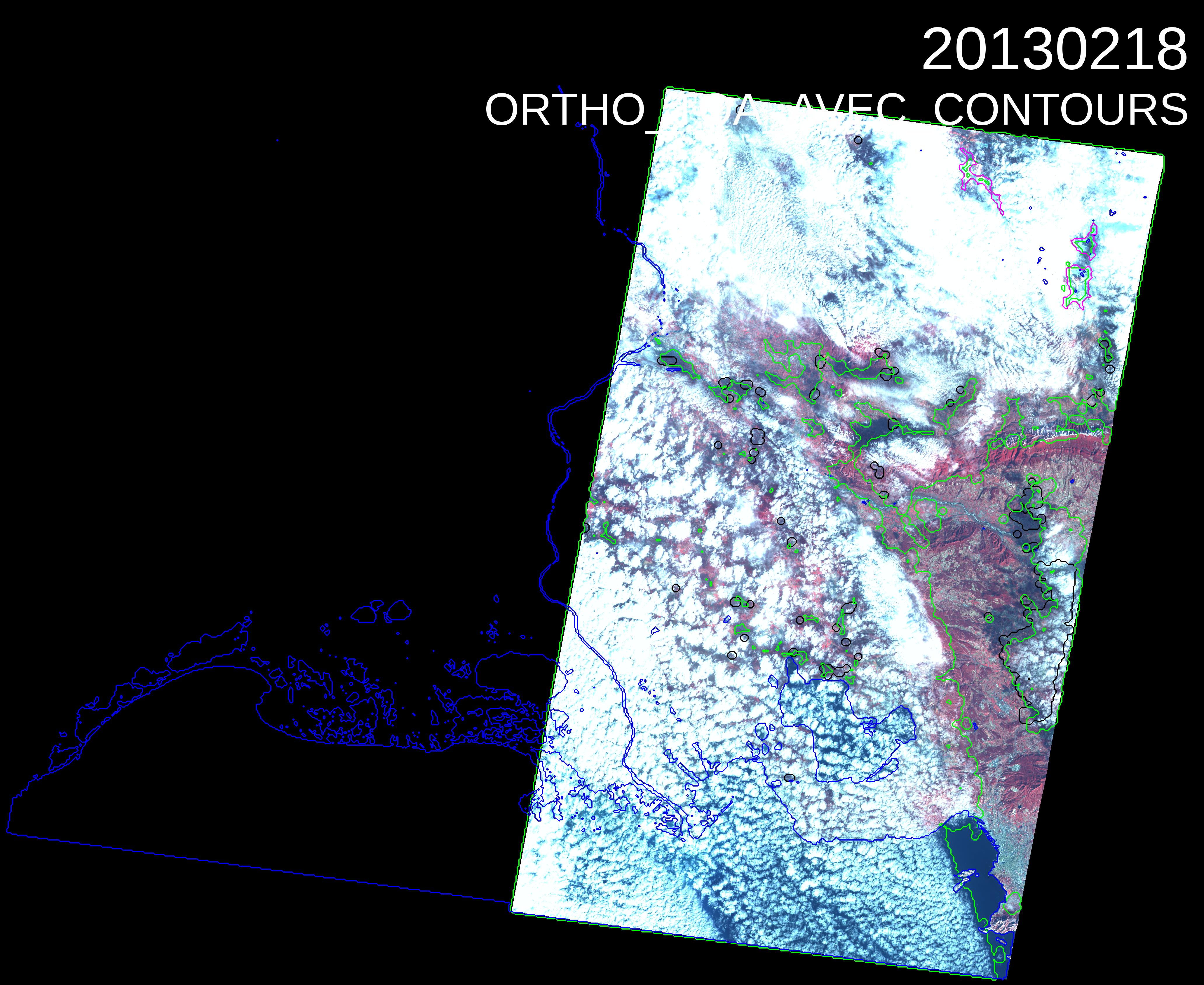
Now that you know almost everything on our cloud detection method and on our shadow detection method, we can show you the first results obtained by Mireille Huc (CESBIO) with SPOT4(Take5) time series. As the method is multi-temporal, it needs an initialisation phase, and we had to wait until we had a sufficient number of images to produce the masks. These first results are not (yet) perfect, but are already quite presentable.
The images shown below are a series of 6 Level 1C images, expressed in Top of Atmosphere reflectance, with the contours of several masks orverlayed : the clouds are circled in green, their shadows in black, the water and snow mask are respectively circled in blue and pink. You may click twice on the images to see the details of the masks. These images were acquired in Provence (France), each of them is made from 4 (60×60 km²) SPOT Images obtained on the same day, ortho-rectified, then merged.
Most clouds are detected, including very thin clouds, while the number of false cloud detections is very low. Most large cloud shadow are also detected, even if a few of them were missed. The water mask is also quite accurate with nearly no false detections, taking into account it is produced at 200m resolution. The snow is well classified when the snow cover is high, but often, pixels with a moderate snow cover are classified as clouds. This is a classical difficulty with snow masks.
However, we know that your sharp eyes will have noticed some very thin clouds partly missed by our classification in the North East of the first image, a few false cloud detections on the 3rd and the 5th images (the ground dries and becomes brighter and whiter), some missed cloud shadows for some small clouds once in a while (we know why, it is an initialisation problem, but quite long to explain…). The cloud detection threshold for water pixels (the method is different from the cloud detection above land), is maybe a little to low, as some bright Camargue Lakes are wrongly classified as cloudy. But after all, for a first run, the result is not bad, and we will refine all the parameters when we have a sufficient number of images.
On the Fourth Image, only two of the 4 (60*60 km²) images are available, because the two others are too cloudy to be ortho-rectified, as we need to see the surface to take ground control points. In fact, the ortho-rectification step is the first of our cloud masking steps.
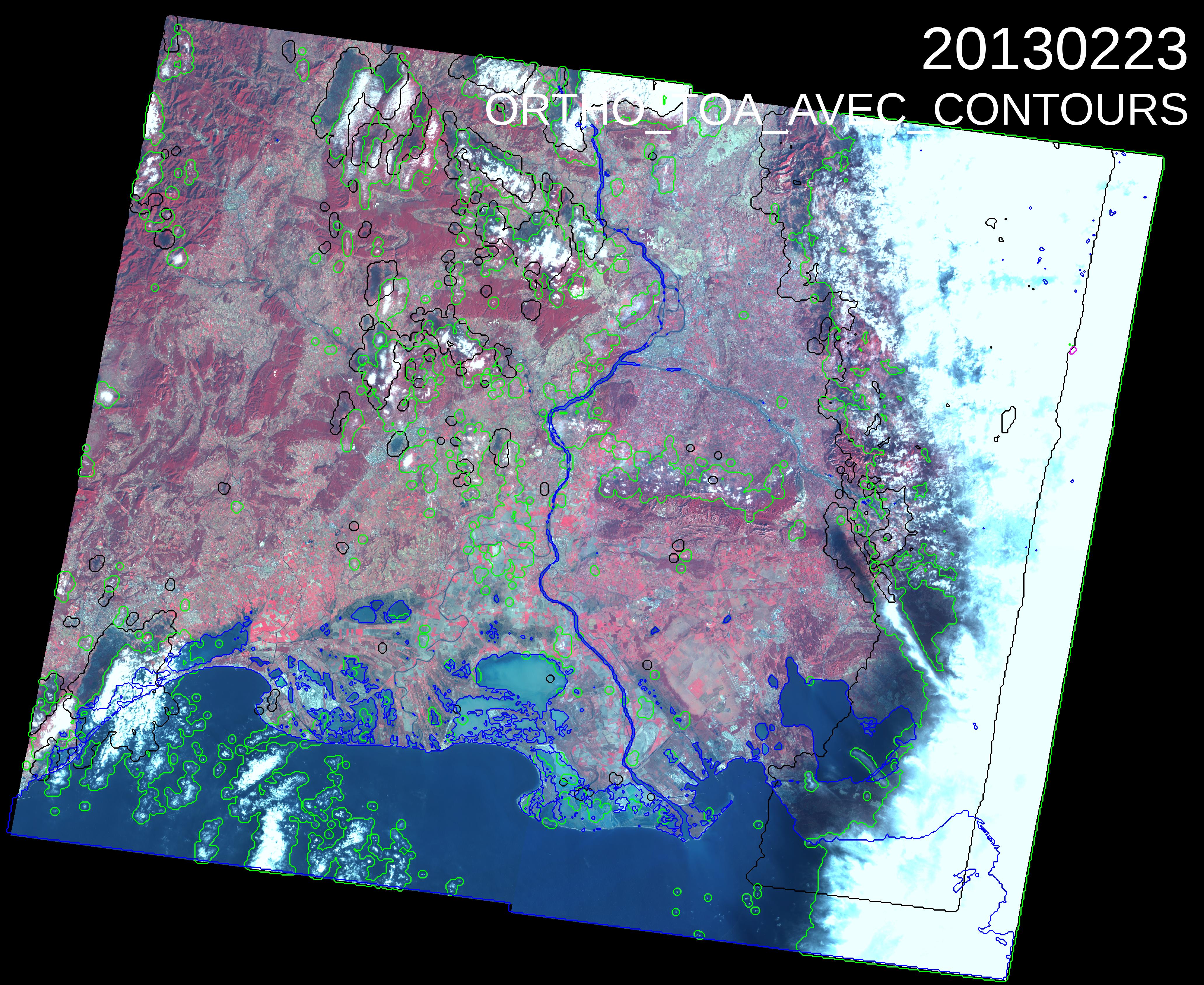
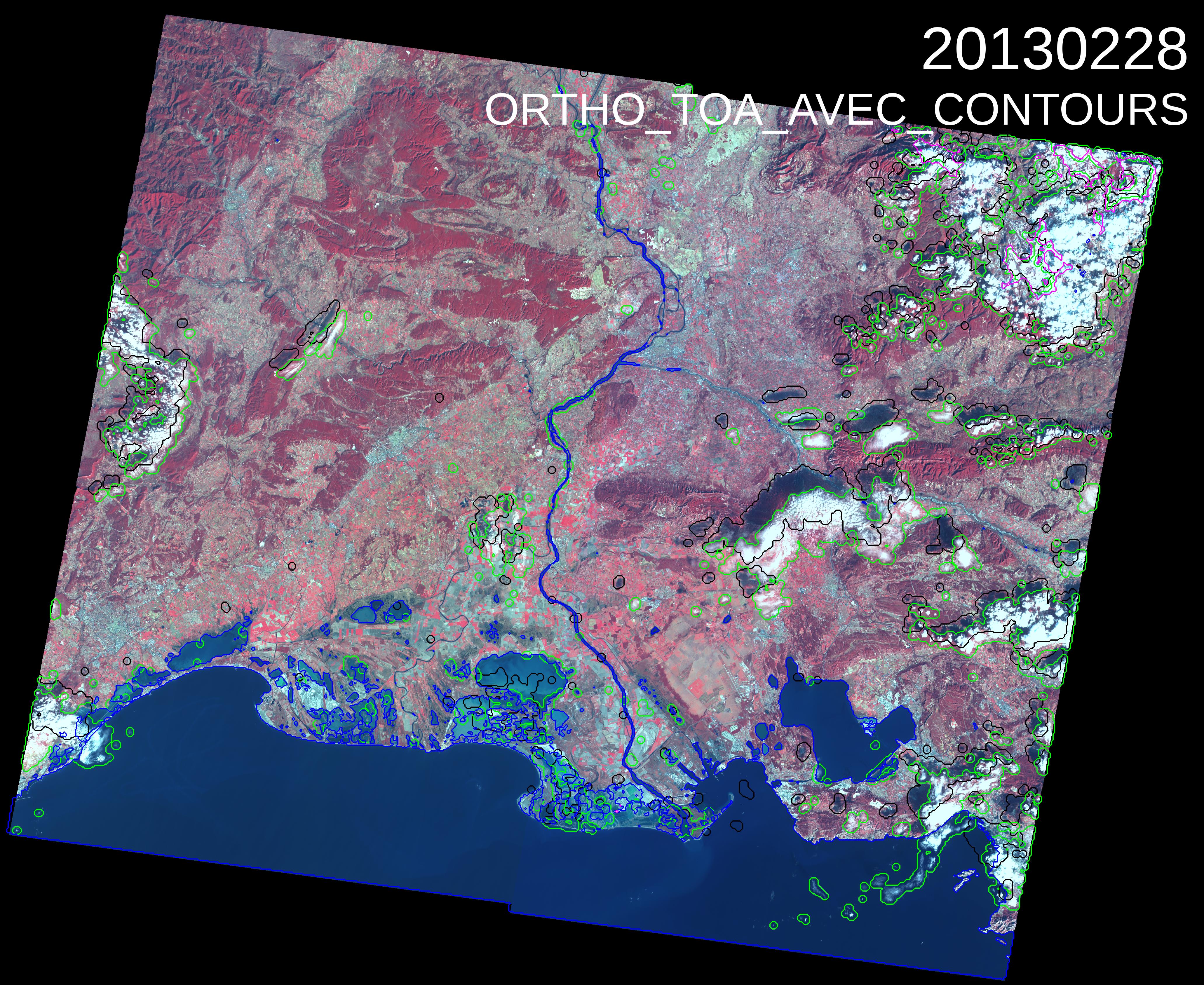
| The clouds are circled in green, their shadows in black, the water and snow mask are respectively circled in blue and pink. You may click twice on the images to see the details of the masks. |
|---|

