Our new job: gardeners !

=>

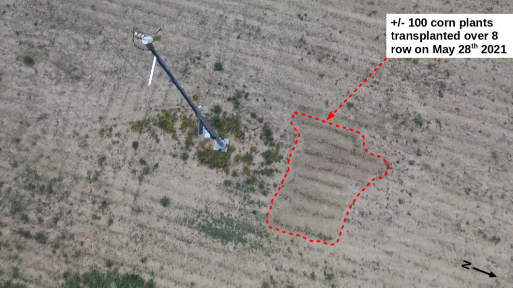
After a first tractor came too close from our ROSAS station, the next one passed by a little too far. Even if we’re never satisfied, it is much better ! This tractor sowed the maize on the plot on which we have built the station.  If it is acceptable to leave a two meter circle of uncultivated ground around the mast (the foot of the mast is masked in the processing), the gap without maize plants was much too large and reached six meters.

The MAJA team at work (you know that MAJA, the wasp, has yellow and black stripes)

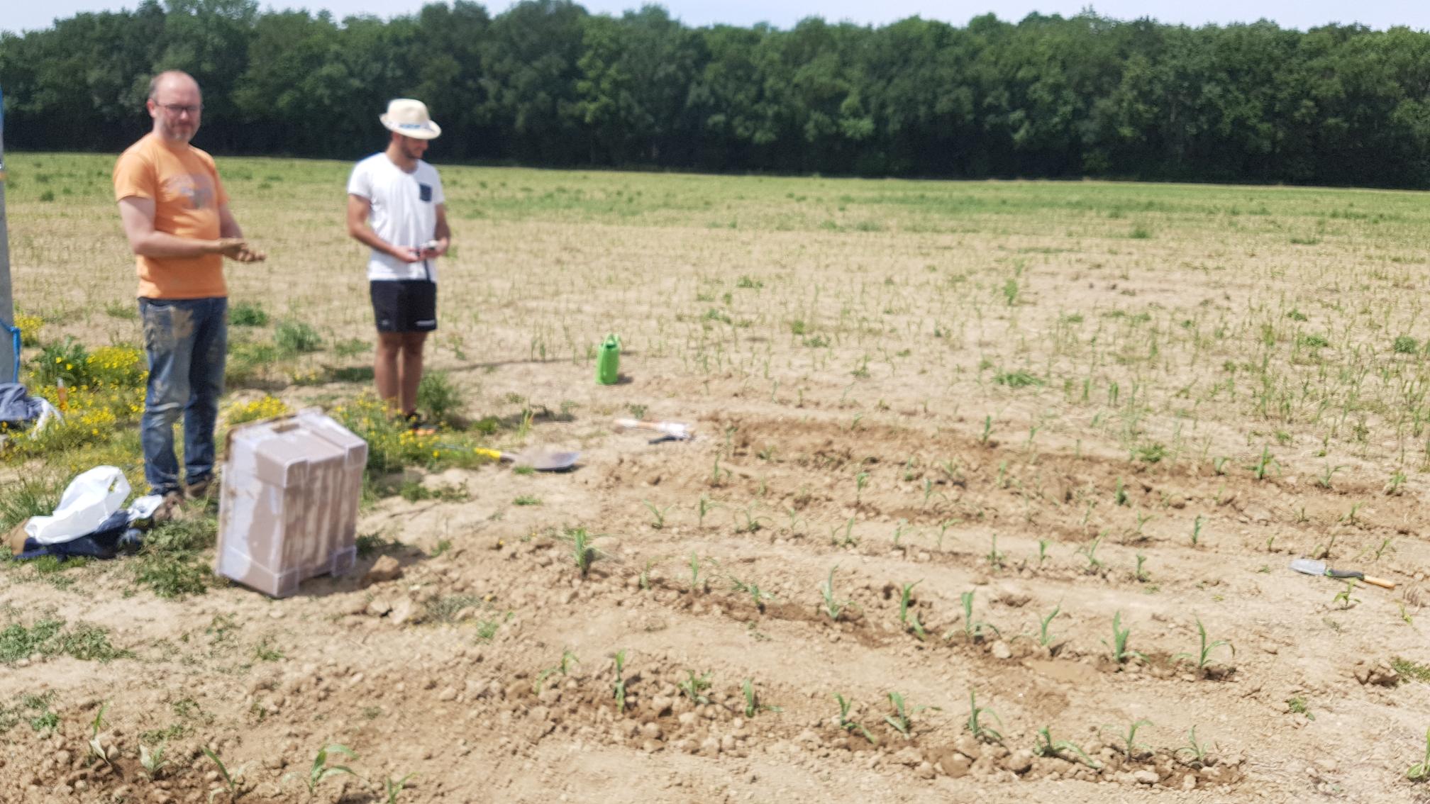
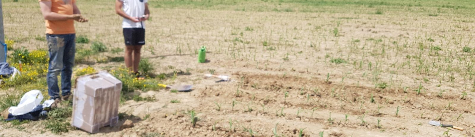
To solve that issue, on the 28th of May, our little team went gardening to transplant a few sprouts of Maize to the foot of the mast. Without a tractor, and at 500 m from the closest water source, it was quite an effort, but much more fun that spending the day in video conferences. As always, Jerome organized this perfectly, and you should see how he pampers the sprouts,  Micaël Lassalle makes an excellent water carrier,  I am the shovel expert.

Below is the result as seen from above, we hope our little plants will grow as well there than in their initial location.


Plus d'actualités

Le chaînon manquant dans la valorisation des travaux de recherche en télédétection

=> Mes collègues du CESBIO sont très créatifs ! Ils ont mis au point, au cours des dix dernières années, un grand nombre de nouveaux produits et de méthodes d’extraction de l’information à partir des données Copernicus (Sentinel-1 et 2). Et bien souvent, ils ne s’arrêtent pas à la mise au point de la méthode […]

Evolution des glaciers du Vignemale sous l’œil des satellites Pléiades (2013-2025)

Grâce à DINAMIS, un couple d’images stéréoscopiques a été acquis par Pléiades 1B le 14 septembre 2025. Le modèle numérique de surface (MNS) produit à partir de ces images peut être comparé à un autre MNS de septembre 2013 produit à partir des images Pléiades 1A commandées par Marti et al. (2014). Le glacier d’Ossoue […]

Dates de fauche en France

En 2024, des collègues du Cesbio ont publié un article* sur la cartographie de la date de fauche en France en 2022 à partir des données satellitaires Sentinel-2.   Leur magnifique figure 10 a attiré mon attention. La version à haute résolution fournie avec l’article (2861 × 2911 pixels) correspond à une image dont les pixels font […]

Rechercher