New version of fully automatic land cover map of France for 2014 from LANDSAT8
 =>
=>  Over the last months, we worked a lot on our method for Land Cover map production. Three main topics (1) were studied with Arthur Vincent and David Morin at CESBIO :
- porting and validating the iota2 processor on the CNES High Performance Computing facilities (HPC);
- enhancing the method for reference data preparation. Reference data are used both for training and validation;
- developing a stratification method which allows to train and apply classifiers per eco-climatic area, for instance.
Using all these new features, we produced a lot (really a lot!) of maps for the continental France. We just released the 4 following examples, produced using all the available LANDSAT8 data in 2014 :
- regarding reference data :
- regarding the stratification method :
- using eco-climatic areas (4);
- without stratification, but using a fusion of several classifiers trained over different sets of tiles.
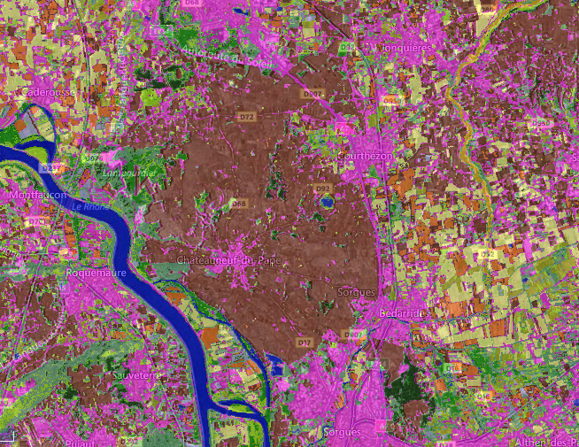
- The pink urban spot, in the center of brown zone, is the village of Chateauneuf du Pape which is famous for its wine, and the brown color is the vineyard class. Validated !
Arthur set up a convenient user interface for displaying and comparing the maps. You can see them here. The top left icon allows you to select the displayed maps. On the left, under the buttons which set the zoom level, you can select 2 of the maps and display their F-score statistics5. You can also display the older version published earlier this year, whose quality is lower. If the Overall accuracy is higher than the new ones, it is only because at that time we used a lot of water surfaces in the validation, which are easy to detect. But that version classified mineral surfaces and orchards as urban areas. Improving the reference data improved the results. To compare the maps, you can have a look at the F-Score values : the eco-climatic stratification deeply enhances the average values and narrows the confidence intervals. To retrieve the full resolution files (which are really big), you can use the following links :
- No stratification and 4 urban classes
- Stratification and 4 urban classes
- No stratification et 1 urban class
- Stratification et 1 urban class
Please send us feedback, it will be useful to further enhance our methods.
Notes: