Satellite Missions

SPOT4(Take5) data downloads statistics

=> Three and a half months after the first release of SPOT4 (Take5) products, we can draw a first analysis of the SPOT4(Take5) data downloads (from THEIA distribution website : http://spirit.cnes.fr/take5/)  We have also obtained a ranking of the 45 sites versus the number of downloads, and notice that all 45 sites where at least […]

08.11.2013

Next Sentinel-2 Conference

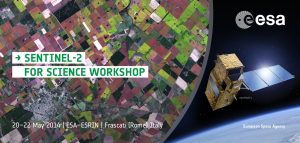
Our colleagues from ESA/ESRIN are organizing a new workshop to discuss the status of the preparation of Sentinel-2 scientific applications and methods. The three days workshop will be held at ESA/ESRIN premises, next May in Frascati, near Rome. It would be good to have some talks and posters about the results obtained from SPOT4(Take5) experiment. […]

05.11.2013

SPOT4(Take5) aerosol optical thickness validation results

=> We are currently preparing a data reprocessing of all SPOT4 (Take5) data, to be released before the end of 2013. For this, I tested several aerosol models and compiled all the validation results for our multi-temporal Aerosol Optical Thickness (AOT) estimation method named MACCS. Our estimates are compared to AERONET in-situ AOT measurements.The MACCS […]

04.11.2013

Validation des épaiseurs optiques d’aérosols obtenues pour SPOT4(Take5)

=>Nous sommes en train de préparer un retraitement des données SPOT4 (Take5) pour la fin de l’année. Pour en choisir les paramètres, j’ai compilé tous les résultats de validation des épaisseurs optiques mesurées par notre méthode MACCS, en les comparant avec celles mesurées par le réseau Aeronet. Dans la méthode MACCS appliquée à SPOT4(Take5), en […]

Characterising the phenology of tropical rain forests in North Congo thanks to image time series at low and high resolution

=> The CIRAD research institute studies the North Congo rain forests, and uses satellite image time series to tell mainly deciduous forests from mainly evergreen forests, The analysis or 10 years of a vegetation index time series (Enhanced Vegetation Index – EVI) from MODIS images at 500m resolution, was used to produce a synthetic annual […]

19.10.2013

Caractérisation de la phénologie des forêts tropicales humides du nord Congo grâce aux séries temporelles à haute et basse résolution

=>Le CIRAD s’intéresse aux forêts tropicales du Nord du Congo, et utilise les séries temporelles d’images pour distinguer les forêts à tendance sempervirente des forêts à tendance décidue. L’analyse de 10 années de données d’un indice de végétation (Enhanced Vegetation Index – EVI) issues d’images MODIS à 500m de résolution, a permis de reconstituer un […]

16.10.2013

SPOT4 (Take5) users’s day presentations

Voici les présentations de la Journée SPOT4 (Take5) du 2 octobre, qui a réuni une centaine de personnes au CNES pour faire un bilan des acquisitions et des produits distribués, et prendre connaissance des premiers retours des utilisateurs. J’en profite pour remercier les deux organisatrices, Sylvia Sylvander et Danielle Barrère, du CNES (DCT/ME/OT), les 23 […]

15.10.2013

The Level 2A products lose weight

=> This discreet bug was spotted by Mireille Huc a couple of weeks ago, but it had been bothering all SPOT4(Take5) data users for2 months : the L2A products were twice larger than necessary. The bug occurred when converting data to GeoTIFF format,  it happened only on the production computer and not on the test […]

10.10.2013

Les N2A perdent du poids

=>C’est Mireille Huc qui a vu ce bug discret qui embêtait pourtant tous les utilisateurs des données de SPOT4 (Take5), sans qu’ils le sachent, depuis deux mois : les produits de N2A avaient une taille deux fois plus grande que nécessaire. Le bug s’est produit lors de la transformation des données au format Geotiff, uniquement […]

Rechercher