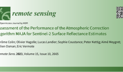
Satellite Missions

A 10 m resolution land cover map of Sahel with iota2

iota2 is the large scale mapping software developed at CESBIO. iota2 takes high resolution satellite image time series (SITS), usually Sentinel (1 and 2) or Landsat, and produces maps over large areas. Maps of most usual variables of interest in remote sensing can be produced, since iota2 can compute user-defined functions at the pixel level, […]

09.01.2023

Iceberg B-22A on the go

B-22A is the largest iceberg in the Amundsen Sea, Antarctica (50 times Manhattan land area). It broke off from Thwaites Glacier’s tongue and remained grounded for 20 years.. But now it’s on the go, as shown by this animation I made from Sentinel-1 SAR images (about 1 per month since June 2015, total 75 frames): […]

08.01.2023

Some news from ESA regarding the coming launches of Sentinels 1 and 2

In this article, ESA gave us some news of the time table for the coming launches of next Sentinel1 and 2 satellites. As you may have heard, we have these days a shortage of European launchers, due to the ending of Soyouz launches from Kourou, the delays in Ariane 6 delivery, and the initial uncertainties […]

08.12.2022

Feedback on hydrological monitoring of Telangana region in India using remote sensing

=> Claire Pascal, PhD student at CESBIO, under the supervision of Olivier Merlin (CNRS researcher) and Sylvain Ferrant (IRD researcher) brilliantly defended her thesis on the monitoring of water resources by satellite on November 18. Claire’s work focused on the Telangana region of India where rainfed cotton and flooded rice farming dominate. The region has […]

01.12.2022

Retour d’expérience sur le suivi hydrologique d’une région Indienne par télédétection

=> Claire Pascal, doctorante au CESBIO, sous la direction d’Olivier Merlin (chercheur CNRS) et co-dirigée par Sylvain Ferrant (chercheur IRD) a brillamment soutenu sa thèse sur le suivi des ressources en eau par satellite le 18 novembre. Les travaux de Claire se sont focalisés sur la région du Telangana en Inde où la culture non […]

10.11.2022

[THEIA] Near real time production of Sentinel-2 images has resumed

Due to Brexit,  the ECMWF moved some of its computer infrastructure from Reading (UK) to Bologna (IT), and a 5 week interruption of service occurred for the production of Copernicus Atmosphere Monitoring Service. As our Level 2A production for Sentinel-2 uses this information to set the type or aerosols for the atmospheric correction, we had […]

02.11.2022

First satellite images of Nord Stream leaks

I found the leak from Nord Stream 2 in the latest Sentinel-1 image (29 Sep 2022). It’s large enough to be visible from space. From this radar image, I could also spot the leak in the Landsat image captured on the same day (29 Sep). And there’s another leak visible northeast of Bornholm Island, this […]

29.09.2022

After 6 years of Copernicus data, I have never seen France that yellow

=> What can we say, except that the vegetation situation in France has worsened significantly in July 2022 compared to an already alarming June. The monthly syntheses of Sentinel-2 for the month of July are available since a few days, and the comparison with previous years shows an exceptional drought on the whole territory. Only […]

02.09.2022

INFERNO: a new software processing radar interferometry time series using Sentinel 1 products

=> The applications of interferometric techniques on radar images are currently developing in many fields. Being able to easily process and plot radar images, interferograms or time series of interferograms with a tool and data that are free and available without being a specialist is an important issue for scientists or companies that do not […]

01.09.2022

Rechercher