Satellite Missions

Evaluating ERA5 wind direction with Copahue Volcano plume

Copahue is an active volcano in the Andes on the Chile-Argentina border. It erupted in 2016 and a plume of smoke was visible in many Sentinel-2 images during that period. Looking at these pictures I thought it would be fun to use that plume as a giant anemometer to evaluate climate model data. I extracted […]

27.11.2020

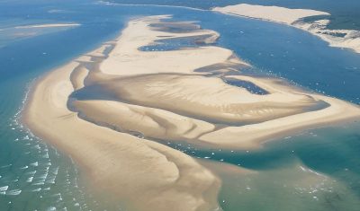
Le banc d'Arguin et la dune du Pilat vus d'avion

Le banc d’Arguin vu par satellite depuis 1984

L’archive Landsat est une mine d’or pour regarder notre planète changer. Google et Amazon ne s’y sont pas trompés puisque leur serveurs ont avalé l’ensemble des images pour permettre aux scientifiques et autres curieux d’y accéder plus facilement. Par exemple, cette application basée sur Google Earth Engine par Qiusheng Wu permet de générer une animation […]

15.11.2020

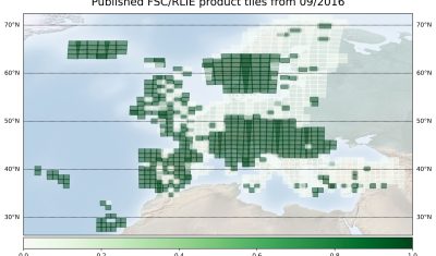
Copernicus Land – High-resolution Snow and Ice Monitoring: processing campaign status

  Snow and ice products are now available at high resolution (20×20 m) for all Europe in near-real time. However, Magellium is also processing the Sentinel-2 archive since September 2016. About 70% of Sentinel-2 observations have already been processed and 50 % are already published. This huge computation is being done on the CNES HPC […]

12.11.2020

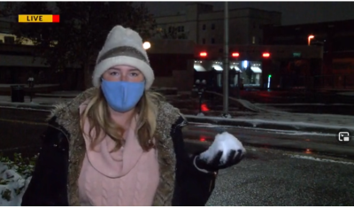
Stealth snow near Albuquerque, New Mexico

« Give me a hundred tries, I’ll never be able to spell it. » Jimmy McGill I haven’t seen the « Breaking Bad » series but I’m a huge fan of « Better Call Saul ». Both series take place in Albuquerque, New Mexico. With its dry, sunny weather, Albuquerque is the perfect place for a modern-day Western. Vince Gilligan, the […]

08.11.2020

Lancement de l’enquête d’expression de besoins en imageries radar

Avec le Groupement d’Intérêt Scientifique Bretagne Télédétection (GIS BRETEL) et en lien avec le dispositif VIGISAT, DINAMIS lance l’enquête nationale d’expression de besoins en imageries radar : Elle s’inscrit dans le cadre du rapprochement avec le dispositif VIGISAT entamée au premier trimestre de cette année, et d’une initiative associant DINAMIS aux Directions des Pôles de […]

02.11.2020

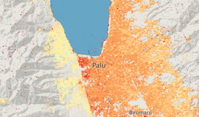
Using PEPS to compute the ground surface displacement after the Palu earthquake

The 7.5 magnitude Palu earthquake in 2018 was a disaster that left 2,081 people dead, 1,309 missing and 206,494 displaced. An impressive surface slip associated with the earthquake was visible in optical satellite imagery like Sentinel-2. I used this case to test the new tool that has been made availabe by the PEPS team (https://peps.cnes.fr/). This tool enables […]

14.10.2020

Sentinel-2 time series resolution should finally reach 10m in November

We have been waiting for a long long time, but it seems the production of geometry refined Sentinel-2 L1C will start by next month. I have heard ESA plans to reproduce the whole data set later on, but the schedule has not been announced yet. « Start of the geometry-refined production using the Global Reference Image […]

13.10.2020

A phase 0 study for Sentinel-HR

=> In 2018, Olivier Hagolle presented in this article the Sentinel-HR concept : an optical satellite in the metric spatial resolution class providing global, repetitive, systematic observations with an open access policy. By doing so, he continued the work of Gérard Dedieu who had already advocated for this concept in the previous years. Thanks to […]

09.10.2020

Une étude de phase 0 pour Sentinel-HR

=> En 2018, Olivier Hagolle vous avait parlé dans cet article du concept Sentinel-HR : une mission de résolution métrique fournissant des observations globales, répétitives, systématiques et libres d’accès. Il reprenait ainsi le flambeau de Gérard Dedieu qui portait déjà ce concept dans les années précédentes. Fruit de ces années de sensibilisation, une étude de […]

Rechercher