In English

Sentinel-2 adds colors to the 2017 super bloom in California

Texas had the super bowl in 2017 but California got the super bloom! After its worst drought in 1,200 years, California is now experiencing one its wettest year. The Sierra Nevada snowpack is currently one of the biggest ever recorded. In February, severe winter rainfalls caused the evacuation of many California residents under the threat of […]

27.04.2017

10000 L2A products available at Theia for Sentinel-2

The number of L2A products from Sentinel-2 available at Theia, just passed above 10 000 ! Data from France, Belgium, North of Spain, Morocco, Tunisia, Senegal, the Burkina-Mali transect, or La Reunion Island are now processed in real time : our requirement is 60 hours, after the data is available in Copernicus hub. Next site […]

15.04.2017

Senegal Sentinel-2 L2A data available at Theia

One year of Senegal S2A L2A data available at https://theia.cnes.fr/atdistrib/rocket/#/search?q=Senegal&?lang=enUne année de données S2A de niveau 2A sur le Sénégal disponibles depuis https://theia.cnes.fr/atdistrib/rocket/#/search?q=Senegal&?lang=en  

06.04.2017

THEIA/MUSCATE nears real time for Sentinel-2 L2A

THEIA MUSCATE production of Sentinel-2 L2A products nears real time, and L2A products acquired until March 2017 over France and Reunion Island have started to appear on our distribution server : The production will progressively be extended over the whole France and over the other sites (Spain, Morocco, Belgium Tunisia, Senegal, Burkina, Mali…) and then […]

05.04.2017

Quantitative comparison of cloud masks from MACCS/MAJA, Sen2Cor and GEOSYS (hand made)

=> As already explained in a previous post, we obtained some Sentinel-2 hand made cloud masks from GEOSYS company. We used those to validate the cloud masks from MACCS/MAJA. But we wanted to use them further to make a quantitative comparison with Sen2Cor cloud masks.But this comparison required solving a little issue : GEOSYS cloud masks […]

03.04.2017

The land cover classification for France in 2016 is available

=> just this once, we are ahead of time. Well, nearly. We had promised the 2016 land cover map or France before the end of first term of 2017. It exists and is available here. It’s resolution is 10m, with the same 17 classes nomenclature that we used for Landsat landcover map of 2014..The map […]

30.03.2017

Quantitative validation of MACCS cloud masks

=> At the annual review  of PEPS project (CNES Sentinel global mirror site), the GEOSYS company showed its operational activities centered on the use of Sentinel-2 data to provide advise on agriculture on many regions of the world. On this occasion, GEOSYS showed their cloud detection process for Sentinel-2 images. The Sen2cor solution was not considered […]

25.03.2017

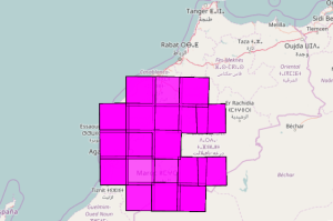
Theia releases Sentinel-2A L2A data over Morocco

=> After France, Belgium, North of Spain, Tunisia, a transect from Burkina Faso to Mali and some tiles in Ethiopia, Theia just released the production of one year of Sentinel-2A data at Level 2A above a large region of Morocco, from Ouarzazate to Casablanca. Level 2A products provide surface reflectances corrected from atmospheric effects, with a […]

MUSCATE S2 product versions

V1_0 was a preliminary processing performed with early version of MACCS adapted to Sentinel-2. It was plagued with a bug in the cloud shadow mask : when more than 255 clouds were present in one image, shadow detection went completely wrong and shadows were detected anywhere. V1_0 was not produced in MUSCATE operationnal context, but […]

23.03.2017

Rechercher