Comment ça marche /how it works

[How it works] Can reflectances be greater than 1 ?

=>  Beware, this document contains equations Having written a lot of posts in this blog, twitter or linkedIn, or due to the distribution of products and softwares on Theia or Github, Users of these channels questions per week in one of these channels, which I try to answer, even if not always at once. Many […]

03.09.2019

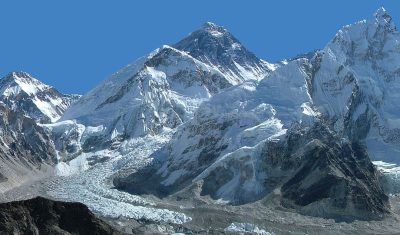
The Khumbu Icefall by Venµs

This is a time-lapse of all clear-sky images captured by Venµs over the Khumbu Icefall near Mount Everest since November 2017 (one year of data, 51 images at 5 m resolution) . Here I used the Level-1C products (i.e. without atmospheric correction) because the Level-2A products are provided at a lower resolution (10 m). Anyway, […]

09.11.2018

Using NDVI with atmospherically corrected data

NDVI NDVI is by far the most commonly used vegetation index. NDVI was developed in the early seventies (Rouse 1973, Tucker 1979), and widely used with remote sensing in the nineties until now. It is computed from the surface reflectance in the red and near infra-red channels on each side of the red-edge.  where and […]

04.02.2018

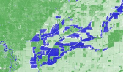
Using the NDWI to map flooded areas in the Central US

These Sentinel-2 images show the extent of the recent flooding near the border between Arkansas and Missouri on Apr 24, 2017 (36°30’N 90°38’W). The left image is a natural color composite (similar to what our eyes could see if we were in orbit). The right image is a color representation of the Normalized Difference Water […]

04.05.2017

MUSCATE S2 product versions

V1_0 was a preliminary processing performed with early version of MACCS adapted to Sentinel-2. It was plagued with a bug in the cloud shadow mask : when more than 255 clouds were present in one image, shadow detection went completely wrong and shadows were detected anywhere. V1_0 was not produced in MUSCATE operationnal context, but […]

23.03.2017

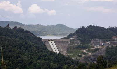
Sentinel-2A unveils two new lakes in Borneo

The remote sensing company Planet has published images, which were captured by its fleet of nano-satellites, of Lake Bakun on the island of Borneo [1]. Planet tells us that this artificial lake is the largest lake in Southeast Asia since its flooding in 2011. Yet it is not visible on mapping web services like Bing […]

26.01.2017

Radiometric quantities : irradiance, radiance, reflectance

=> Beware, this document contains equations. Radiometric quantities are numerous and may seem rather complex at first sight. Here is a little guide of the various quantities you might stumble upon when using optical remote sensing data. It might be a little boring, it is full-up with integral formulas, but well, to really understand what […]

13.11.2016

New shadows for SPOT5 (Take5)

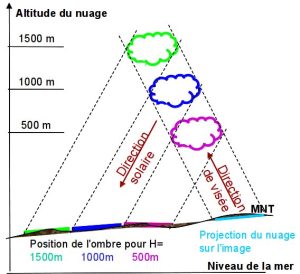
=> Don’t worry, everything is fine for SPOT5 (Take5) ! While SPOT5 is peacefully getting some well deserved rest, THEIA just reprocessed the Take5 data to solve a little list of issues detected after the first processsing. The data should be released very soon. The most significant change involves the cloud shadows mask computed by […]

08.04.2016

De nouvelles ombres pour SPOT5 (Take5)

=>Ne vous inquiétez pas, tout va bien pour SPOT5 (Take5) ! Alors que le satellite SPOT5 vit une retraite paisible, Theia vient de retraiter les données Take5 pour résoudre un petit nombre de problèmes détectés lors du premier traitement. Les données devraient être mises en ligne dans les jours qui viennent. La modification la plus […]

07.04.2016

Rechercher