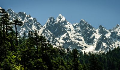
Applications

TropiSCO : un projet pour le suivi hebdomadaire de la déforestation tropicale avec Sentinel-1

=> On ne vous rappelle pas tous les dommages collatéraux liés à la déforestation ni les services éco-systémiques que nous rendent les forêts, puisqu’on en a déjà parlé dans ce blog (là, et là aussi). Pourtant, les forêts disparaissent à un rythme alarmant. Entre 1990 et 2020, une surface de forêt équivalente à plus de […]

18.02.2021

Pléiades images of the Uttarakhand disaster

Update 17 June 2021: these images were used in a study published in Science by Shugar et al. (2021) A massive rock and ice avalanche caused the 2021 disaster at Chamoli, Indian Himalaya, doi:10.1126/science.abh4455. The Indian Space Agency (ISRO) activated the International Charter « Space and Major Disasters » to image the area of the disater in […]

09.02.2021

Aidez-nous à mesurer la neige orange !

Mise à jour 22 février 2021 : la campagne est terminée ! Merci aux participantes et participants, nous avons ~60 échantillons que nous allons analyser dans les mois qui viennent. [la suite est ici] Un dépôt de poussières sahariennes a recouvert la neige des Alpes et des Pyrénées. Avis aux amateurs de montagne : nous […]

06.02.2021

What makes earthworms move ?

What makes earthworms move? Eartworms directly relies on soil water. Though, their activity seems completely disconnected to the variations of soil water content. Earthworms have a key role in soil dynamics. Among them, the anecic earthworms dig vertical galleries, ingest the earth located in the first meters of the ground and come to reject it […]

30.01.2021

Le glacier de l’Astrolabe s’apprête à vêler un bel iceberg

Sur une image Pléiades acquise le 15 janvier, Etienne a remarqué une fracture qui traverse une bonne partie de la langue du glacier de l’Astrolabe auprès de la base Dumont-d’Urville en Antarctique. On peut reconstituer l’ouverture de cette crevasse à partir d’une série d’images Sentinel-1 (une année complète de janvier 2020 à janvier 2021) D’après […]

22.01.2021

Crop Irrigation, a new project labeled by the Space Climate Observatory

=>  The Space Climate Observatory (SCO) is an international initiative of the One Planet Summit, launched in June 2019, which is also a French initiative. The SCO brings together several space agencies around the world and international organizations (UNDP, ESA, UNEP). It aims at developping projects for local decision-makers to help them adapt to climate […]

20.01.2021

Irrigation Grandes Cultures, un nouveau projet labellisé par l’observatoire spatial du climat

=> L‘ Observatoire Spatial du Climat (SCO pour Space Climate Observatory) est une initiative internationale du One Planet Summit, lancée officiellement en Juin 2019, à l’initiative de la France. Cette initiative regroupe des agences spatiales du monde entier et des organisations internationales (PNUD, ESA, PNUE). Elle a pour vocation de développer des projets à destination […]

Free and open data: fine, but who pays for the processing?

In the previous post, Olivier advocated for the open data policy in remote sensing. Although Oliver is facing some actual resistance because the Sentinel-HR mission would step on the toes of industrial champions, my feeling is that there is now a large consensus on this issue. The economic and social benefit of the open data […]

21.12.2020

How to make a mosaic of Theia snow products in three command lines

Assuming that you have downloaded from Theia and unzipped several products in the same directory. Assuming that you have a Linux OS with GNU Parallel, GDAL and OTB command line utilities installed..      Then, in your terminal, type: # Get the color table wget https://gitlab.orfeo-toolbox.org/remote_modules/let-it-snow/-/raw/75-lis-color-table-for-otb-not-updated-after-changed-nodata/hpc/LIS_SEB_style_OTB.txt # reproject all SNW raster products to a common […]

11.12.2020

Rechercher