In English

Theia’s Landsat data are moving

=> It is true that many of us can be moved by the Landsat L2A data produced by THEIA, but this time, the data were literally moved. The presently used downloading site http://theia.cnes.fr is being prepared to host Sentinel-2A data produced by the operational MUSCATE ground segment, and meanwhile, the prototype center goes on producing LANDSAT […]

En Français

Les données LANDSAT de THEIA déménagent

=>Beaucoup d’utilisateurs nous l’ont dit, « elles déménagent vos données », mais cette fois, c’est au sens propre. En effet, le site de téléchargement actuel http://theia.cnes.fr se prépare à accueillir les données sentinel-2 produites par le centre de production MUSCATE opérationnel,. Pendant ce temps, le centre prototype continue à traiter les données LANDSAT sur la France, mais […]

En Français

The Sentinel-2 contest – Grand jeu-concours !

Play to win the prize: ONE YEAR OF FREE SUBSCRIPTION to the blog « Séries Temporelles »! Jouez pour gagner : UN AN D’ABONNEMENT GRATUIT au blog « Séries Temporelles » !

In English

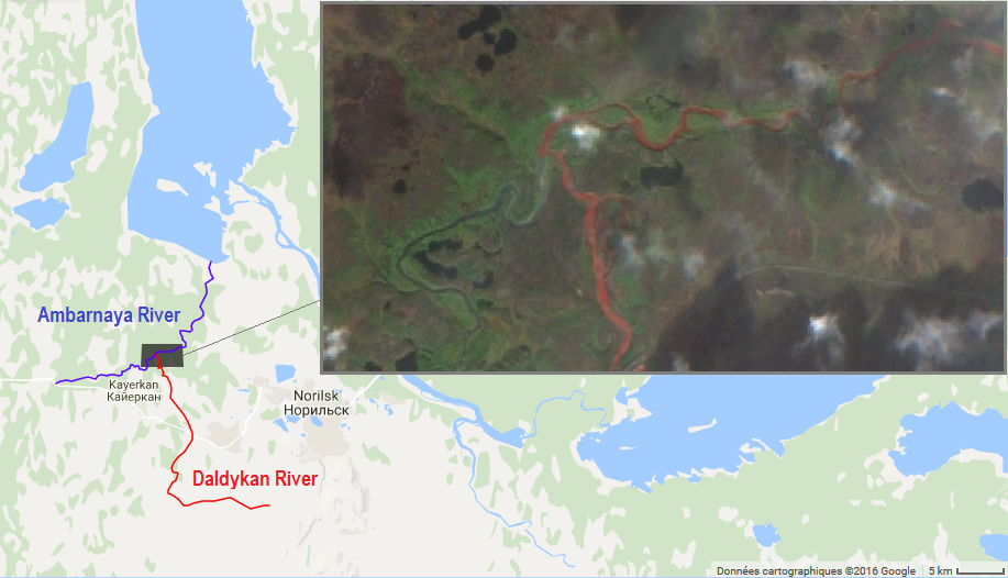
Sentinel-2 witnesses the Blood River in Siberia

The Daldykan River is a tributary of the Ambarnaya River, which feeds the Lake Pyasino in Siberia (738 km²). According to Wikipedia in English Lake Pyasino « is almost completely devoid of fish ». However, Wikipedia in French states that « Il est très poissonneux » (full of fish).

In English

Some news from Theia’s production of Sentinel-2A L2A data

=>The production of Level2A Sentinel-2A data by Theia is a little delayed, but we will still deliver, before the end of the month, the level 2A products acquired over France by Sentinel-2A so far. The production of the other selected sites, and the real time production will start a little later. It is not a piece […]

En Français

Des nouvelles de la diffusion des produits N2A pour Sentinel-2 par Theia

=>La production des données de N2A de Sentinel-2 par Theia a pris du retard, mais nous allons cependant fournir, dès la fin septembre, les produits de niveau 2A correspondant aux données acquises sur la France par Sentinel-2. La production des autres sites sélectionnés, et celle en temps réel démarreront un peu plus tard. Ce n’est pas […]

fire

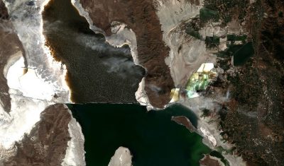
Wildfires in California spotted by Sentinel-2A

Wildfires were raging in California this summer. Let’s see if we can spot some of them in Sentinel-2A images with the new Sentinel-Playground by Sinergise. The combination of the SWIR and NIR bands of Sentinel-2 or Landsat enables to produce accurate maps of burnt areas. The SWIR band is sensitive to the water content in the […]

En Français

Sentinel-2 et Landsat-8 font équipe pour suivre la coulée de lave du volcan Kilauea

=> Le volcan Kilauea à Hawaï est un des plus actifs au monde. Cela fait déjà plus de trente ans qu’il est entré en éruption, mais il a fait les gros titres récemment car ses coulées ont atteint l’océan Pacifique, agrandissant le territoire hawaïen de deux hectares d’un coup ! Voilà une technique efficace pour […]

Applications

Chambord flooding: An update to « Mapping flooded areas using Sentinel-1 in Google Earth Engine » from Simon

Short after working with Simon on the script for the  article about the mapping of flooded areas, I wanted to be sure that our short script was realistic. I had some time to loose at the airport, so, after finding a wifi connection, I looked for pictures of the flooded areas of the north of […]