Sentinel-2

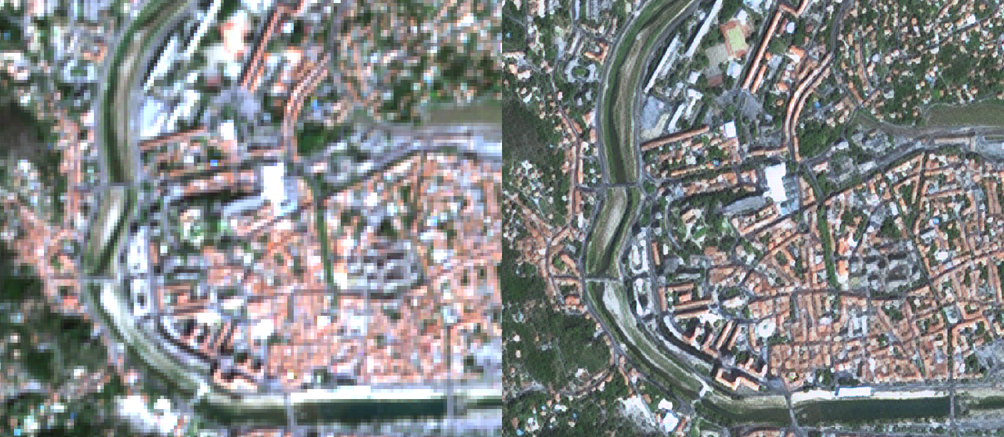
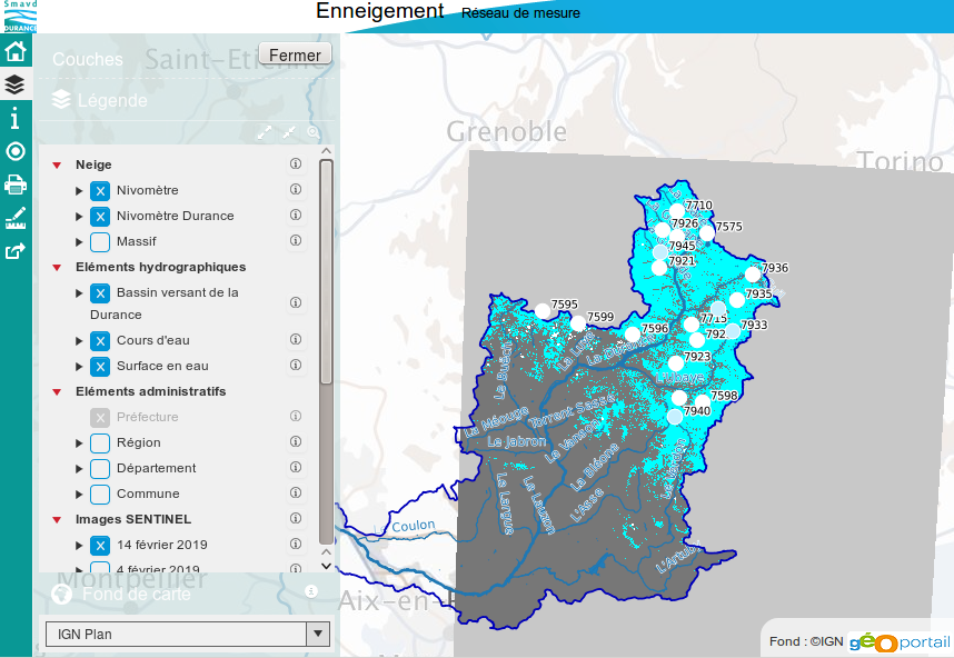
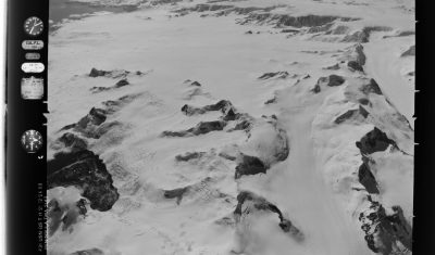
Synthèses de la durée de l’enneigement au 1er avril dans les Pyrénées

Le 1er avril est la date souvent utilisée par les hydrologues pour caractériser le stock de neige disponible avant la saison de fonte. A partir des produits neige Theia, j’ai calculé la durée d’enneigement par pixel de 20 m dans les Pyrénées depuis le début de l’année hydrologique (le 1er septembre 2018) jusqu’au 1er avril […]

Non classé

« Claude Shannon’s nightmare »

How did I miss the blog animated by Remi Cresson, from « la maison de la télédétection » in Montpellier (House of Remote Sensing) ? It is well written, very funny  and above all it shows impressive results from our favourite optical satellites, exactly what I intended to do in multitemp blog when I had time to […]

Composite (3A)

WASP source and executable are now openly available

WASP (Weighted Average Synthesis Processor) is the tool we use to compute the nice (mostly) cloud free syntheses of Sentinel-2 surface reflectances, as shown in the images below. A full resolution viewer is also available in this post, or you may also download the products you can download from Theia. As promised (but it took […]

Composite (3A)

Visualizing shipping lanes from Sentinel-1

I found in Twitter [1,2,3] that a simple way to visualize the sea lanes is to compute the maximum of each pixel across a time series of Sentinel-1 images.

En Français

Utilisation du produit neige Theia dans le bassin de la Durance

Le Syndicat Mixte d’Aménagement de la Vallée de la Durance [1] commence à utiliser les cartes d’enneigement produites par Theia pour alimenter sa cartothèque. Il s’agit d’un démonstrateur en cours d’élaboration mais qui est consultable par tous en ligne.   Merci à Pascal Dumoulin pour l’info !

In English

Satellite detection by satellite

=>  Airplanes largely disrupt our remote sensing images, because of the ice contrails they leave behind them, which often turn into cloud cover. We had to set up a method for detecting and correcting aircraft contrails. LANDSAT 8 image acquired over Paris on 14/04/2013. On the left, RGB color composition, on the right, image of […]

En Français

Detection de satellites par satellite

=>Les avions perturbent largement nos images spatiales, en raison des traces de cristaux de glace qui se forment derrière eux et qui se transforment souvent peu à peu en voiles nuageux. Nous avons dû mettre en place une méthode de détection et de correction des traces d’avion. Chaque vol en avion, en plus de participer […]

In English

Flying over Antarctica in 1968

The Polar Geospatial Center has put online a nice web mapping interface to browse and download trimetrogon aerial (TMA) photography of Antarctica [1]. The trimetrogon was a system of three cameras which captured three photographs at the same time, one vertical and two high oblique. I made the animation [2] below with the left photos […]

In English

Rain-on-snow flood in Nebraska

Several areas in Nebraska experienced record flooding this past week.