First SPOT5 (Take5) time series
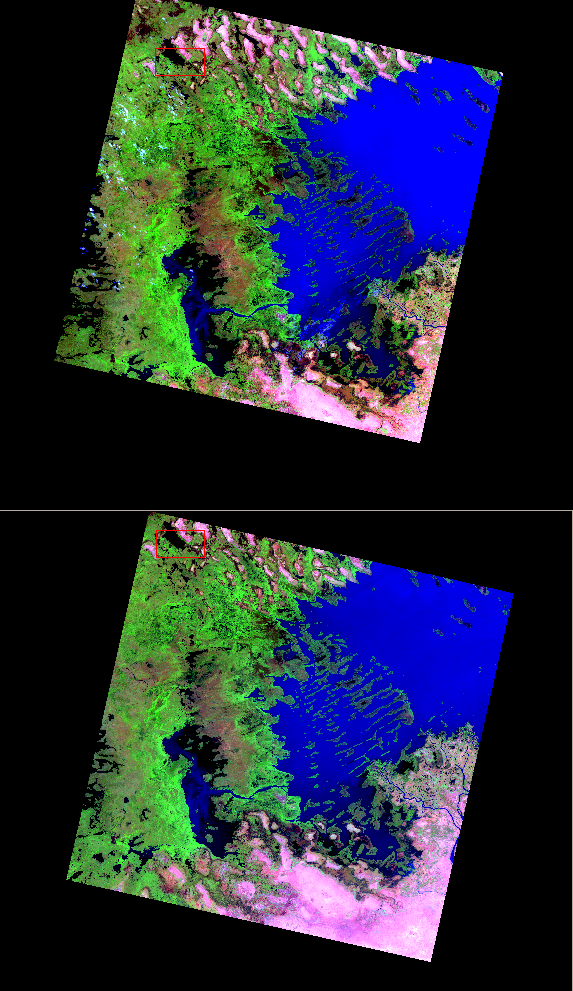
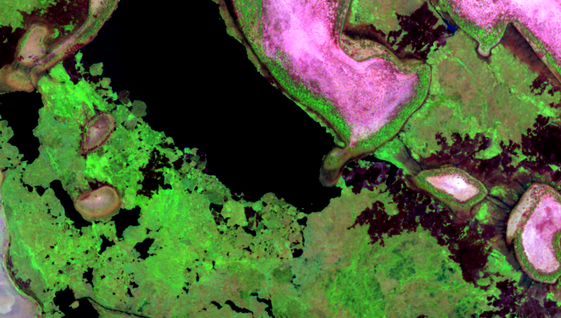
Airbus Defence and Space (Ex Spot Image), produces every week the new data downloaded from the satellite to level 1A (Thanks Myriam !). We have now received nearly two entire cycles of SPOT5 (Take5) images, which means that we have our first time series, although made of only two dates ! Our processing center, MUSCATE, within THEIA Land data center in CNES, is now able to produce systematically the L1C data (ortho-rectified and converted to TOA reflectance). The THEIA teams (including exploitation, ground segment and image quality) did a very good work in chasing the last configuration glitches among the dozens of parameter files necessary to produce the data. A good point for me is that I had nearly nothing to do except writing this post. As an example, the image on the right shows two different dates from the Lake Chad site. Although the footprints are different (SPOT5 footprints are not constant as we had a manoeuvre to avoid a debris between both acquisitions), the data are perfectly registered (see the zoom below) and the TOA reflectances are consistent. To convince you I did not provide twice the same image, you may see in the attached zoom that some clouds are present in the first image (09/04) and not in the second (14/04), and that some floating vegetation crossed the lake in 5 days. The wind was probably blowing from the North on the14th of April or just before.

Next steps in our processing will include the first test of Level 2A images, as soon as we get data from the third cycle. I am sorry to tell that users will still have to wait for several weeks, as the Level 2A processor needs one month to be correctly initialized, as we have to perform minimal checks of the quality of the products before releasing them, and as we need to finalize the download site.