Snowmelt and snow sublimation in the Indus basin

The Indus basin has one of the largest irrigation system in the world. Available water resources are abstracted almost entirely, mostly for crop irrigation in Pakistan.

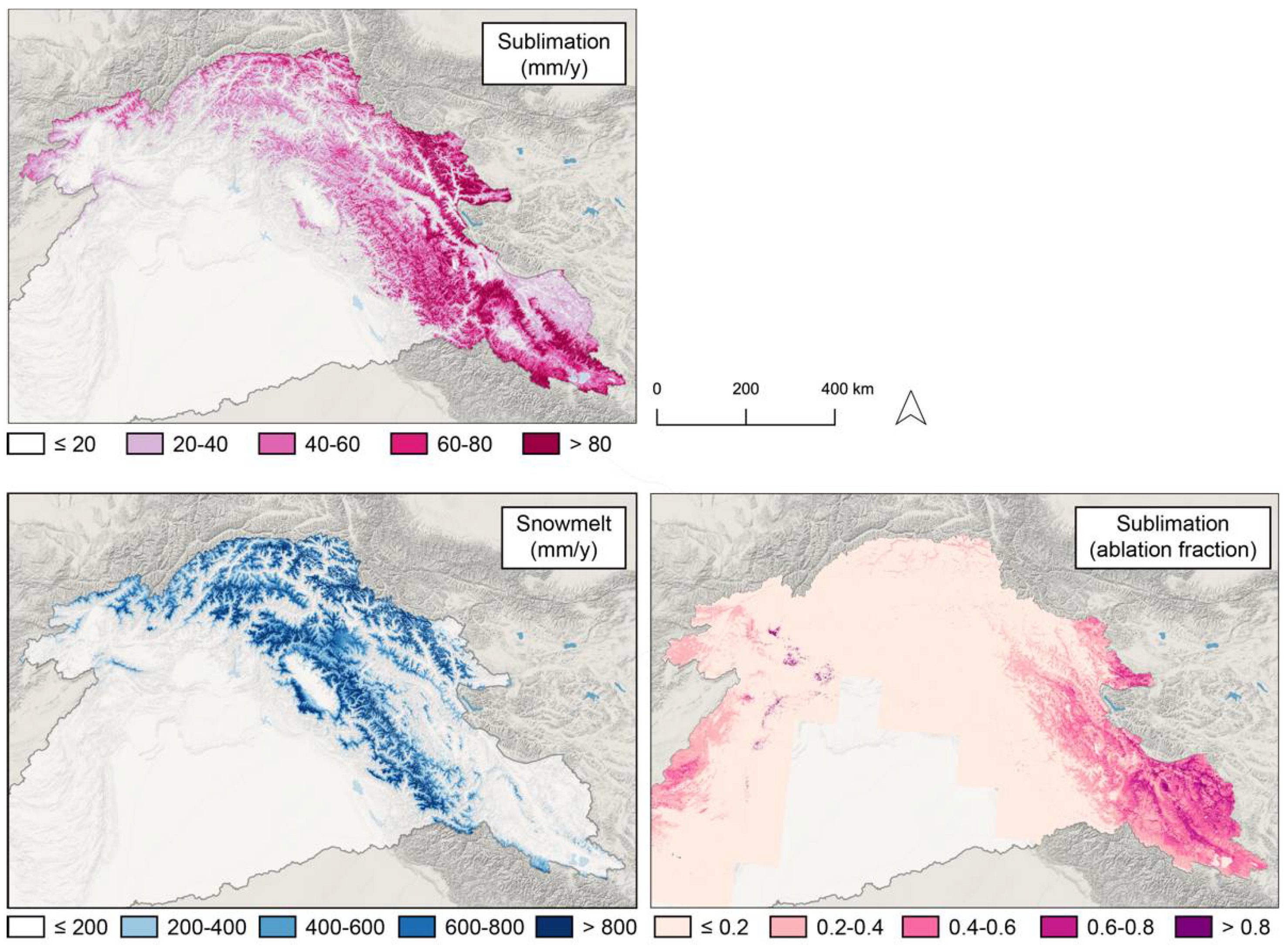
The Indus basin is also considered as one of the large basins in Asia with the highest dependence on snowmelt runoff.

VIIRS false color image of the Indus basin (irrigated areas in green, snow cover in blue)

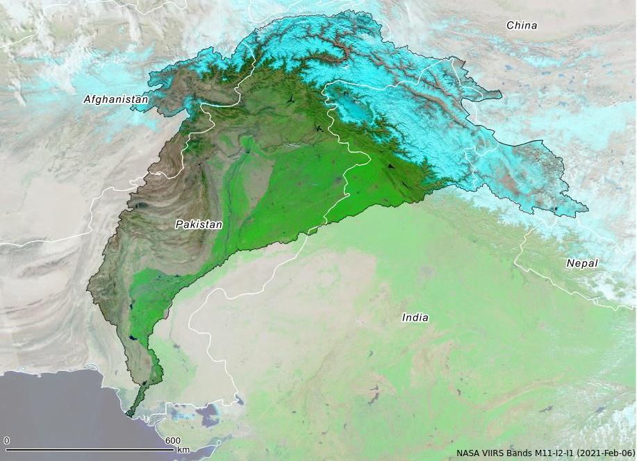
The contribution of snow and ice melt to runoff in the Indus basin was already well studied [1,2,3] but a pending question was how much water is lost by sublimation of the snow cover in the high mountain regions of the basin?

I used the recent High Mountain Asia snow reanalysis to re-evaluate snowmelt and estimate snow sublimation at the scale of the Indus basin.

Image
Snowmelt and sublimation in the Indus basin. Timeseries of annual snowmelt and sublimation (a) and timeseries of the mean daily snowmelt and sublimation (b).

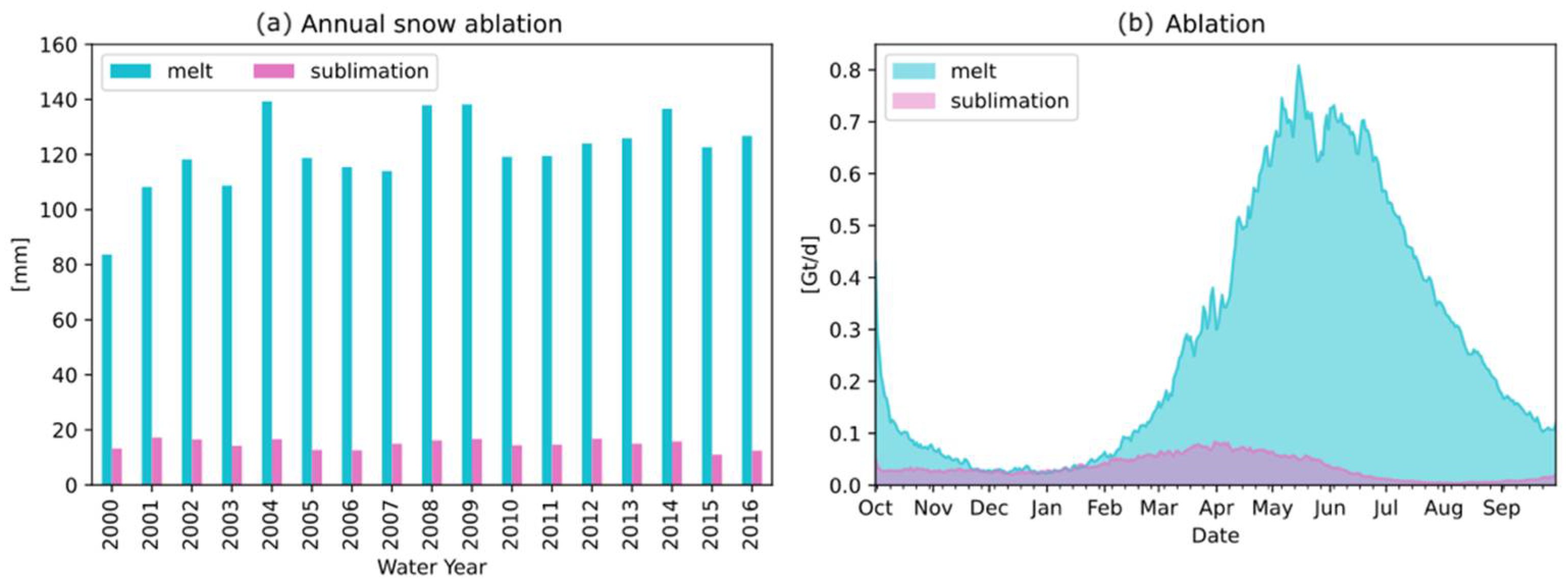
Over 2000–2016, snowmelt was about 25–30% of basin-average annual precipitation. About 11% of the snowfall was « lost » by sublimation, but with a large spatial variability across the basin. Sublimation fraction can be much higher in the arid regions in Ladakh and Western Tibet.

Image

For this study I challenged myself to follow best practices in open science. I only used open data and the code to reproduce the study is available online. It was fun!

Paper: mdpi.com/2073-4441/13/1

Dataset: nsidc.org/data/HMA_SR_D/

Code: https://github.com/sgascoin/HMA-Snow-Reanalysis-scripts/

Many thanks to the authors High Mountain Asia snow reanalysis for sharing this amazing dataset!

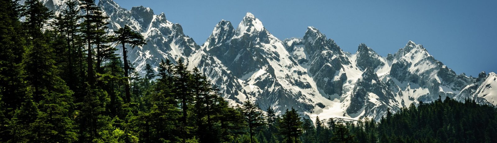
Top picture: Mountains in Swat Valley Pakistan (by Designer429, CC BY-SA 3.0, via Wikimedia Commons)


Plus d'actualités

BIOMASS, the third launched satellite mission designed at CESBIO !

After SMOS in 2009, and VENµS in 2017, the CESBIO laboratory is very proud to see its third proposed mission, Biomass, reach orbit. As always, it has been a long journey from the idea, at the beginning of the century, to the selection in 2013 as the seventh Earth Explorer Mission by ESA, to the […]

Evolution de l’altitude de la ligne de neige au cours des 41 dernières années dans le bassin versant du Vénéon (Oisans)

Pour contribuer à caractériser les conditions hydrométéorologiques lors de la crue torrentielle qui a frappé la Bérarde en juin, j’ai analysé une nouvelle série de cartes d’enneigement qui couvre la période 1984-2024 [1]. Grâce à la profondeur temporelle de cette série, on constate que l’altitude de la ligne de neige dans le bassin versant du […]

Biophysical parameter retrieval from Sentinel-2 images using physics-driven deep learning for PROSAIL inversion

The results presented here are based on published work: Y. Zérah, S. Valero, and J. Inglada. « Physics-constrained deep learning for biophysical parameter retrieval from sentinel-2 images: Inversion of the prosail model« , in Remote Sensing of Environment, doi: 10.1016/j.rse.2024.114309. This work is part of the PhD of Yoël Zérah, supervised by Jordi Inglada and Silvia Valero. […]

Rechercher