Flying over Antarctica in 1968
The Polar Geospatial Center has put online a nice web mapping interface to browse and download trimetrogon aerial (TMA) photography of Antarctica [1]. The trimetrogon was a system of three cameras which captured three photographs at the same time, one vertical and two high oblique. I made the animation [2] below with the left photos of flightline ABCA2143 which were collected on 24 December 1968 (Christmas Eve!).
The survey started over the south Shetlands Islands of Livingstone, Deception and Trinity, then crossed the Antarctic Peninsula up to the Weddell Sea.


The photos show the former Larsen A ice shelf, which disintegrated in 1995. The northern part of Larsen B ice shelf is visible in the end of the animation after Robertson Island. This sector of Larsen B also collapsed in 2002.
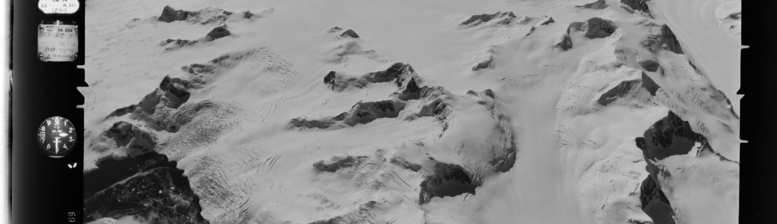
From trimetrogon photographs it’s also possible to make a panorama extending from the left horizon to right horizon.. Here is a hand-made example from the same flightline.
Footnotes
[1] « From 1946 to 2000, the U.S. Navy collected black and white trimetrogon aerial (TMA) photography of Antarctica. TMA photography is a camera system that collects a left-oblique, on-nadir (straight down), and right-oblique static frame » (source: Polar Geospatial Center, https://www.pgc.umn.edu/data/aerial/).
[2] This post was inspired by a tweet by Peter Neff. See also this example over Thwaites glacier by Bert Wouters.