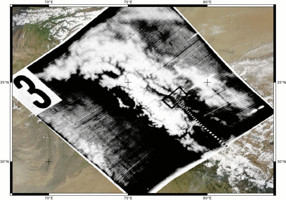
Snow cover in the High Mountain Asia on 13 May 1960
TIROS-1 weather satellite was launched by NASA on 01 April 1960. It took the first weather satellite picture on 02 April 1960 [1], and also the real first weather satellite picture on 01 April 1960 [2]. On 02 April 1960, it also captured what I believe is the first publicly available satellite picture of the snow cover in the Alps (picture 1 below). A few weeks later, on 13 May 1960, it captured a stunning view of the snow cover over the High Mountain Asia, including the Himalayas, Hindu Kush, Pamir and Karakoram ranges. These pictures are shown in the TIROS-1 final report [3].
![]()
Thanks to Pierre Markuse, I could (roughly) georeference the picture 3 based on a clear-sky Terra MODIS image acquired on 24 May 2014 and using the QGIS georeferencer tool.
While glaciologists can use satellite archives from the 1970’s (including declassified spy satellite imagery) to study glacier changes, it doesn’t make sense to compare the snow cover extent on two single dates… Or does it?

Reference
[1] Anderson, G. D. (2010), The first weather satellite picture. Weather, 65: 87. doi:10.1002/wea.550
[2] Kållberg, P., Uppala, S. and Simmons, A. (2010), The real first weather satellite picture. Weather, 65: 211–213. doi:10.1002/wea.652
[3] Tiros 1 Meteorological Satellite System Final Report, Nasa technical report, Jan 01, 1962.