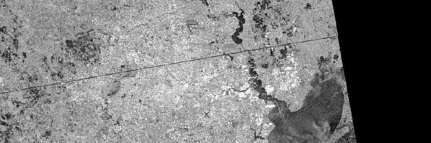
Flooded areas in Houston by Sentinel-1
Hurricane Harvey hit Texas on August 25. The first Sentinel-1 image of Houston since landfall was acquired on Aug 29 at 00:26 UTC. I’m writing this post at 21:09 UTC. As reported by the local news website chron.com « The most severe flooding is around the Highway 90 and Eastgate areas ». This is also what we can see on the image comparison below: dark areas are flooded areas: Click on this link to see in full screen. Or check by yourself in the EO Browser.Below is a zoom between Dayton and Highway 90 (full screen):Images are orthorectified VV backscatter in dB (-20 dB is black, 0 dB is white). The backscatter intensity received by Sentinel-1 drops over flooded soil because the emitted electromagnetic waves bounces off the water surface and thus do not return to the antenna (as explained in this post).