3 years of Landsat L2A data above France available at THEIA
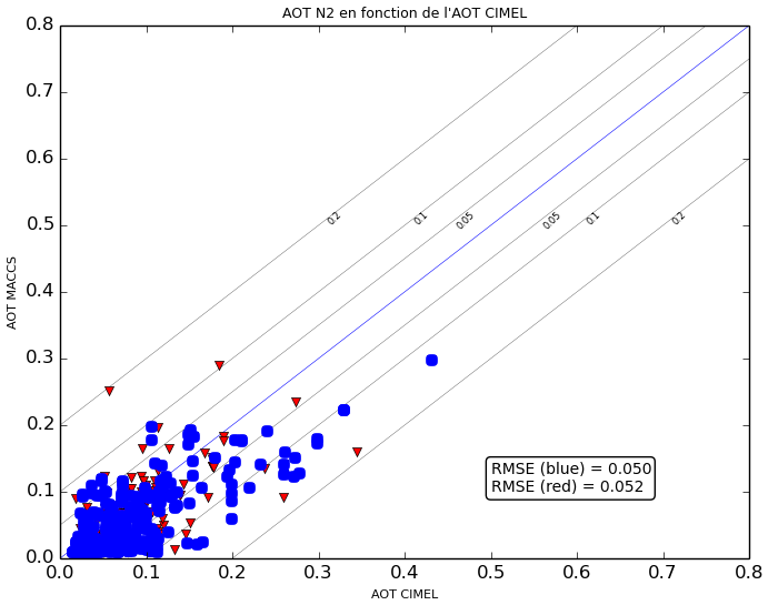
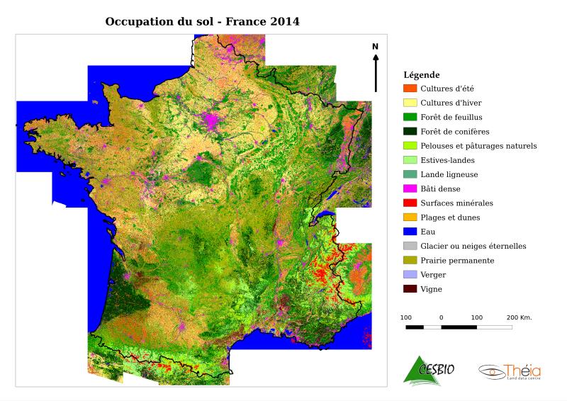
The MUSCATE processing centre at CNES, which belongs to French THEIA land data centre, produces and distributes all the Landsat 8 data acquired above France at Level 2A. Level 2A products contain surface reflectances after atmospheric correction, and a very good cloud mask. LANDSAT 8 first routine data had been acquired on April 13th 2013, and THEIA released the data acquired from the first fortnight of April 2015, a few days ago. Three full years of data are therefore now available, and even 6 years if we account for the LANDSAT 5 and 7 data acquired from 2009 to 2011. And very soon, we will start delivering data above the French oversea regions and communitiesThe atmospheric correction and the cloud detection are processed using the MACCS processor, developped at CESBIO. You have probably already seen several examples of cloud masks in this blog. Regarding atmospheric correction, Camille Desjardins, from CNES, did a validation of the Aerosol optical thicknesses (AOT) over all the Aeronet sites in France, over the 3 last years. The results are summarized in the plot on the right. For the non-specialists, it is a very good resuls, similar to the state of the art. And as the estimates of AOT condition the quality of atmospheric correction, you may be confident on its quality The diversity of the users of this product shows that they can be used for a large diversitu of themes and applications. Here is a good example of whan can be done automatically with this data set (here all the data from 2014). Please click on the image for more details. This land cover map, still in validation, was created by the iota2 software, whose development is led by Jordi Inglada at CESBIO. For more details, see Jordi’s presentaion at the Living Planet Symposium. The LANDSAT 8 L2A products have been used by 127 different users so far since July last year, when the new distribution server was put on line. And before that, 98 other users were already using the previous version, probably some users belong to both lists, but I did not count them.
| Number of downloaded products since July 2015 | 13074 |
| Number of users | 127 |
As already observed with SPOT (Take5), few users tell us what they do with the data, which indeed is a good sign, because in case of an issue, we receive questions very quickly. But if you are one of the users, please let you know about how you use the data and the results you get. Your results would even be welcome on this blog !


